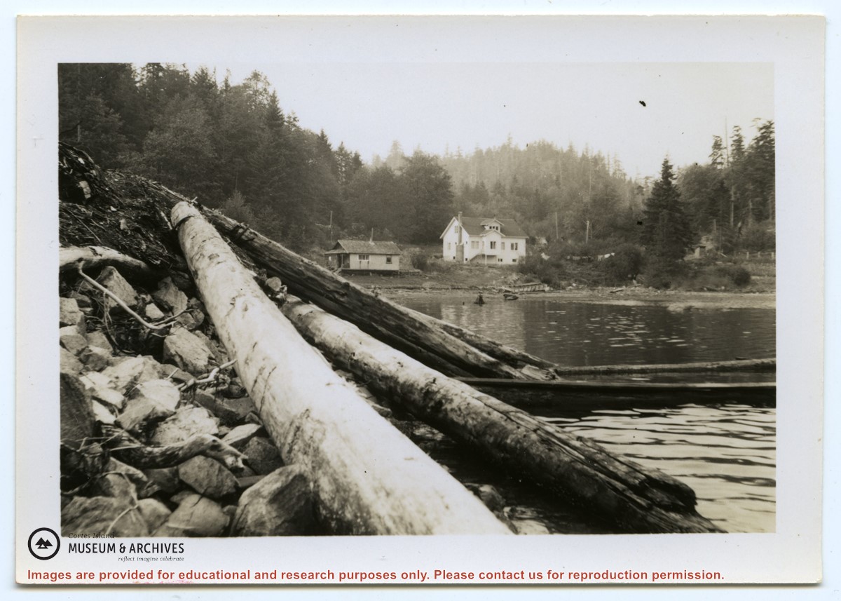
Photograph of the Hayes family house at the head of Cortes Bay. To the left on the beach is a smaller house; to the right a line of laundry is hanging, and a small building (outhouse or smokehouse?) is further to the right. In the foreground some logs are piled on the rocky beach. (same as #1999.001.653)
Photograph of the Hayes family house at the head of Cortes Bay. To the left on the beach is a smaller house; to the right a line of laundry is hanging, and a small building (outhouse or smokehouse?) is further to the right. In the foreground some logs are piled on the rocky beach. (same as #1999.001.653)
File contains photocopies of original Crown Grants, subsequent title changes and maps for:
To Joseph Gregson: 1926, Crown Grant for fractional W 1/2 of Lot 899 and Lot 901 (between Coulter and Carrington Bays), with a water easement for Wailes
To John Nugent McIllree: 1957, Crown Grant of mineral rights to lots at Coulter Bay surveyed as the "Arrow" and "Bullseye" mineral claims
To Hilda Peterson: 1919, Crown Grant for Lot 878, Carrington Bay, 55 acres
(Files 12 through 16 are from the same envelope.)
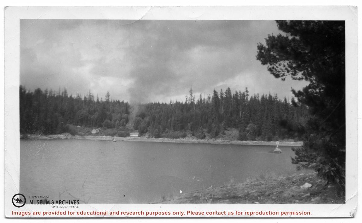
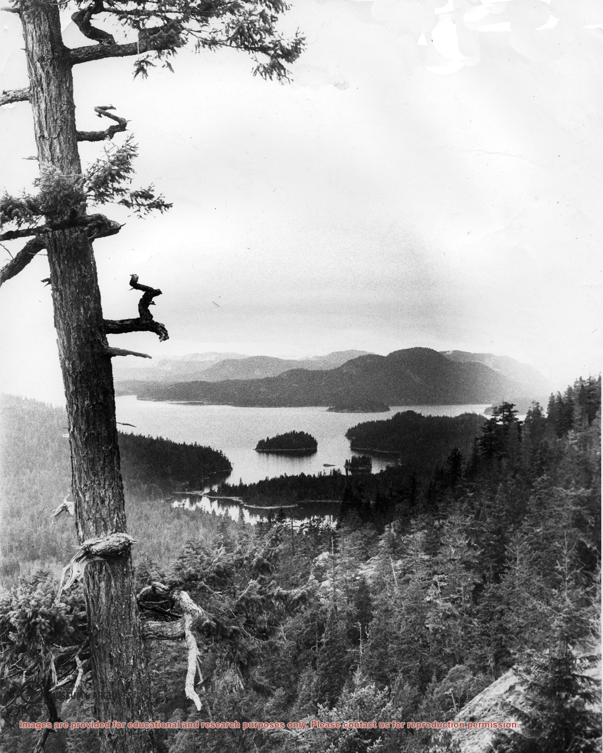
Looking north from Green Mountain over Carrington Lagoon and Carrington Bay (tidal falls in between) across 5 miles of water to Read Island, with a slew of islands to the north.
Photograph of two people (Iikely Ernie Mee and his wife Jean) sitting on the steps of Mee's house in Whaletown Bay (the old Richens place.) Identification pencilled on the back by Doreen Huck Thompson.
Photograph of two people (Iikely Ernie Mee and his wife Jean) sitting on the steps of Mee's house in Whaletown Bay (the old Richens place.) Identification pencilled on the back by Doreen Huck Thompson.
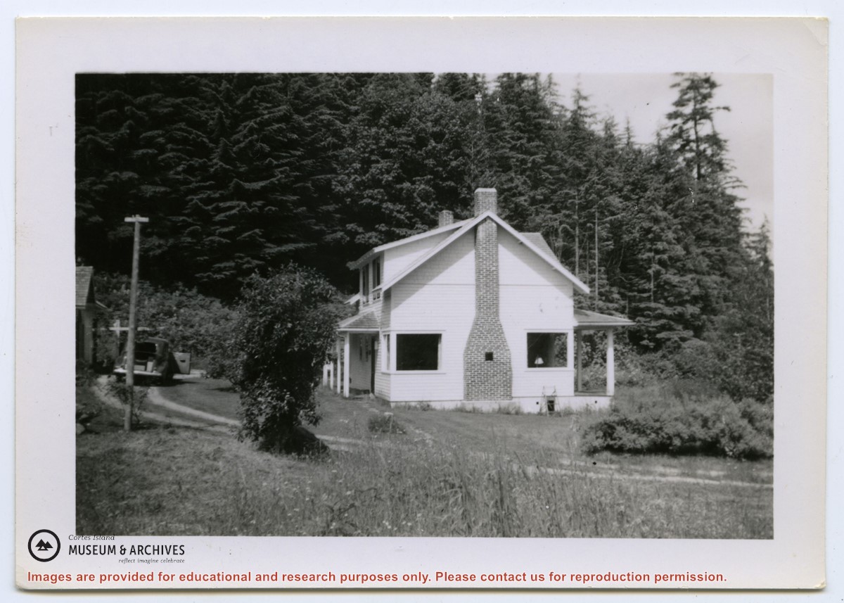
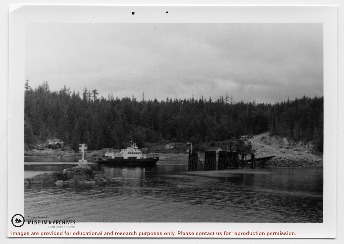
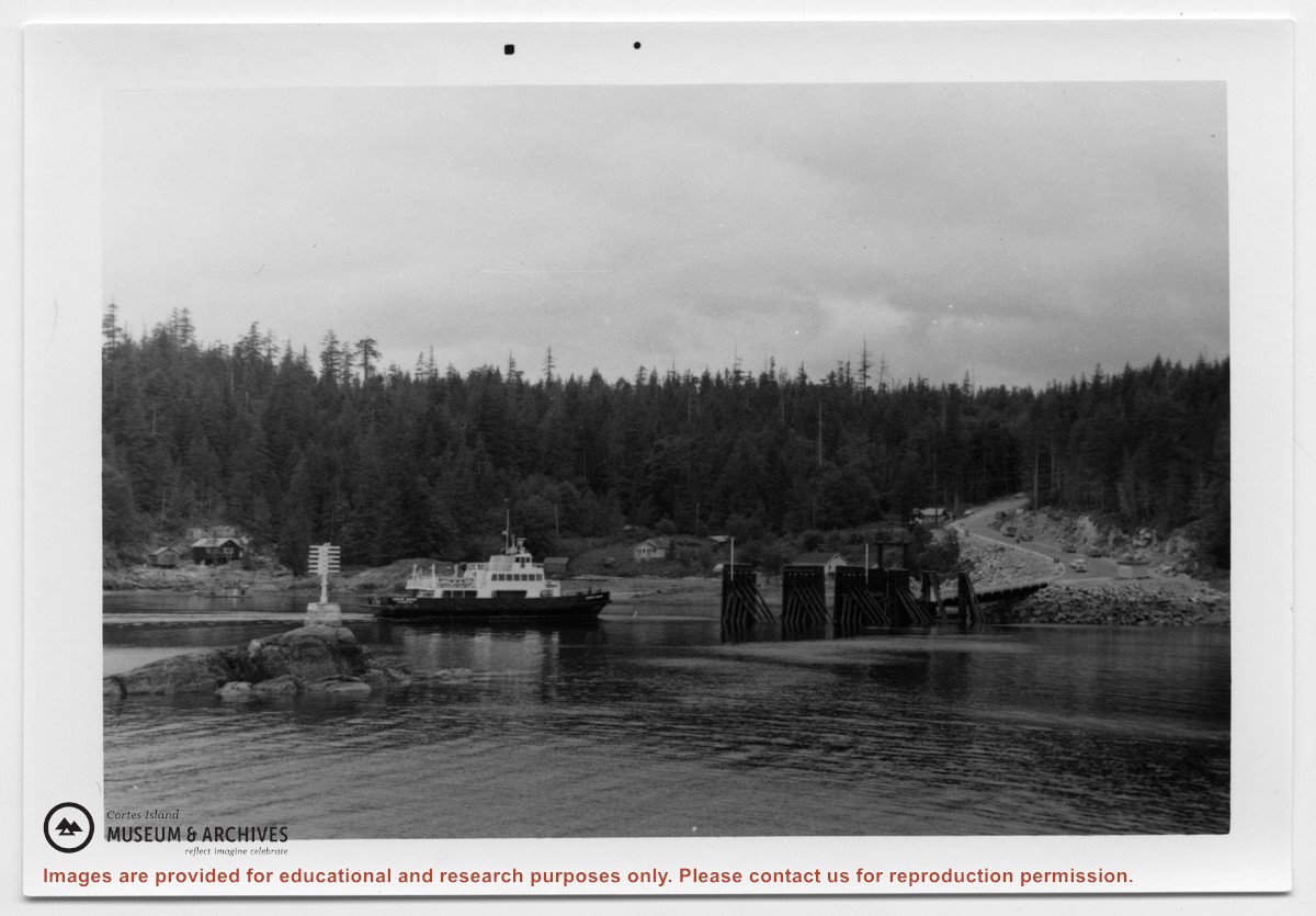
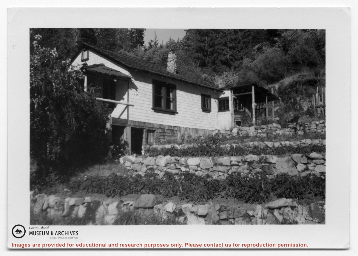
Photograph of a white house with rock-walled terraces to its right. This was Amy and Scotty McKenzie's float house, moved from Von Donop Inlet in 1951. Amy was daughter of Ruth and Henry Byers, who lived in the “Grey House” west of the ferry landing. (The "Grey House" was later moved to Squirrel Cove next to the Store.) The McKenzie house was between the Grey House and the ferry landing; it was torn down ca. 1974. The terraces may still be seen in the small park next to the ferry landing.
Photograph of a white house with rock-walled terraces to its right. This was Amy and Scotty McKenzie's float house, moved from Von Donop Inlet in 1951. Amy was daughter of Ruth and Henry Byers, who lived in the “Grey House” west of the ferry landing. (The "Grey House" was later moved to Squirrel Cove next to the Store.) The McKenzie house was between the Grey House and the ferry landing; it was torn down ca. 1974. The terraces may still be seen in the small park next to the ferry landing.