Collection comprises nine large maps of Cortes Island with handwritten family trees on the back sides, created when Marg Sullivan handed out the maps at a gathering and asked everyone present to write their family trees down. Families documented include: Sullivan, Marg and Sully; Smith, Marion; Jeffery, Baron and Nellie Smith; Ringwood, Gail and Stephen; Campbell, Duane and Florence; Hansen, Hazel and Ken; Rogers, Art and Hendon, Del; McDevitt, Lottie; Borden, Vern (Borden homestead is marked on the map); Froud family; Petznick family; Beesley family; Hayes family; Mike Manson family; John Manson family; Morrison, David Reekie; Lambert family; Padgett family; Tiber (Teuber) family; Henry Hague family.
Margaret (Marg) Sullivan (1934-2017) was born in Flin Flon, Manitoba. She married Clarence “Sully” Sullivan in 1955, and they moved to Cortes Island in the early 1980s, taking an active part in community affairs. Marg was a stained-glass artist, and she created the windows for St. Saviour-By-The-Sea Church overlooking Cortes Bay. Each personalized window commemorates a long-time Cortes resident and there is a fascinating story behind the creation of each window. Marg also custom designed the circular stained glass window above the entrance door of St. Michael’s Catholic Church in the Klahoose village of Tork in Squirrel Cove. This window is imbued with symbolism meaningful to the Klahoose First Nation and tells a story all its own. The Band Administrator in 1998 arranged for Marg to meet with Klahoose elders and artists to consider design elements the Band wished to have her incorporate in the window. She made research trips to the First Nations Museum at Alert Bay and to the Klahoose traditional lands in Toba Inlet before designing the window. Marg’s personal stories about each of these windows were recorded for preservation in the Museum’s Archives at a tea in 2015.
Custodial History
Donated to CIMAS by Marg Sullivan in 2016.
Scope and Content
Collection comprises nine large maps of Cortes Island with handwritten family trees on the back sides, created when Marg Sullivan handed out the maps at a gathering and asked everyone present to write their family trees down. Families documented include: Sullivan, Marg and Sully; Smith, Marion; Jeffery, Baron and Nellie Smith; Ringwood, Gail and Stephen; Campbell, Duane and Florence; Hansen, Hazel and Ken; Rogers, Art and Hendon, Del; McDevitt, Lottie; Borden, Vern (Borden homestead is marked on the map); Froud family; Petznick family; Beesley family; Hayes family; Mike Manson family; John Manson family; Morrison, David Reekie; Lambert family; Padgett family; Tiber (Teuber) family; Henry Hague family.
File contains correspondence, CSRD staff reports and notes from a public hearing regarding a proposed rezoning application for water-access only land on Gorge Harbour.
File contains correspondence, CSRD staff reports and notes from a public hearing regarding a proposed rezoning application for water-access only land on Gorge Harbour.
File contains title information and photocopies of land grants and subsequent conveyances for the following:
John Williams: 1914, Crown Grant for the fractional SW 1/4 of Sec 22 and fractional NW 1/4 of Sec 22 (east of Gorge Harbour entrance)
John Williams: 1914, Crown Grant for the fractional SW 1/4 of Sec 22 and frac. NW 1/4 of Sec 18 (west of the Gorge Harbour entrance)
File contains three oversize maps which are stored in the map cabinet: Map of Section 22, Plan VIP52378, Lots A,B,C (blueprint map; 85 cm x 54 cm, 1985); map of Plan 27966 (blueprint map; 55 cm x 43 cm, 1974); photocopy of map of fractional NW 1/4 Sec 17 (55 cm x 43 cm, 1973)
(Files 3 through 7 are from the same envelope.)
File contains information for the following properties:
E. H. Vaughn: 1893, Crown Grant for fractional N 1/2 of Sec. 22; 90 acres for $90.00.
James P. Allen: 1913, Crown Grant for NW 34 acres of Sec. 23; $170.00
Bernard Robinson Allen: 1919, Crown Grant for SW 1/4 of Sec. 23, 159 acres
Charles Allen: 1912, Crown Grant for SW 1/4 of Sec. 33; 160 acres for $160.00
Harold Marshall Wood: Crown Grant for E 1/2 of NE 1/4 of Sec. 46 (east of Carrington Bay); 81 acres for $1.00.
File contains the following maps, stored in the Map Cabinet:
Subdivision Plan of parcel C & E, NW 1/4 of Sec. 21, 1976
Subdivision of the fractional NE 1/4 of Sec 21, 1966; with names of property owners penciled in
Subdivision Plan of Parcel C and part of Parcel E of fractional NE 1/4 of Sec. 21, 1975
Subdivision Plan of fractional NE 1/4 of Sec. 21 and W 1/2 of SW 1/4 of Sec. 34
(Files 17 through 19 are from the same envelope.)
File contains two copies of a draft of the Cortes Official Community Plan prepared by Planistics Management Inc. in conjunction with the Cortes Island Advisory Planning Commission: one clean copy with a cover letter, and one copy with annotations.
File contains two copies of a draft of the Cortes Official Community Plan prepared by Planistics Management Inc. in conjunction with the Cortes Island Advisory Planning Commission: one clean copy with a cover letter, and one copy with annotations.
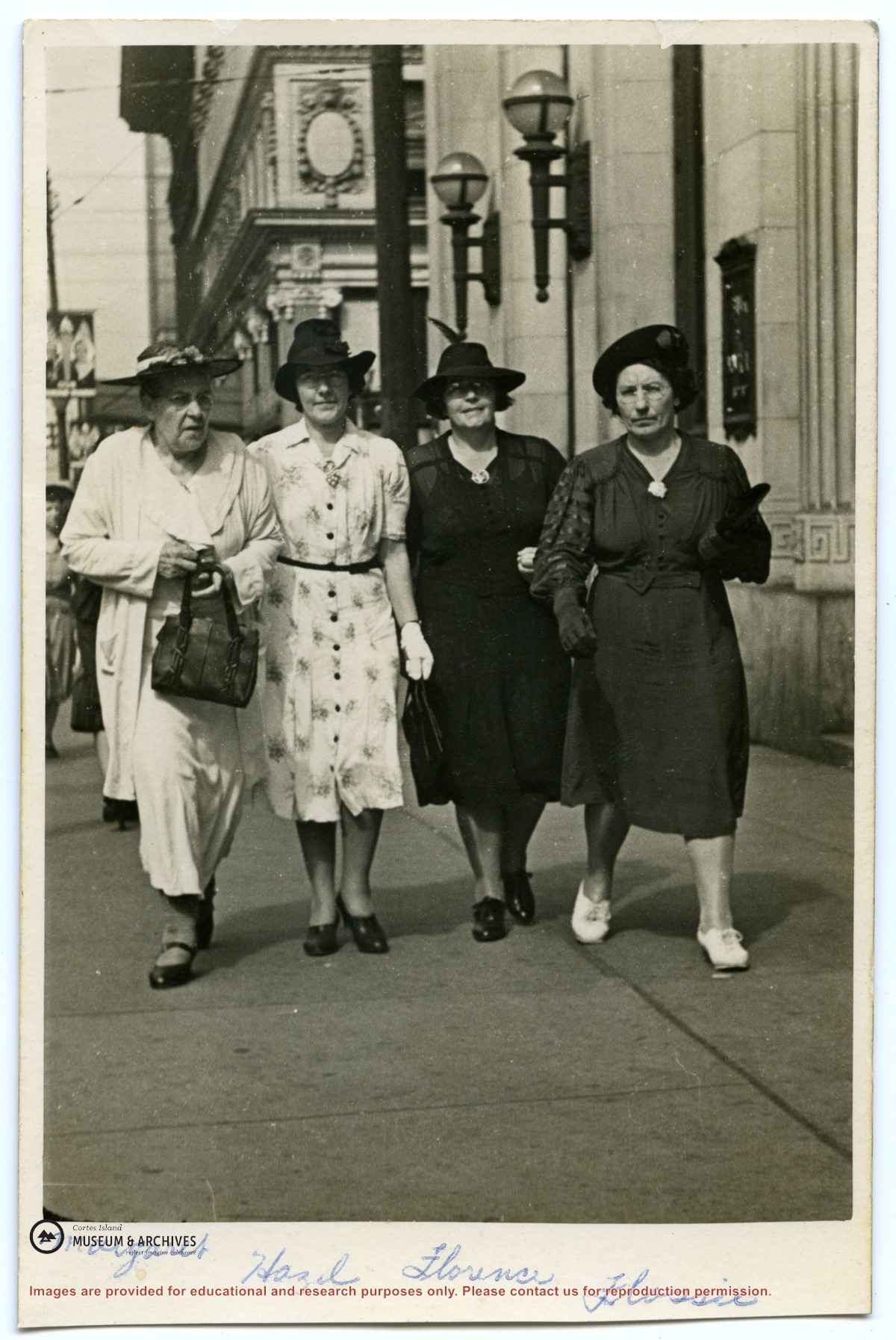
Margaret Manson and three of her daughters walking down Granville Street in Vancouver.
L to R: Margaret Manson, Hazel (Manson) Herrewig, Florence (Manson) McKay, and Flossie (Manson) Kenny.
Margaret Manson and three of her daughters walking down Granville Street in Vancouver.
L to R: Margaret Manson, Hazel (Manson) Herrewig, Florence (Manson) McKay, and Flossie (Manson) Kenny.
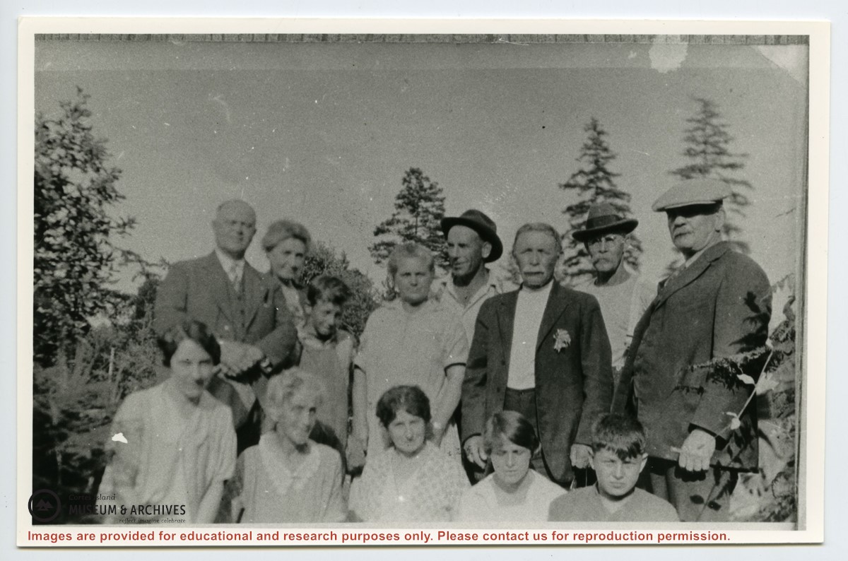
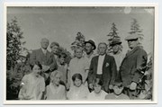
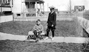
Adam and Martha Thompson, Hazel Herrewig, Wilfred Freeman, Mrs. Niven, Mrs. Neen (Adam Thompson's sister), Margaret (sister of Jane) Manson, Wilfred Manson, Mike Manson, Jean Manson, John Manson, John Renwick, Mike Herrewig