File contains a map key to the areas of Sections 17, 18, 19, 22 and 34 (south of Gorge Harbour) which were researched (Information in Files 3-7).
It contains photocopies of original land grants and subsequent conveyances for the following:
Reginald James Smith: 1946, Crown Grant 165414I for fractional SE 1/4 of Sec 23, 1946 (the Thunder Road subdivision at the eastern end of Gorge Harbour).
(Files 3 through 7 are from the same envelope.)
File contains a photocopy of Crown Grant and documentation of subsequent changes in title for:
William Barrett Lennard: 1928, Crown Grant for the SE and SW 1/4s of Section 23 (on the SE shore of Gorge Harbour)
(Files 3 through 7 are from the same envelope.)
File contains a photocopy of Crown Grant and documentation of subsequent changes in title for:
William Barrett Lennard: 1928, Crown Grant for the SE and SW 1/4s of Section 23 (on the SE shore of Gorge Harbour)
(Files 3 through 7 are from the same envelope.)
File contains a coloured map with researched properties coloured in, and title information and photocopies of land grants and subsequent conveyances for the following:
Edward James Breeze: 1931, Crown Grant for District Lot 1373 (parts of Section 23 and Section 17, at the southeast end of Gorge Harbour by Anvil Lake)
Frank Harper: 1913, Crown Grant for the NE 96 acres of Section 23 (at the northeast end of Gorge Harbour)
(Files 3 through 7 are from the same envelope.)
File contains a section map showing properties southeast of Gorge Harbour and title information on the property, later owned by Gilean Douglas, and known as Channel Rock.
To John Pool: 1930, Crown Grant of the W 1/2 of the SE 1/4 of Sec. 21 and fractional SW 1/4 of Sec. 21 and Crown Grant fo the fractional E 1/2 of fractional SE 1/4 of Sec. 21
File contains a Key Map to the sections covered in Files 17-19; a list of the sections researched and two pages of notes.
It contains photocopies of Crown Grants and subsequent title changes for the following:
Charles Allen: 1908, Crown Grant for part of NE 1/4 of Sec. 21 lying north of Gorge Harbour (property known as Bute Ranch); 46 acres for $46.00
Bernard Robinson Allen: 1919, Crown Grant for NW 1/4 of Sec. 21; 162 acres for $247.00
Charles Allen: 1905, Crown Grant for SE 1/4 of Sec. 34
(Files 17 through 19 are from the same envelope.)
File contains information for the following properties:
Frederick James Smith: 1921, Crown Grant for SE 1/4 of Sec. 33; 160 acres for $1.00
Charles Allen: 1912, Crown Grant for SW 1/4 of Sec. 33; 160 acres for $160.
George Robson: 1907, Crown Grant for NW 1/4 of Sec. 21; $247.00 for 142 acres.
(Files 17 through 19 are from the same envelope.)
File contains information for the following properties:
E. H. Vaughn: 1893, Crown Grant for fractional N 1/2 of Sec. 22; 90 acres for $90.00.
James P. Allen: 1913, Crown Grant for NW 34 acres of Sec. 23; $170.00
Bernard Robinson Allen: 1919, Crown Grant for SW 1/4 of Sec. 23, 159 acres
Charles Allen: 1912, Crown Grant for SW 1/4 of Sec. 33; 160 acres for $160.00
Harold Marshall Wood: Crown Grant for E 1/2 of NE 1/4 of Sec. 46 (east of Carrington Bay); 81 acres for $1.00.
File contains the following maps, stored in the Map Cabinet:
Subdivision Plan of parcel C & E, NW 1/4 of Sec. 21, 1976
Subdivision of the fractional NE 1/4 of Sec 21, 1966; with names of property owners penciled in
Subdivision Plan of Parcel C and part of Parcel E of fractional NE 1/4 of Sec. 21, 1975
Subdivision Plan of fractional NE 1/4 of Sec. 21 and W 1/2 of SW 1/4 of Sec. 34
(Files 17 through 19 are from the same envelope.)
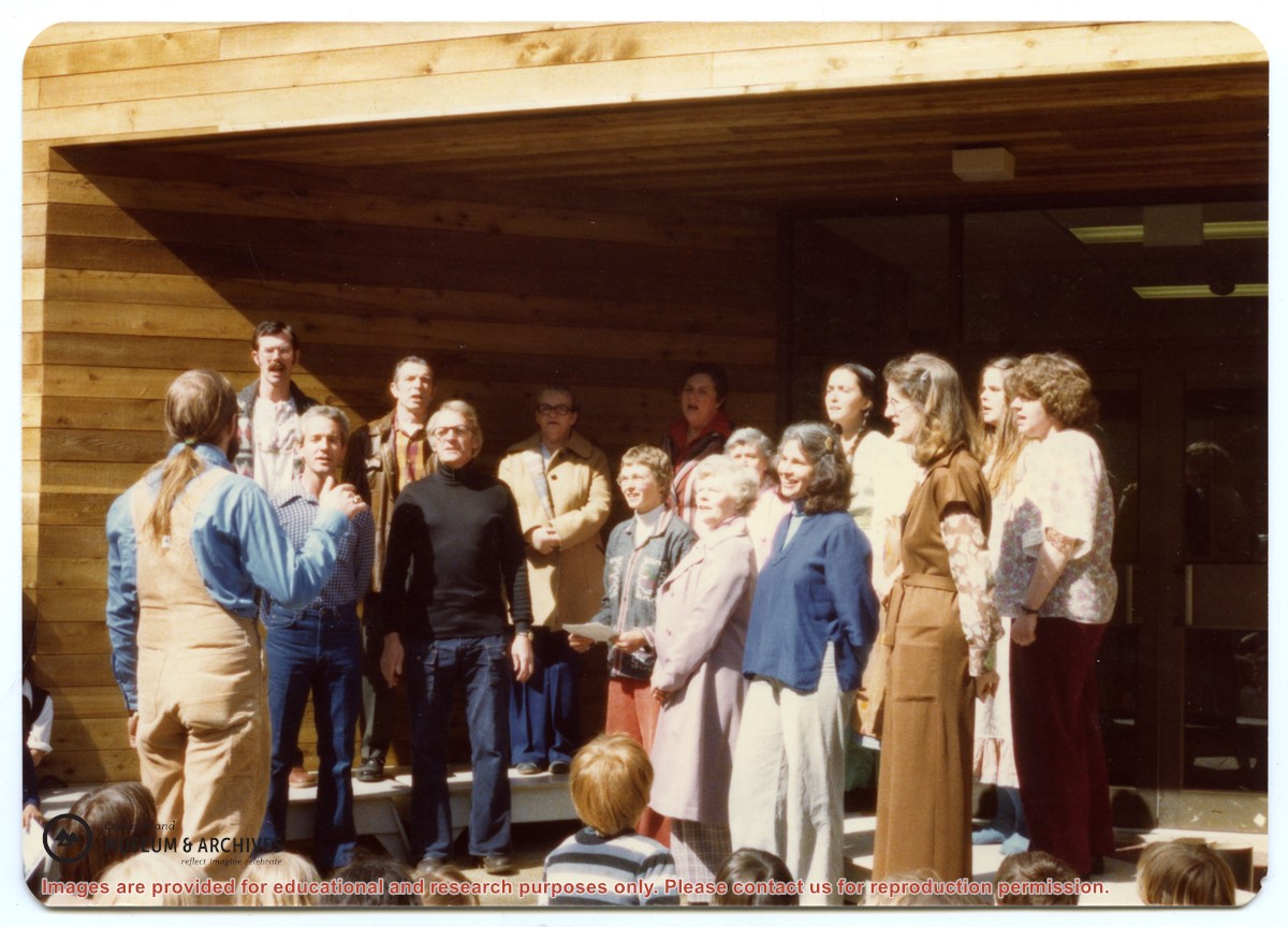
Back, L to R: Bruce Campbell, Duane Campbell, Bonnie Killian, Joan Disney, Peggy Newsham, Wendy Knudson, Kate Hathaway, Donna Norman
Front: David Blinzinger, Conductor; Bruce Ellingsen, Jack Killian, Fay Raymont, Velma Bergman, (ID), Rebecca Campbell
Back, L to R: Bruce Campbell, Duane Campbell, Bonnie Killian, Joan Disney, Peggy Newsham, Wendy Knudson, Kate Hathaway, Donna Norman
Front: David Blinzinger, Conductor; Bruce Ellingsen, Jack Killian, Fay Raymont, Velma Bergman, (ID), Rebecca Campbell