File contains information for the following properties:
Frederick James Smith: 1921, Crown Grant for SE 1/4 of Sec. 33; 160 acres for $1.00
Charles Allen: 1912, Crown Grant for SW 1/4 of Sec. 33; 160 acres for $160.
George Robson: 1907, Crown Grant for NW 1/4 of Sec. 21; $247.00 for 142 acres.
(Files 17 through 19 are from the same envelope.)
File contains a key map and list for the areas researched and information on the following:
George Herbert Wailes: 1920, Crown Grant for fractional SW 1/4 of Sec. 48; 48 acres for $217; with a tax sale notice, 1939
Ina Vernon Munro: 1920, Crown Grant for NE 1/4 of Sec. 37; 161 acres; includes a sale to Hawkins and a forfeit in 1939
Allan Olmsted: 1939, Crown Grant for SW 1/4 of Sec. 37
Ira Furry: 1911, Crown Grant for W 1/2 of SE 1/4 of Sec. 33
Walter Malcolm: 1919, Crown Grant for fractional SW 1/4 of Sec. 36
Frank Leslie Tooker: 1926, Crown Grant for N 1/2 of Sec. 36, 124 acres
Ira Furry: 1897, Crown Grant for SE 1/4 of Sec 36; 160 acres for $160.00.
Donald McDonald: 1926, Crown Grant for fractional NW 1/2 of Sec. 37; 144 acres for $1.00
Binder contains interviews, stories, clippings and photographs documenting the social history of the Coulter Bay and Carrington Bay areas. It was created as part of the Windows on Whaletown Exhibit, curated and mounted by Doreen Thompson.
Binder contains interviews, stories, clippings and photographs documenting the social history of the Coulter Bay and Carrington Bay areas. It was created as part of the Windows on Whaletown Exhibit, curated and mounted by Doreen Thompson.
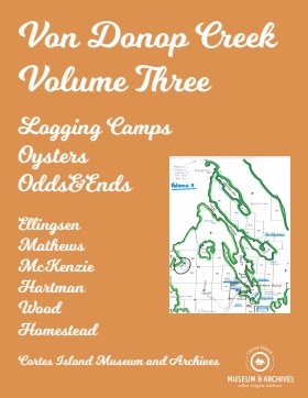
Binder contains interviews, stories and pictures. It was created in 2001 as part of the exhibit "The Von Donop Creek Story - 1920-1960", curated and mounted by Doreen Thompson. Binder contains interviews, stories and pictures.
Binder contains interviews, stories and pictures. It was created in 2001 as part of the exhibit "The Von Donop Creek Story - 1920-1960", curated and mounted by Doreen Thompson. Binder contains interviews, stories and pictures.
File contains a section map showing properties southeast of Gorge Harbour and title information on the property, later owned by Gilean Douglas, and known as Channel Rock.
To John Pool: 1930, Crown Grant of the W 1/2 of the SE 1/4 of Sec. 21 and fractional SW 1/4 of Sec. 21 and Crown Grant fo the fractional E 1/2 of fractional SE 1/4 of Sec. 21
Binder contains interviews, stories and photographs documenting the social history of the Whaletown area. It was created as part of the Windows on Whaletown Exhibit, curated and mounted by Doreen Thompson.
Additional information:
re photo on p 79: "Dell Tooker with Stephen Williams (son of Trefor Williams). The Titus’s were gone by 1960 when the photo was taken. This horse was “Lady” and belonged to Bert Hansen. He kindly loaned her to us sometimes which was so appreciated." (from Tari Tooker Chiasson, 5/2021)
File contains a Key Map to the sections covered in Files 17-19; a list of the sections researched and two pages of notes.
It contains photocopies of Crown Grants and subsequent title changes for the following:
Charles Allen: 1908, Crown Grant for part of NE 1/4 of Sec. 21 lying north of Gorge Harbour (property known as Bute Ranch); 46 acres for $46.00
Bernard Robinson Allen: 1919, Crown Grant for NW 1/4 of Sec. 21; 162 acres for $247.00
Charles Allen: 1905, Crown Grant for SE 1/4 of Sec. 34
(Files 17 through 19 are from the same envelope.)
File contains photocopies of original Crown Grants, subsequent title changes and maps for:
To Joseph Gregson: 1926, Crown Grant for fractional W 1/2 of Lot 899 and Lot 901 (between Coulter and Carrington Bays), with a water easement for Wailes
To John Nugent McIllree: 1957, Crown Grant of mineral rights to lots at Coulter Bay surveyed as the "Arrow" and "Bullseye" mineral claims
To Hilda Peterson: 1919, Crown Grant for Lot 878, Carrington Bay, 55 acres
(Files 12 through 16 are from the same envelope.)