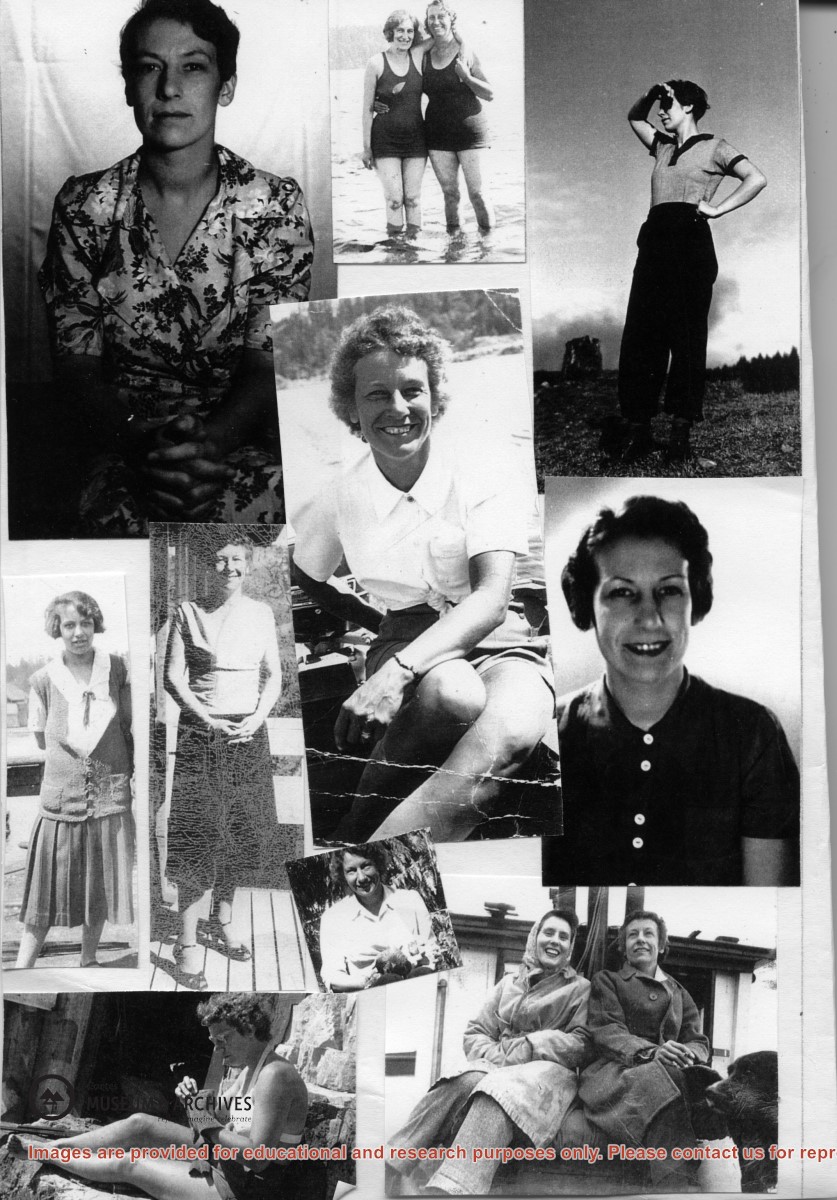
Series consists of one photograph album containing 329 black and white photographs with captions, dating from 1922 to 1924. The photographs depict Dorothy Huck, friends and family, on Cortes and in Saskatchewan. There are also some commercial photographs of the Rocky Mountains.
Edges of the cover are frayed; the first five, the eighth and the last four pages are broken along the fold and are loose. The photographs are glued onto the black cardboard pages and show signs of rippling, creasing, dirt and wear but most of the images are very clear. Some of the pictures are loose or missing.
Scope and Content
Series consists of one photograph album containing 329 black and white photographs with captions, dating from 1922 to 1924. The photographs depict Dorothy Huck, friends and family, on Cortes and in Saskatchewan. There are also some commercial photographs of the Rocky Mountains.
Excerpt from Transactions of the Edinburgh Geological Society, 1868; A Trapper's Journal, Charlie Rasmussen, 1929; excerpt from The Last Great Sea mentioning Bute Wax, 2000; Bute Inlet history and the Glacier Museum Project, Judith Williams, 2010; BC Arts Capacity and Sustainability Grant draft application, 2011; emails and webpage printouts, 2010, 2011, 2015. Newspaper clippings and magazine articles relating to Bute Inlet, 2010-2019, subjects mentioned include: George Vancouver, Cougar Companions, Disposition of Crown Land and Allocation of Water, Plutonic Power, fishing, Homalco history and culture, Tsilqot'in, Glen Macklin, National Geographic. CIMAS promotional material for the Bute Inlet boat trip and exhibit; photographs and post cards
Excerpt from Transactions of the Edinburgh Geological Society, 1868; A Trapper's Journal, Charlie Rasmussen, 1929; excerpt from The Last Great Sea mentioning Bute Wax, 2000; Bute Inlet history and the Glacier Museum Project, Judith Williams, 2010; BC Arts Capacity and Sustainability Grant draft application, 2011; emails and webpage printouts, 2010, 2011, 2015. Newspaper clippings and magazine articles relating to Bute Inlet, 2010-2019, subjects mentioned include: George Vancouver, Cougar Companions, Disposition of Crown Land and Allocation of Water, Plutonic Power, fishing, Homalco history and culture, Tsilqot'in, Glen Macklin, National Geographic. CIMAS promotional material for the Bute Inlet boat trip and exhibit; photographs and post cards
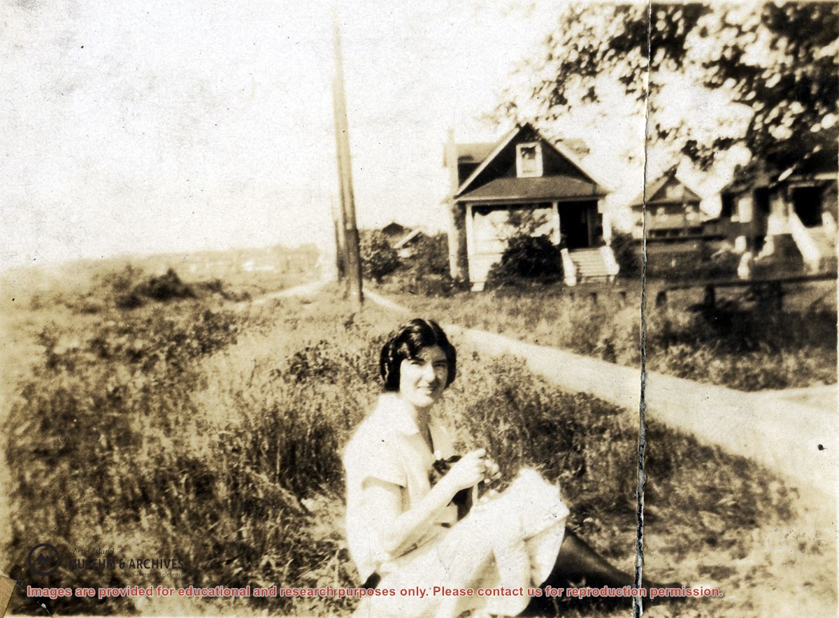
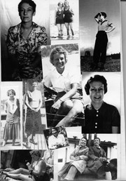
Photograph of a young woman (unidentified, but the same as in photo #2001.001.472) sitting in the grass beside a narrow road; several houses are in the background, Sk.
Photograph of a young woman (unidentified, but the same as in photo #2001.001.472) sitting in the grass beside a narrow road; several houses are in the background, Sk.
File contains photocopies of the original Crown Grants and subsequent title changes with plan maps.
To Moses Ireland: 1893, Crown Grant for the W 1/2 of the SW 1/4 of Section 35 and the fractional SE 1/4 of Section 35 (161 acres around Whaletown Bay
To George Alderson: 1961, Crown Grant for Lot 3 of Section 34
Binder contains interviews, stories and pictures. Binder contains interviews, stories and pictures. It was created in 2001 as part of the exhibit "The Von Donop Creek Story - 1920-1960", curated and mounted by Doreen Thompson.
Binder contains interviews, stories and pictures. Binder contains interviews, stories and pictures. It was created in 2001 as part of the exhibit "The Von Donop Creek Story - 1920-1960", curated and mounted by Doreen Thompson.
File contains a photocopied part of a map showing the locations of researched property in the Whaletown Lagoon and Whaletown Harbour area. The map is glued to an envelope which has a list of Crown grants and other conveyances on the back.
It contains photocopies of original land grants and other conveyances for the following:
Moses Ireland: 1893, Crown Grant for the W 1/2 of SW 1/4 of Sec 35 and W 1/2 of the SW 1/4 of Section 34
Joseph Youart: 1900, Crown Grant for Fractional NE 1/4 of Sec 35 (sold to Alice Robertson in 1908; "Burnside" is still in the Robertson family).
Nicholas Thompson: 1920, Crown Grant for the Fractional SW 1/4 of Sec 35
Charles Strange: 1914, Crown Grant for the NW 1/4 of Sec 35
File contains information on subdivision and title changes, and a photocopy of the original Crown grant, in the Whaletown Lagoon area, to:
Samuel Thompson: 1894, Crown Grant for SW 1/4 of Section 35 and NW 1/4 of Section 34, 160 acres
File also contains four maps (stored in the Map Cabinet):
1) Subdivision map of part of NE 1/4 of Sec. 34 and part of NE 1/4 of Sec. 34, 1995
2) Subdivision Plan of NW 1/4 of Sec. 34 and NE 1/4 of Sec. 34 and part of E 1/2 of SE 1/2 of Sec. 34, 1995
3) Subdivision Plan of Lot A, NW 1/4 of Sec. 34, 1976
4) Subdivision Plan of part of NW 1/4 of Section 34, 1994
(Files 9 and 10 are from the same envelope.)
Binder contains interviews, stories and photographs documenting the social history of the Whaletown area from 1907-1930. It was created as part of the Windows on Whaletown Exhibit, curated and mounted by Doreen Thompson.
Binder contains interviews, stories and photographs documenting the social history of the Whaletown area from 1907-1930. It was created as part of the Windows on Whaletown Exhibit, curated and mounted by Doreen Thompson.
Series consists of photographs of Cortes Island people and places which were collected from various sources by Doreen Thompson during her work on Museum exhibits.
Series consists of photographs of Cortes Island people and places which were collected from various sources by Doreen Thompson during her work on Museum exhibits.
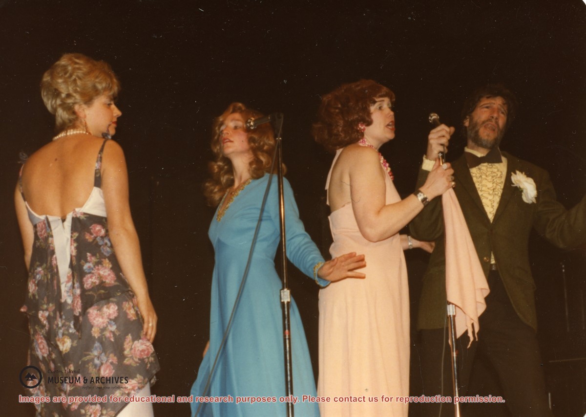
(L to R): Isolde Ruthenberg, Sheril Matthews, Gloria Jorg and Paul Kirmmse performing "Hit the Road Jack" at a Gorge Hall Variety Night. The name of the group was based on the doo-wop band Ray Charles and the Raylettes.
(L to R): Isolde Ruthenberg, Sheril Matthews, Gloria Jorg and Paul Kirmmse performing "Hit the Road Jack" at a Gorge Hall Variety Night. The name of the group was based on the doo-wop band Ray Charles and the Raylettes.
File contains title information to 1991 and a photocopy of the original Crown Grant to:
Nicholas Thompson: 1920, Crown Grant of Fractional SW 1/4 of Section 35; 54 acres on the southwest of Whaletown Bay
File contains a small explanatory map if a 5.5 acre portion of fractional SW 1/4 of Sec. 35, 1949, and a Subdivision Plan map of part of fractional SW 1/4 of Sec. 35, 1957 (stored in the Map Cabinet).
(Files 9 and 10 are from the same envelope.)
File contains scanned copies of photographs donated by Jim Palmer for the Carrington Bay exhibit in 2009, depicting the community living in Carrington Bay in the 1970s and 1980s.
Jim Palmer and Jan Gemmel lived in a house on the west side of the log jam between Carrington Lagoon and Carrington Bay. Jim built the house at the property of John and Anna Gregg in Manson's Landing and relocated it onto pilings in Carrington Bay. Jim and Jan later fabricated steel pontoons for it. In 1985 the house was moved onto the floats and towed into Gorge Harbour by Bob Thompson with his boat "Sutil Chief".