Fonds consists of ten diaries kept by James Layton, covering the years 1948-1981, and a Time Book. (Years 1967-1971 are missing.) Layton made brief daily entries in the diaries, noting the weather, activities, social interactions and, occasionally, notable external events. Typical activities included logging, fishing, working on an oyster lease, digging clams, gardening, visiting, reading and writing letters. Times of planting and harvesting the garden, sightings of wildlife, and names of people living nearby or visiting on boats are recorded.
James (Jimmy) George Layton (1897-1990) was born in Camberwell, England. He fought in World War I, was severely wounded when he flung himself on a grenade which had landed in his foxhole, and received a medal for his bravery. In 1920, Layton emigrated to Canada, where he found work in coastal logging camps. Other members of the family, including his parents and seven of his ten siblings, also moved to Canada. At the time of his father's death in 1939, Layton, his parents and three of his brothers were living on Thurlow Island. In the 1940s he moved to the head of Von Donop Inlet on Cortes Island. His float house was drawn up on the beach next to a little islet that was joined to the shore at low tide, where he cultivated a garden and orchard. Layton found work logging and caretaking for local camps active in Von Donop, and helping his brother on his oyster lease. He moved to Lund in 1972, where he passed away at the age of 92.
Custodial History
Diaries were given to Joan Bevington by her cousin Capt. Harrison Layton, the nephew of James Layton, for donation to CIMAS.
Scope and Content
Fonds consists of ten diaries kept by James Layton, covering the years 1948-1981, and a Time Book. (Years 1967-1971 are missing.) Layton made brief daily entries in the diaries, noting the weather, activities, social interactions and, occasionally, notable external events. Typical activities included logging, fishing, working on an oyster lease, digging clams, gardening, visiting, reading and writing letters. Times of planting and harvesting the garden, sightings of wildlife, and names of people living nearby or visiting on boats are recorded.
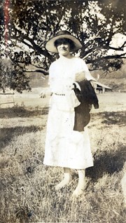
Photograph of Marion Cafferata standing in a clearing in front of a spreading tree. Fields, fences and a building can be seen in the background. The Cafferata family had a homestead at the present-day junction of Carrington Bay Rd. and the old road to Carrington Bay.
Photograph of Marion Cafferata standing in a clearing in front of a spreading tree. Fields, fences and a building can be seen in the background. The Cafferata family had a homestead at the present-day junction of Carrington Bay Rd. and the old road to Carrington Bay.
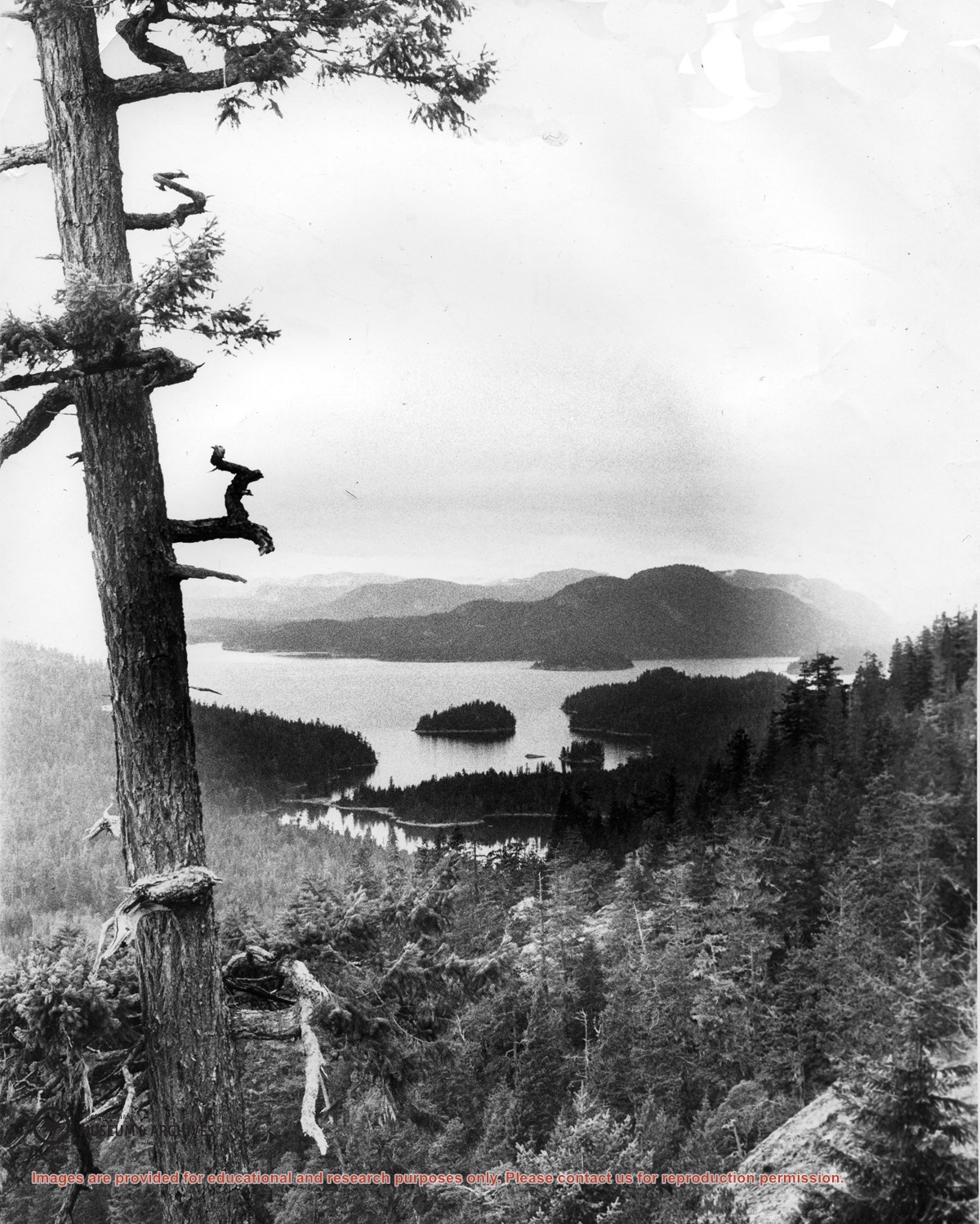
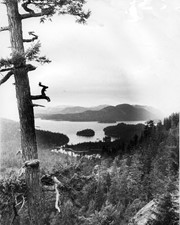
Looking north from Green Mountain over Carrington Lagoon and Carrington Bay (tidal falls in between) across 5 miles of water to Read Island, with a slew of islands to the north.
File contains photocopies of original Crown Grants, subsequent title changes and maps for:
To Joseph Gregson: 1926, Crown Grant for fractional W 1/2 of Lot 899 and Lot 901 (between Coulter and Carrington Bays), with a water easement for Wailes
To John Nugent McIllree: 1957, Crown Grant of mineral rights to lots at Coulter Bay surveyed as the "Arrow" and "Bullseye" mineral claims
To Hilda Peterson: 1919, Crown Grant for Lot 878, Carrington Bay, 55 acres
(Files 12 through 16 are from the same envelope.)
File contains a page of notes, and photocopies of a tax sale notice (1938) and list of properties forfeited for non-payment of taxes, Crown Grants and other title information for the following:
William Walter James: 1926, Crown Grant for NW 1/4 of Sec. 38; 156 acres for $1.00; forfeited to Crown in 1939
Tom Albinson: 1919, Crown Grant for Lot 867; forfeited in 1927
Sadie McMurray: 1917, NE 1/4 of Sec. 39; 160 acres for $160
Peter Police: 1925, fractional NW 1/4 of Sec. 39; 103 acres for $1.00
(Files 12 through 16 are from the same envelope.)
File contains a key map which was pasted on the front of the envelope indicating the areas researched for Files 12-16; notes on the titles; photocopies of Crown Grants and subsequent title information for:
BC Buildings Corp: 1982, Crown Grant for Block A of SW 1/4 of Sec. 25 (Highways Maintenance Yard)
District Lot 871 (40 acres between Carrington and Coulter Bays): to James Frederick McManus, 1919
To Ernest Henry Vaughn: 1922, Crown Grant for NE 1/4 and NW 1/4 of NE 1/4 of Sec. 24; SE 1/4 of SW 1/4 and SW 1/4 of SE 1/4 of Sec 31
Herbert Proctor: 1928 for fractional SW 1/4 of Sec. 41, bordering Tork Reserve; 159 acres for $159.00 (orig. Crown Grant to Herbert Proctor in 1922)
To William Cowan: 1937, E 1/2 of SE 1/4 of Sec. 26, 89 acres
(Files 12 through 16 are from the same envelope.)