Coloured map of southwestern BC showing municipalities, geographical features, land and sea routes, natural resources, etc. The back of the map is fully printed with information about BC and suggested travel itineraries.
Map needs preservation: edges are frayed and there are several tears.
Coloured map of southwestern BC showing municipalities, geographical features, land and sea routes, natural resources, etc. The back of the map is fully printed with information about BC and suggested travel itineraries.
Map needs preservation: edges are frayed and there are several tears.
File contains maps of Bute Inlet (1970), Cortes Island/Read Island and surrounding area (ca. 1950), Powell River (1968) and Cortes Island zoning maps (Jan 1974).
File contains maps of Bute Inlet (1970), Cortes Island/Read Island and surrounding area (ca. 1950), Powell River (1968) and Cortes Island zoning maps (Jan 1974).
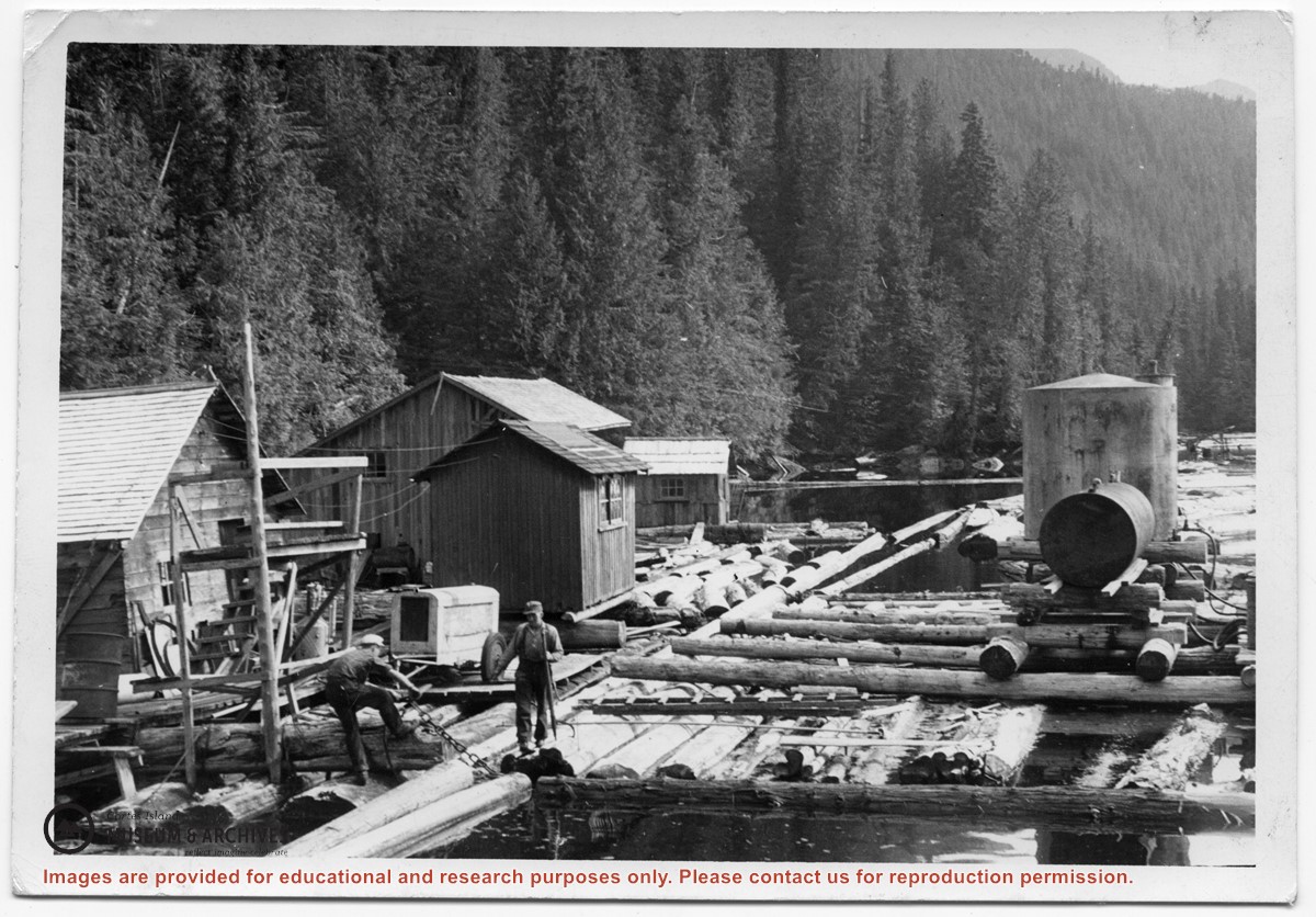
Photograph of two men on floats made of logs chained together, with the buildings, tanks and other paraphernalia of a logging camp on the floats. Location is Seymour Inlet.
Photograph of two men on floats made of logs chained together, with the buildings, tanks and other paraphernalia of a logging camp on the floats. Location is Seymour Inlet.
File contains hand-drawn maps from the early 1900s. There are two copies of the plan of part of SW 1/4 of Section 34; a plan of Gorge Harbour with names of owners written in; and a plan showing part of Read Island.
File contains hand-drawn maps from the early 1900s. There are two copies of the plan of part of SW 1/4 of Section 34; a plan of Gorge Harbour with names of owners written in; and a plan showing part of Read Island.
File contains five maps of Hernando Island: two showing plans of pre-emptions, 1891-1892; two copies of an old hand-drawn map, 1955; and one map of a later proposed development (undated). Some maps have notes on homesteads.
File contains five maps of Hernando Island: two showing plans of pre-emptions, 1891-1892; two copies of an old hand-drawn map, 1955; and one map of a later proposed development (undated). Some maps have notes on homesteads.
The base map is a zoning map produced by the Regional District of Comox-
Strathcona for the Cortes Island Land Use Project (Aug 1969). Edwards used
coloured pencil to show land and foreshore zones, and transferred information
about early preemptions and old roads and trails from an earlier map (see
Donald Palmer fonds, 2020.002.011, map of Cortes Island, Sayward District, ca.
1915).
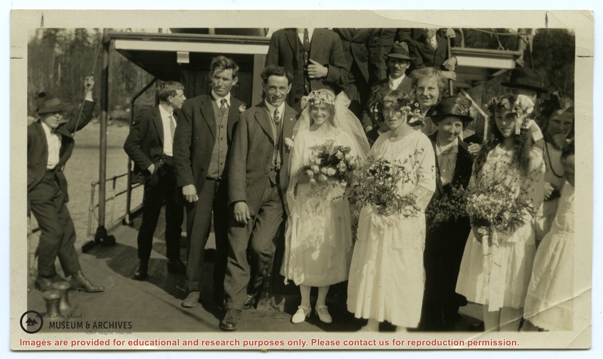
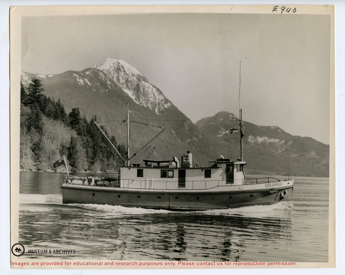
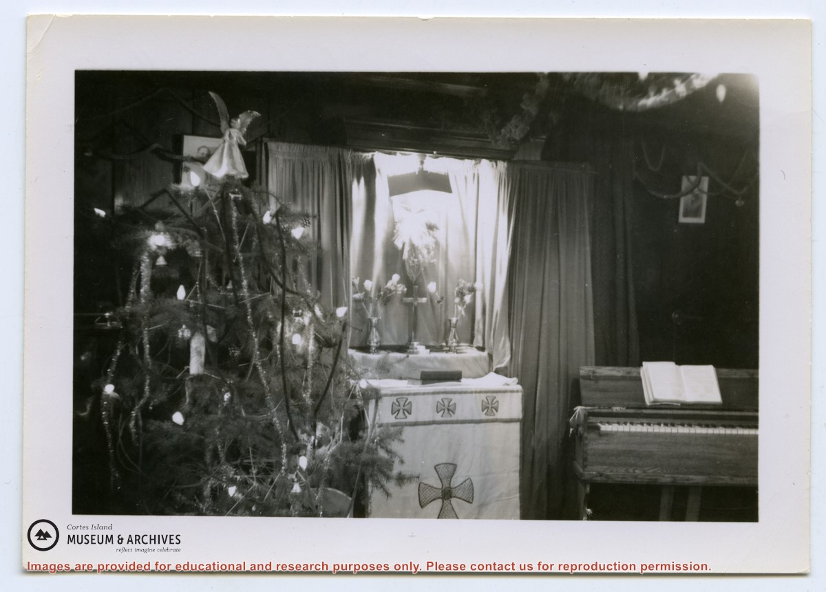
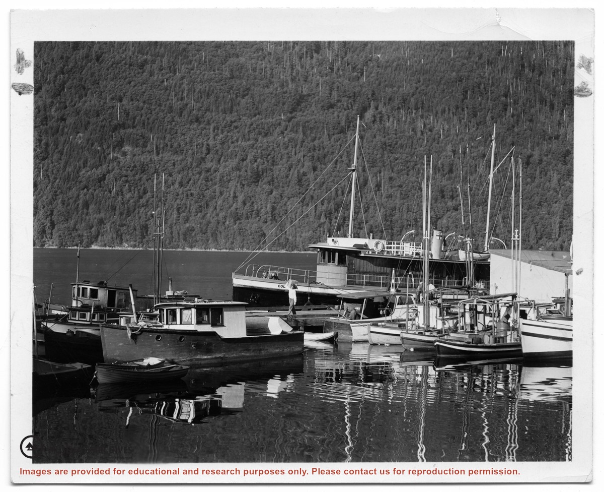
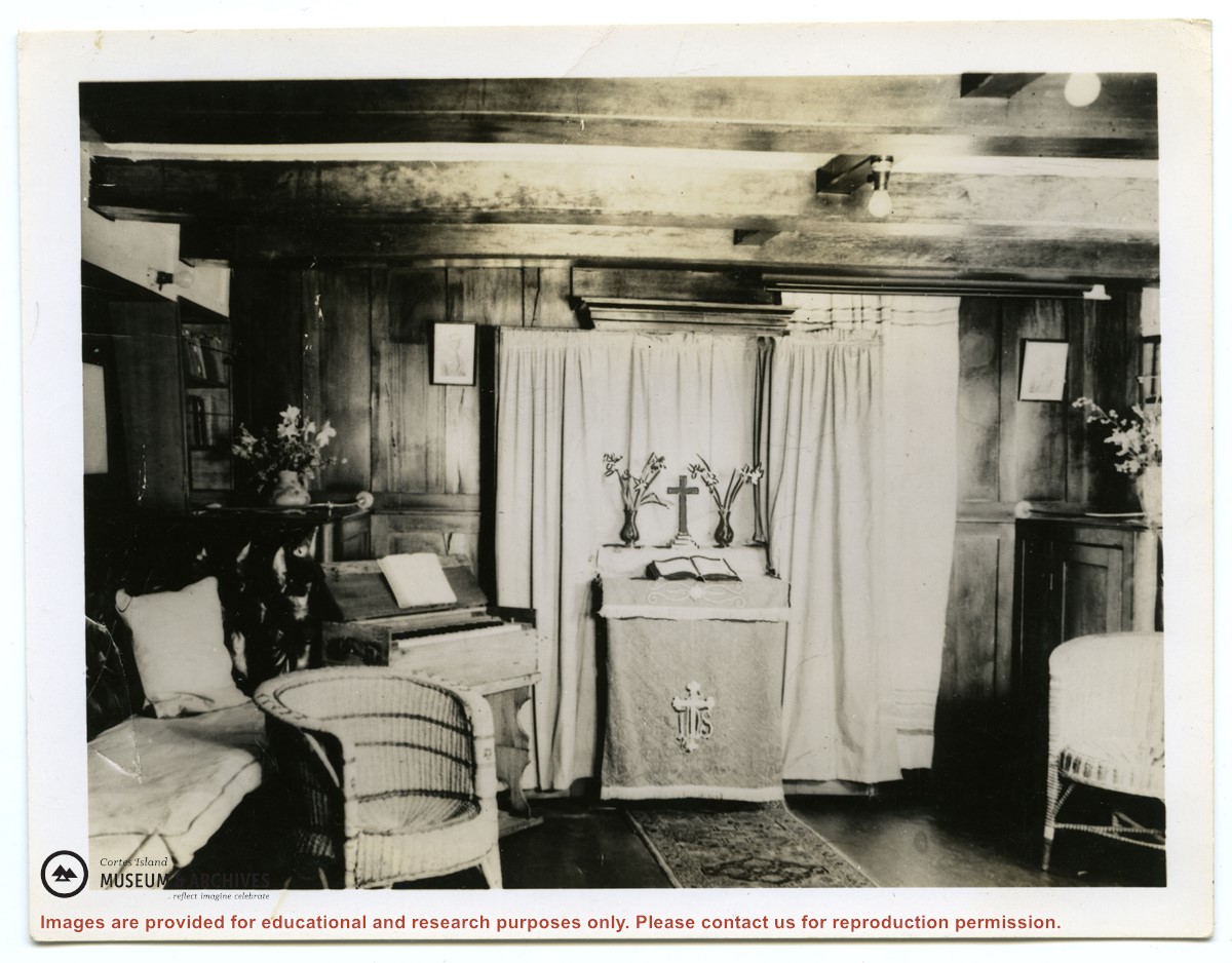
Photograph of the chapel in the cabin of the second "Columbia", with the organ on the left and the portable altar set up for a service. (see "Anderson, Doris, "The Columbia Is Coming"; Gray's Publishing, 1982, photo inset)
2 photograph prints: b&w; 25.6 x 20 and 13 x 10 cm
Scope and Content
Photograph of the chapel in the cabin of the second "Columbia", with the organ on the left and the portable altar set up for a service. (see "Anderson, Doris, "The Columbia Is Coming"; Gray's Publishing, 1982, photo inset)