Series consists of a hand drawn map of Cortes Island showing places of interest to visitors, maps showing the location of hydro distribution lines on Cortes Island, maps related to zoning and rezoning on Cortes Island, the Official Settlement Plan, and a drawing showing an engineering plan for the Whaletown ferry terminal.
Series consists of a hand drawn map of Cortes Island showing places of interest to visitors, maps showing the location of hydro distribution lines on Cortes Island, maps related to zoning and rezoning on Cortes Island, the Official Settlement Plan, and a drawing showing an engineering plan for the Whaletown ferry terminal.
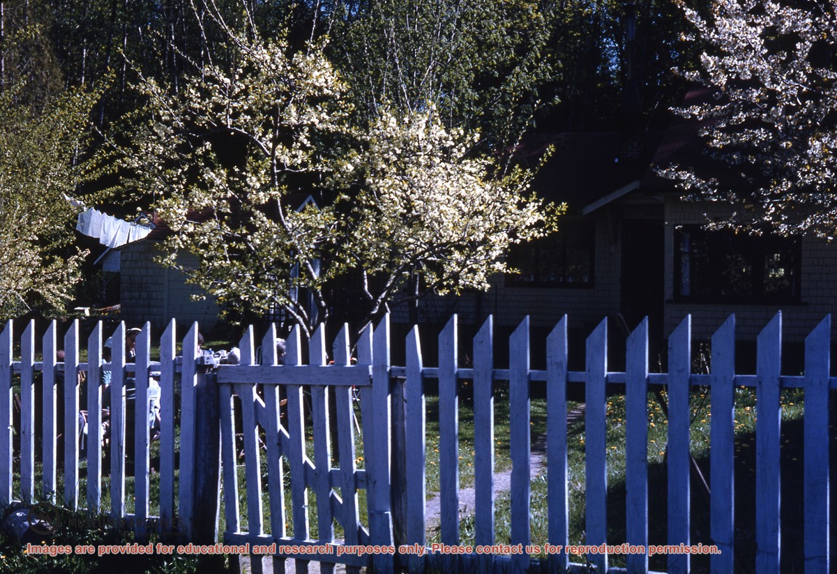
Series consists of materials relating to the Cortes Island Official Community Plan (OCP) and the Zoning Bylaw. It includes copies of the first and second Official Community Plans (1979 and 1995) and the first and second Zoning Bylaws (1970 and 2002). There are materials from an OCP revision (1992 -1995) and a Zoning Bylaw revision (ca. 1998-2003) including annotated draft copies, detailed APC commentary, correspondence, background materials and minutes of public meetings; Plan Maps and maps of Cortes properties.
?? cm of textual records; 4 cerlox-bound map books
Scope and Content
Series consists of materials relating to the Cortes Island Official Community Plan (OCP) and the Zoning Bylaw. It includes copies of the first and second Official Community Plans (1979 and 1995) and the first and second Zoning Bylaws (1970 and 2002). There are materials from an OCP revision (1992 -1995) and a Zoning Bylaw revision (ca. 1998-2003) including annotated draft copies, detailed APC commentary, correspondence, background materials and minutes of public meetings; Plan Maps and maps of Cortes properties.
File contains a draft of the Sustainable Resource Management Plan for the Cortes Landscape Unit, by the Ministry of Agriculture and Lands with responses from Director Hiebert and the Cortes Ecoforestry Society.
File contains a draft of the Sustainable Resource Management Plan for the Cortes Landscape Unit, by the Ministry of Agriculture and Lands with responses from Director Hiebert and the Cortes Ecoforestry Society.
File contains a copy of the plan for the Sunshine Coast Forest District, which includes Cortes, Read and Maurelle Islands, with Director Hiebert's comments.
File contains a copy of the plan for the Sunshine Coast Forest District, which includes Cortes, Read and Maurelle Islands, with Director Hiebert's comments.
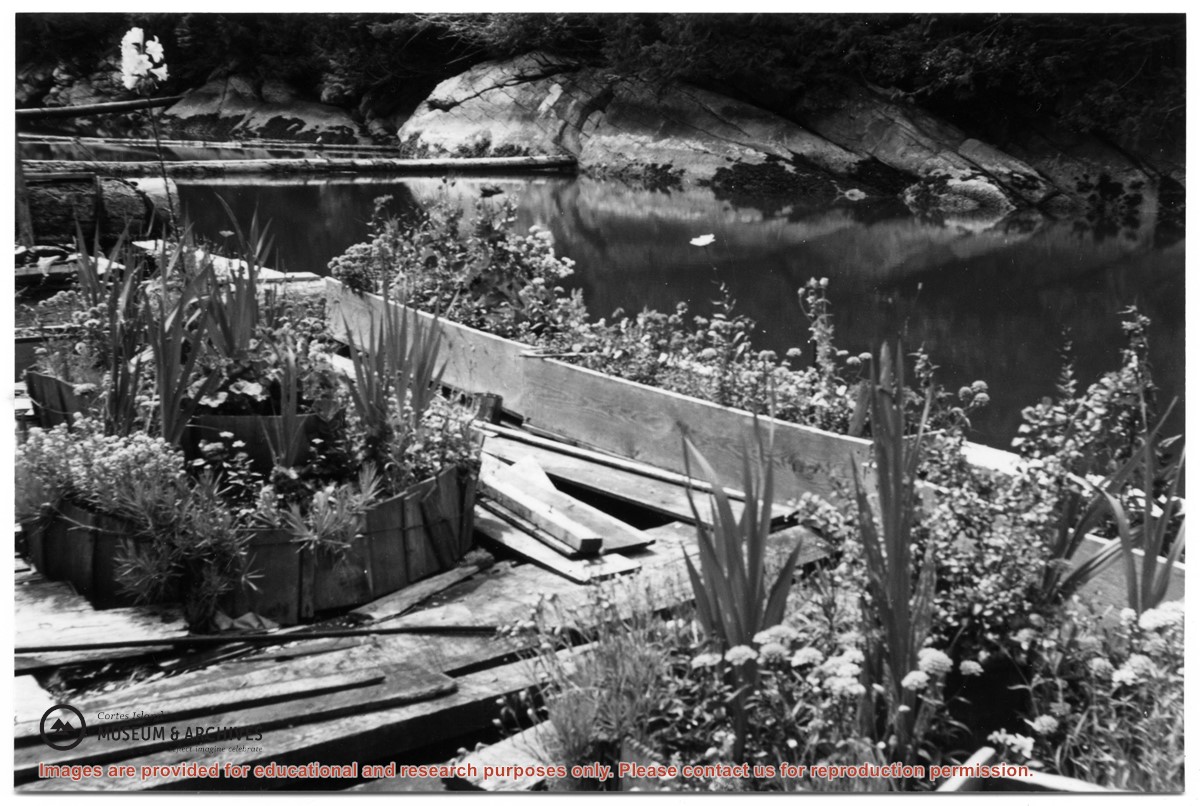
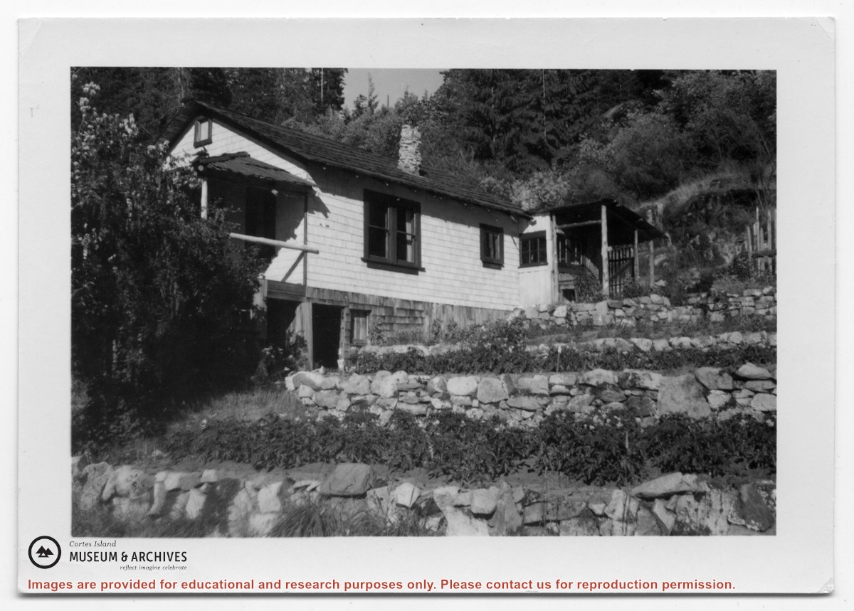
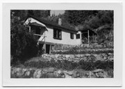
Photograph of a white house with rock-walled terraces to its right. This was Amy and Scotty McKenzie's float house, moved from Von Donop Inlet in 1951. Amy was daughter of Ruth and Henry Byers, who lived in the “Grey House” west of the ferry landing. (The "Grey House" was later moved to Squirrel Cove next to the Store.) The McKenzie house was between the Grey House and the ferry landing; it was torn down ca. 1974. The terraces may still be seen in the small park next to the ferry landing.
Photograph of a white house with rock-walled terraces to its right. This was Amy and Scotty McKenzie's float house, moved from Von Donop Inlet in 1951. Amy was daughter of Ruth and Henry Byers, who lived in the “Grey House” west of the ferry landing. (The "Grey House" was later moved to Squirrel Cove next to the Store.) The McKenzie house was between the Grey House and the ferry landing; it was torn down ca. 1974. The terraces may still be seen in the small park next to the ferry landing.
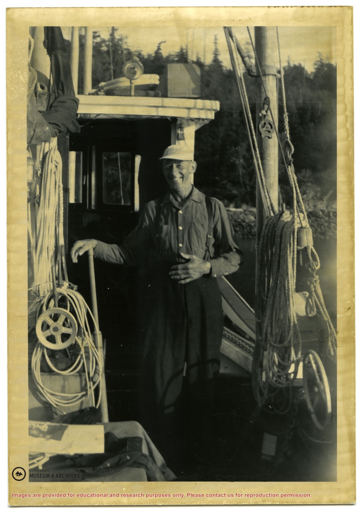
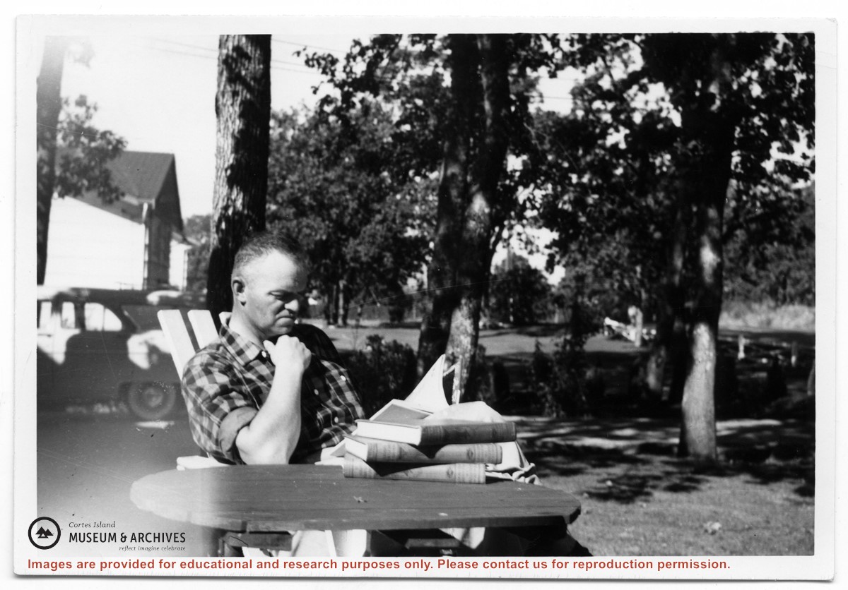
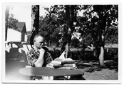
Photograph of Don Maclean in his garden at Cedar Hill Cross Roads. Maclean acted as a Lay Reader for the Columbia Coast Mission in Whaletown in the 1960s when no clergymen were available.
Photograph of Don Maclean in his garden at Cedar Hill Cross Roads. Maclean acted as a Lay Reader for the Columbia Coast Mission in Whaletown in the 1960s when no clergymen were available.