Fonds consists of the records of the Cortes Island Ratepayers Association, an organization of the property owners and residents of Cortes Island from 1963 to 1984. They include administrative documents such as the constitution and membership lists, minutes of CIRA meetings, annual reports, newsletters to members, correspondence and materials related to the provision of services, land use planning and other issues of island concern.
The fonds is composed of the following series: Administrative Documents; Minutes; Financial; Newsletters and Notices; Correspondence; Subject; Community Planning and Land Use (Advisory Planning Commission); Clippings; and Maps and Plans.
The Cortes Island Ratepayers Association (CIRA) was an association of property owners and residents formed in 1963 to "further the development of the island and to have a representative body in dealing with the Provincial government."
The first activity initiated by CIRA was to lobby the provincial government for the provision of electricity and ferry service to Cortes Island. Their efforts met with success. Electricity was brought to the island in 1970 and ferry service from Quadra Island to Cortes Island began in 1969. CIRA also became an important forum for the discussion of other important services on Cortes Island, including roads, fire protection, garbage disposal, water quality, rural mail delivery and library facilities.
As a result of CIRA's efforts to bring electricity to Cortes Island, in 1967 the Minister of Municipal Affairs, Dan Campbell, designated Cortes Island a Local Improvement District. This made Cortes Island into a legal entity for the purpose of negotiating with the province for electrical power. In that same year, Minister Campbell invited CIRA to participate in discussions and committee work on the formation of a regional district level of government.
In 1968, Cortes Island was designated 'Electoral Area I' in the Regional District of Comox-Strathcona (RDCS) with an elected director. Under this system, a Regional Director is elected who in turn sits on the Board of the RDCS. Each Regional Director appoints an Advisory Planning Commission (APC), a committee of island residents who advise the Director on matters of island concern. In 1968, CIRA determined that the elected members of the executive of CIRA would form the APC for Cortes Island. This arrangement lasted until the dissolution of CIRA in 1984. The first zoning by-law was completed in 1970 and an Official Settlement Plan and zoning by-law in 1979.
In 1982, CIRA initiated a court case against Raven Lumber for non-compliance with the Cortes Island Official Settlement Plan and zoning by-law. CIRA won the case upon appeal, but in 1984 an Order in Council allowed Raven Lumber to proceed with their development. The court case had absorbed a great deal of CIRA energy and fund raising effort over a four year period. At the General Meeting in November, 1984 there were no candidates willing to stand for the executive. CIRA was declared inactive at that meeting and was never reactivated.
Custodial History
During the term of the last president of CIRA, the records were kept in the Gorge Harbour Community Hall on Cortes Island. After the dissolution of the CIRA in 1984, the records continued to be stored in the hall. The records were transferred to the Cortes Island Museum and Archives by the Whaletown Community Club (owner of the hall) in 2000.
Scope and Content
Fonds consists of the records of the Cortes Island Ratepayers Association, an organization of the property owners and residents of Cortes Island from 1963 to 1984. They include administrative documents such as the constitution and membership lists, minutes of CIRA meetings, annual reports, newsletters to members, correspondence and materials related to the provision of services, land use planning and other issues of island concern.
The fonds is composed of the following series: Administrative Documents; Minutes; Financial; Newsletters and Notices; Correspondence; Subject; Community Planning and Land Use (Advisory Planning Commission); Clippings; and Maps and Plans.
Regional Director of Electoral Area I (Cortes Island) fonds
Gilean Douglas fonds
Finding Aid
File list available
Arrangement
Materials were received in their original file folders, however the files were not in any discernible order. In the absence of original order, materials were arranged by function and subject at the series level and chronologically within series.
File contains a photocopy of Crown Grant and documentation of subsequent changes in title for:
William Barrett Lennard: 1928, Crown Grant for the SE and SW 1/4s of Section 23 (on the SE shore of Gorge Harbour)
(Files 3 through 7 are from the same envelope.)
File contains a photocopy of Crown Grant and documentation of subsequent changes in title for:
William Barrett Lennard: 1928, Crown Grant for the SE and SW 1/4s of Section 23 (on the SE shore of Gorge Harbour)
(Files 3 through 7 are from the same envelope.)
File contains information for the following properties:
E. H. Vaughn: 1893, Crown Grant for fractional N 1/2 of Sec. 22; 90 acres for $90.00.
James P. Allen: 1913, Crown Grant for NW 34 acres of Sec. 23; $170.00
Bernard Robinson Allen: 1919, Crown Grant for SW 1/4 of Sec. 23, 159 acres
Charles Allen: 1912, Crown Grant for SW 1/4 of Sec. 33; 160 acres for $160.00
Harold Marshall Wood: Crown Grant for E 1/2 of NE 1/4 of Sec. 46 (east of Carrington Bay); 81 acres for $1.00.
File contains the following maps, stored in the Map Cabinet:
Subdivision Plan of parcel C & E, NW 1/4 of Sec. 21, 1976
Subdivision of the fractional NE 1/4 of Sec 21, 1966; with names of property owners penciled in
Subdivision Plan of Parcel C and part of Parcel E of fractional NE 1/4 of Sec. 21, 1975
Subdivision Plan of fractional NE 1/4 of Sec. 21 and W 1/2 of SW 1/4 of Sec. 34
(Files 17 through 19 are from the same envelope.)
File contains a coloured map with researched properties coloured in, and title information and photocopies of land grants and subsequent conveyances for the following:
Edward James Breeze: 1931, Crown Grant for District Lot 1373 (parts of Section 23 and Section 17, at the southeast end of Gorge Harbour by Anvil Lake)
Frank Harper: 1913, Crown Grant for the NE 96 acres of Section 23 (at the northeast end of Gorge Harbour)
(Files 3 through 7 are from the same envelope.)
File contains a map key to the areas of Sections 17, 18, 19, 22 and 34 (south of Gorge Harbour) which were researched (Information in Files 3-7).
It contains photocopies of original land grants and subsequent conveyances for the following:
Reginald James Smith: 1946, Crown Grant 165414I for fractional SE 1/4 of Sec 23, 1946 (the Thunder Road subdivision at the eastern end of Gorge Harbour).
(Files 3 through 7 are from the same envelope.)
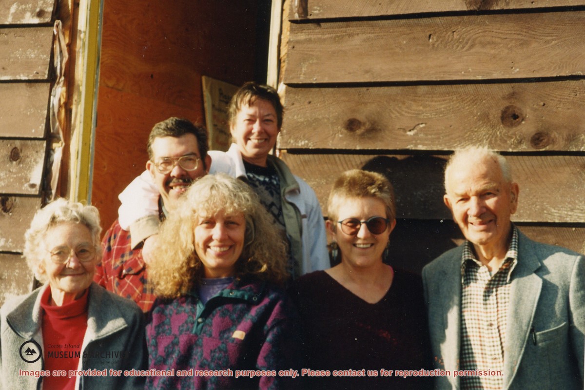
L to R: May Ellingsen, Ian Disney, Nancy Kendall, Bonnie MacDonald, Diane Bersea, Elmer Ellingsen
One of a series of 20 photographs documenting the move of the old Manson's Landing store from its position by the wharf in Mansons Landing Provincial Park to the present Museum site on Beasley Rd. The photographs are from an envelope labelled "Moving Museum, Dec. 1995. Moved by Able Transport. Paid for by Elmer and May Ellingsen."
Found in Information Files folder (Cortes Island Museum & Archives info"), Jan. 2021
Scope and Content
L to R: May Ellingsen, Ian Disney, Nancy Kendall, Bonnie MacDonald, Diane Bersea, Elmer Ellingsen
One of a series of 20 photographs documenting the move of the old Manson's Landing store from its position by the wharf in Mansons Landing Provincial Park to the present Museum site on Beasley Rd. The photographs are from an envelope labelled "Moving Museum, Dec. 1995. Moved by Able Transport. Paid for by Elmer and May Ellingsen."