File contains a photocopy of Crown Grant and documentation of subsequent changes in title for:
William Barrett Lennard: 1928, Crown Grant for the SE and SW 1/4s of Section 23 (on the SE shore of Gorge Harbour)
(Files 3 through 7 are from the same envelope.)
File contains a photocopy of Crown Grant and documentation of subsequent changes in title for:
William Barrett Lennard: 1928, Crown Grant for the SE and SW 1/4s of Section 23 (on the SE shore of Gorge Harbour)
(Files 3 through 7 are from the same envelope.)
File contains information for the following properties:
E. H. Vaughn: 1893, Crown Grant for fractional N 1/2 of Sec. 22; 90 acres for $90.00.
James P. Allen: 1913, Crown Grant for NW 34 acres of Sec. 23; $170.00
Bernard Robinson Allen: 1919, Crown Grant for SW 1/4 of Sec. 23, 159 acres
Charles Allen: 1912, Crown Grant for SW 1/4 of Sec. 33; 160 acres for $160.00
Harold Marshall Wood: Crown Grant for E 1/2 of NE 1/4 of Sec. 46 (east of Carrington Bay); 81 acres for $1.00.
File contains the following maps, stored in the Map Cabinet:
Subdivision Plan of parcel C & E, NW 1/4 of Sec. 21, 1976
Subdivision of the fractional NE 1/4 of Sec 21, 1966; with names of property owners penciled in
Subdivision Plan of Parcel C and part of Parcel E of fractional NE 1/4 of Sec. 21, 1975
Subdivision Plan of fractional NE 1/4 of Sec. 21 and W 1/2 of SW 1/4 of Sec. 34
(Files 17 through 19 are from the same envelope.)
File contains a coloured map with researched properties coloured in, and title information and photocopies of land grants and subsequent conveyances for the following:
Edward James Breeze: 1931, Crown Grant for District Lot 1373 (parts of Section 23 and Section 17, at the southeast end of Gorge Harbour by Anvil Lake)
Frank Harper: 1913, Crown Grant for the NE 96 acres of Section 23 (at the northeast end of Gorge Harbour)
(Files 3 through 7 are from the same envelope.)
File contains a map key to the areas of Sections 17, 18, 19, 22 and 34 (south of Gorge Harbour) which were researched (Information in Files 3-7).
It contains photocopies of original land grants and subsequent conveyances for the following:
Reginald James Smith: 1946, Crown Grant 165414I for fractional SE 1/4 of Sec 23, 1946 (the Thunder Road subdivision at the eastern end of Gorge Harbour).
(Files 3 through 7 are from the same envelope.)
Clippings with Strathcona Regional District public hearing notices, referendums, funding, elections, controversies, hearings, and other regional district information, 1973-2021. Regional Director reports and newsletters (George Sirk, Jenny Hiebert, Jim Abram, Noba Anderson), 1998-2018. Posters, pamphlets, and additional information. Note: file in two folders due to size
Clippings with Strathcona Regional District public hearing notices, referendums, funding, elections, controversies, hearings, and other regional district information, 1973-2021. Regional Director reports and newsletters (George Sirk, Jenny Hiebert, Jim Abram, Noba Anderson), 1998-2018. Posters, pamphlets, and additional information. Note: file in two folders due to size
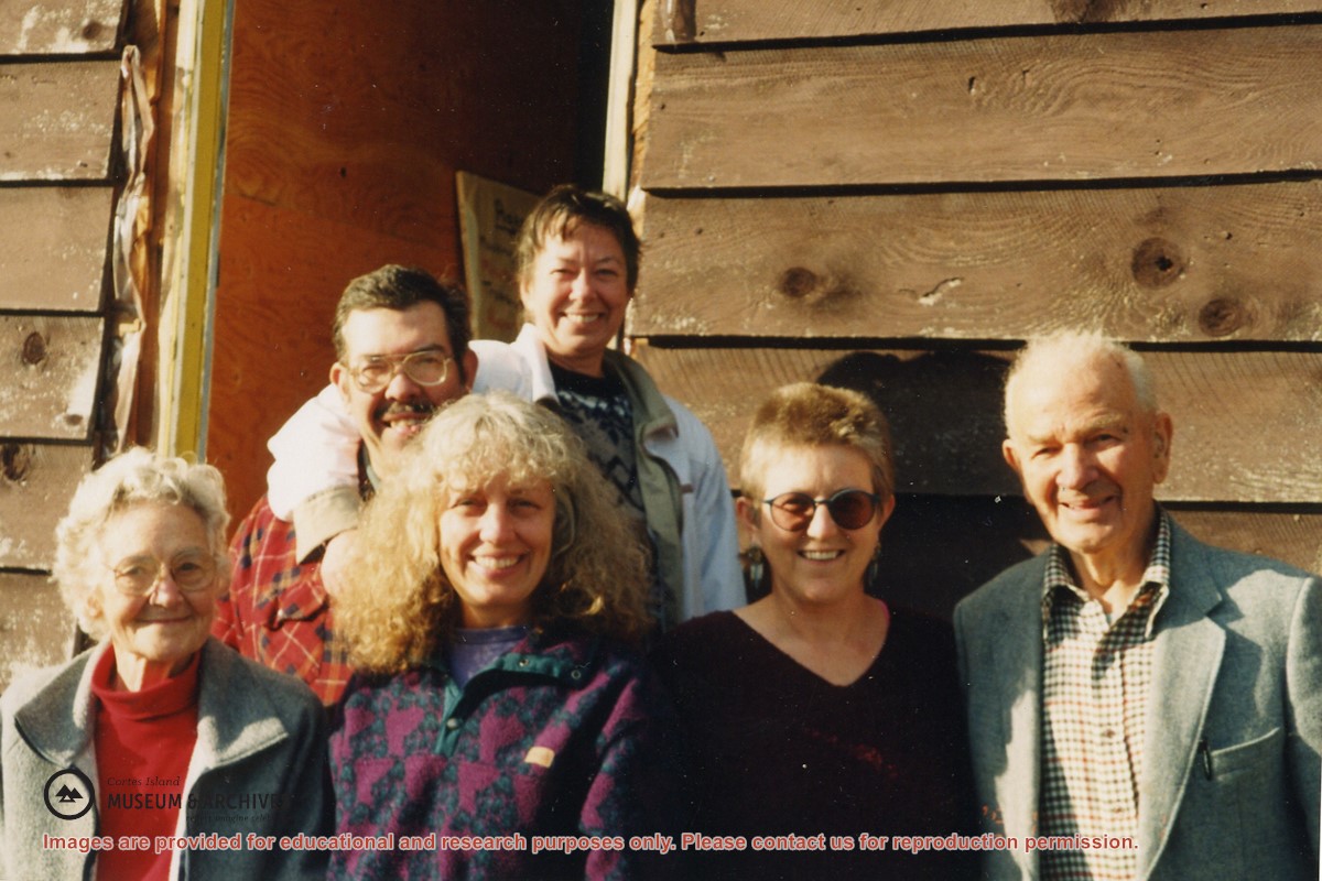
L to R: May Ellingsen, Ian Disney, Nancy Kendall, Bonnie MacDonald, Diane Bersea, Elmer Ellingsen
One of a series of 20 photographs documenting the move of the old Manson's Landing store from its position by the wharf in Mansons Landing Provincial Park to the present Museum site on Beasley Rd. The photographs are from an envelope labelled "Moving Museum, Dec. 1995. Moved by Able Transport. Paid for by Elmer and May Ellingsen."
Found in Information Files folder (Cortes Island Museum & Archives info"), Jan. 2021
Scope and Content
L to R: May Ellingsen, Ian Disney, Nancy Kendall, Bonnie MacDonald, Diane Bersea, Elmer Ellingsen
One of a series of 20 photographs documenting the move of the old Manson's Landing store from its position by the wharf in Mansons Landing Provincial Park to the present Museum site on Beasley Rd. The photographs are from an envelope labelled "Moving Museum, Dec. 1995. Moved by Able Transport. Paid for by Elmer and May Ellingsen."