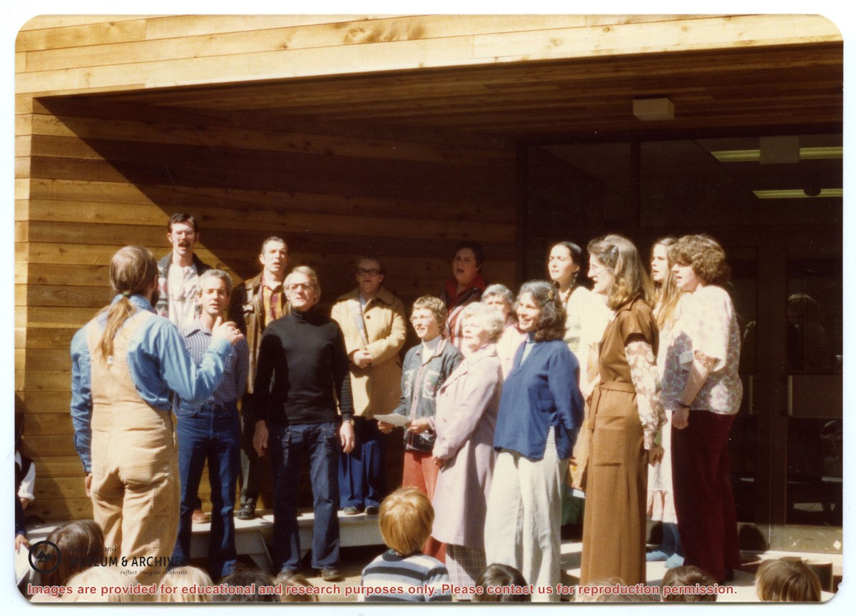
Back, L to R: Bruce Campbell, Duane Campbell, Bonnie Killian, Joan Disney, Peggy Newsham, Wendy Knudson, Kate Hathaway, Donna Norman
Front: David Blinzinger, Conductor; Bruce Ellingsen, Jack Killian, Fay Raymont, Velma Bergman, (ID), Rebecca Campbell
Back, L to R: Bruce Campbell, Duane Campbell, Bonnie Killian, Joan Disney, Peggy Newsham, Wendy Knudson, Kate Hathaway, Donna Norman
Front: David Blinzinger, Conductor; Bruce Ellingsen, Jack Killian, Fay Raymont, Velma Bergman, (ID), Rebecca Campbell
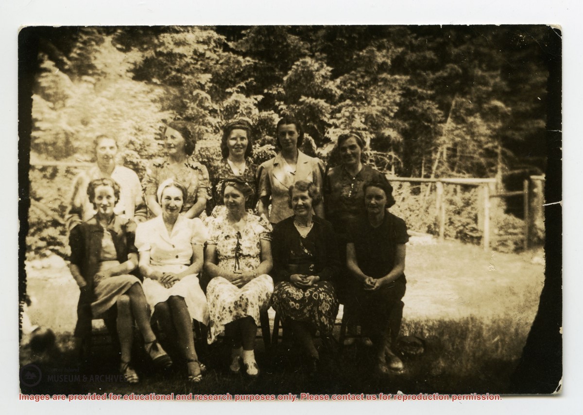
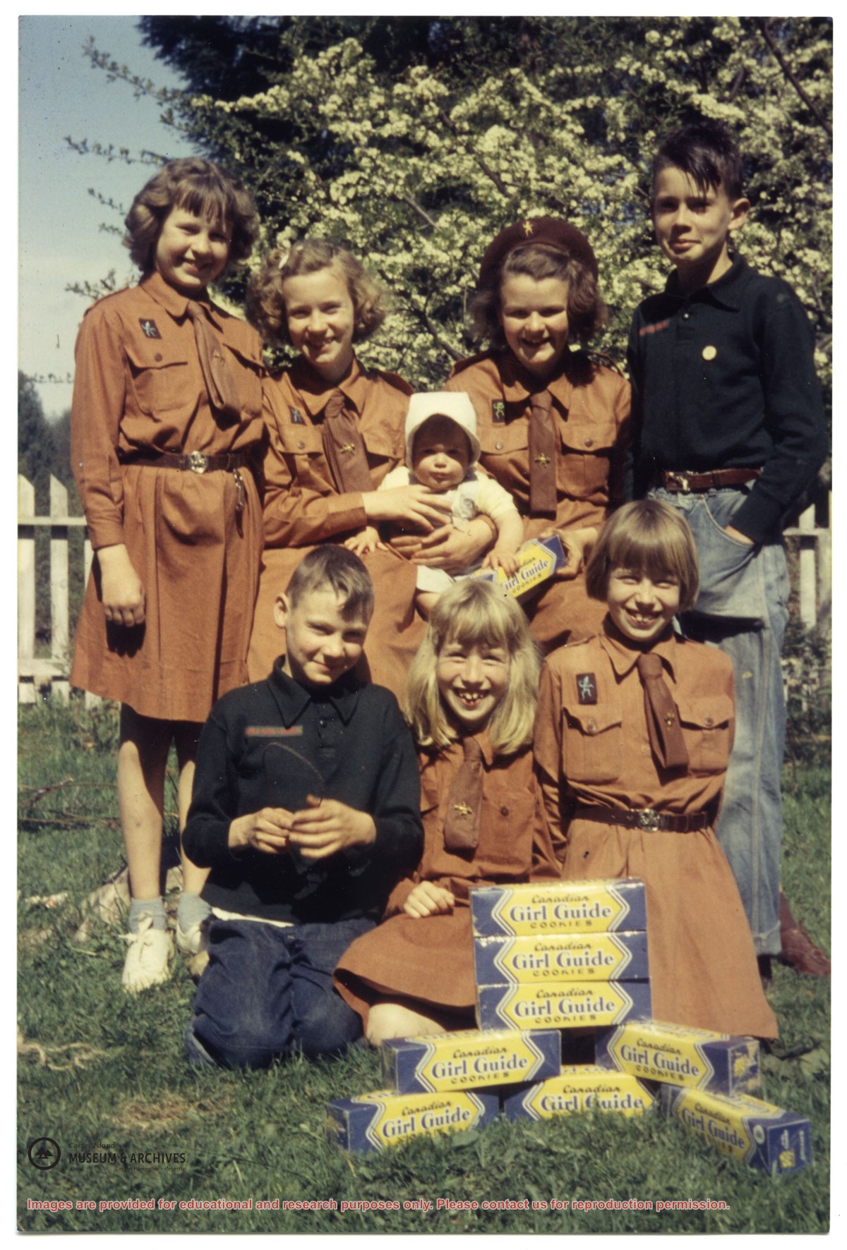
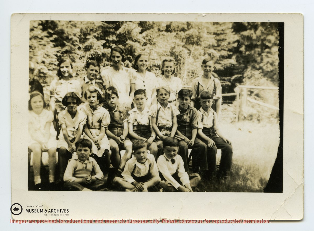
Back row L-R: unknown except Cal Campbell on R
Middle row L-R: Eleanor Christiansen; ?; ?; Fred Brooks Jr, age 8; ?; Bob Hawkins, Bill Illman?, Frank Hayes
Front Row: Bob Christiansen on R
Back row L-R: unknown except Cal Campbell on R
Middle row L-R: Eleanor Christiansen; ?; ?; Fred Brooks Jr, age 8; ?; Bob Hawkins, Bill Illman?, Frank Hayes
Front Row: Bob Christiansen on R
Binder contains interviews, stories and pictures from Etta (McKay) Byers, Bert and Penny Hansen, Peggy Pyner, Frank Hayes, Vida (Trousdale) Hodgson, Bob Milton, Lorne Musclow, and Elton Anderson.
It was created as part of the Memories of Manson's Landing Exhibit, curated and mounted by Doreen Thompson.
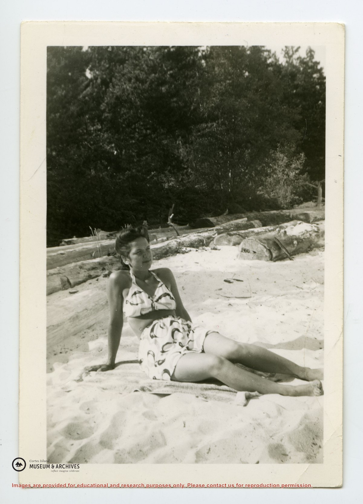
Binder contains interviews, stories and photographs relating to schools in Mansons Landing. It was created as part of the Memories of Manson's Landing Exhibit, curated and mounted by Doreen Thompson.
Binder contains interviews, stories and photographs relating to schools in Mansons Landing. It was created as part of the Memories of Manson's Landing Exhibit, curated and mounted by Doreen Thompson.
This fonds contains textual records, photographs and other archival material relating to the history and functions of the Cortes Island Museum & Archives Society. It includes material created for exhibits and research on Cortes social and natural history.
This fonds contains textual records, photographs and other archival material relating to the history and functions of the Cortes Island Museum & Archives Society. It includes material created for exhibits and research on Cortes social and natural history.
File contains title information and photocopies of land grants and subsequent conveyances for the following:
John Williams: 1914, Crown Grant for the fractional SW 1/4 of Sec 22 and fractional NW 1/4 of Sec 22 (east of Gorge Harbour entrance)
John Williams: 1914, Crown Grant for the fractional SW 1/4 of Sec 22 and frac. NW 1/4 of Sec 18 (west of the Gorge Harbour entrance)
File contains three oversize maps which are stored in the map cabinet: Map of Section 22, Plan VIP52378, Lots A,B,C (blueprint map; 85 cm x 54 cm, 1985); map of Plan 27966 (blueprint map; 55 cm x 43 cm, 1974); photocopy of map of fractional NW 1/4 Sec 17 (55 cm x 43 cm, 1973)
(Files 3 through 7 are from the same envelope.)
File contains a photocopied section map of the northern part of Cortes Island (from just south of Gorge Harbour), coloured to indicate areas for which a Crown Grant was located and areas of ungranted Crown land which still appear to be owned by the government. Scale is 1 mile to 1 inch.
File contains a photocopied section map of the northern part of Cortes Island (from just south of Gorge Harbour), coloured to indicate areas for which a Crown Grant was located and areas of ungranted Crown land which still appear to be owned by the government. Scale is 1 mile to 1 inch.