Series consists of family trees of Cortes Island settler families, with notes on related people and events. These trees are intended to help identify links between families on Cortes. Sources include online databases (e.g. Family Search.org, Ancestry.com and Canada Archives), CIMAS Archives and Information files, interviews and correspondence with family members.
Families researched include: Aldrich; Barrett; Borden; Byers; Cafferata; Froud; Hawkins; Hayes, Ashford and Griffin; Heay; Manson; Marquette; Middleton; Nichols; Percival and Saunders; Petznick; Pickles; Smith; (Carr) Smith& Marflett; Tiber; Tooker; Valley.The family trees and notes are kept in a binder labelled "Cortes Family Trees Project", located above the public access computer in the May Ellingsen Archives Room. Files are not available online due to privacy concerns.
We acknowledge that these trees are of white settler families and reflect colonization of ancestral homelands and displacement of the Indigenous Peoples who have thrived here for generations. We would welcome the opportunity to add those families to our records.
Family trees were researched by Bernice McGowan (1387 Bodington Rd, Whaletown, BC) in 2022. The Manson family tree was provided to CIMAS by Greg Johnson (2837 West 6th Avenue, Vancouver, BC V6K 1X2; phone # 604 897 5925) in 2022.
Scope and Content
Series consists of family trees of Cortes Island settler families, with notes on related people and events. These trees are intended to help identify links between families on Cortes. Sources include online databases (e.g. Family Search.org, Ancestry.com and Canada Archives), CIMAS Archives and Information files, interviews and correspondence with family members.
Families researched include: Aldrich; Barrett; Borden; Byers; Cafferata; Froud; Hawkins; Hayes, Ashford and Griffin; Heay; Manson; Marquette; Middleton; Nichols; Percival and Saunders; Petznick; Pickles; Smith; (Carr) Smith& Marflett; Tiber; Tooker; Valley.The family trees and notes are kept in a binder labelled "Cortes Family Trees Project", located above the public access computer in the May Ellingsen Archives Room. Files are not available online due to privacy concerns.
We acknowledge that these trees are of white settler families and reflect colonization of ancestral homelands and displacement of the Indigenous Peoples who have thrived here for generations. We would welcome the opportunity to add those families to our records.
File contains CCHA Mission and Vision statements, reports on projects, photograph reprints of a broom bash at the Health Centre site (in a report cover), and a copy of the fund-raising calendar (2005).
File contains CCHA Mission and Vision statements, reports on projects, photograph reprints of a broom bash at the Health Centre site (in a report cover), and a copy of the fund-raising calendar (2005).
File contains a copy of the bylaw and map of 1995, a summary of the changes (meant to reconcile 25 year gap between the previous zoning bylaws and the current OCP), and a completion and adoption strategy.
File contains a copy of the bylaw and map of 1995, a summary of the changes (meant to reconcile 25 year gap between the previous zoning bylaws and the current OCP), and a completion and adoption strategy.
File contains a page of notes, and photocopies of a tax sale notice (1938) and list of properties forfeited for non-payment of taxes, Crown Grants and other title information for the following:
William Walter James: 1926, Crown Grant for NW 1/4 of Sec. 38; 156 acres for $1.00; forfeited to Crown in 1939
Tom Albinson: 1919, Crown Grant for Lot 867; forfeited in 1927
Sadie McMurray: 1917, NE 1/4 of Sec. 39; 160 acres for $160
Peter Police: 1925, fractional NW 1/4 of Sec. 39; 103 acres for $1.00
(Files 12 through 16 are from the same envelope.)
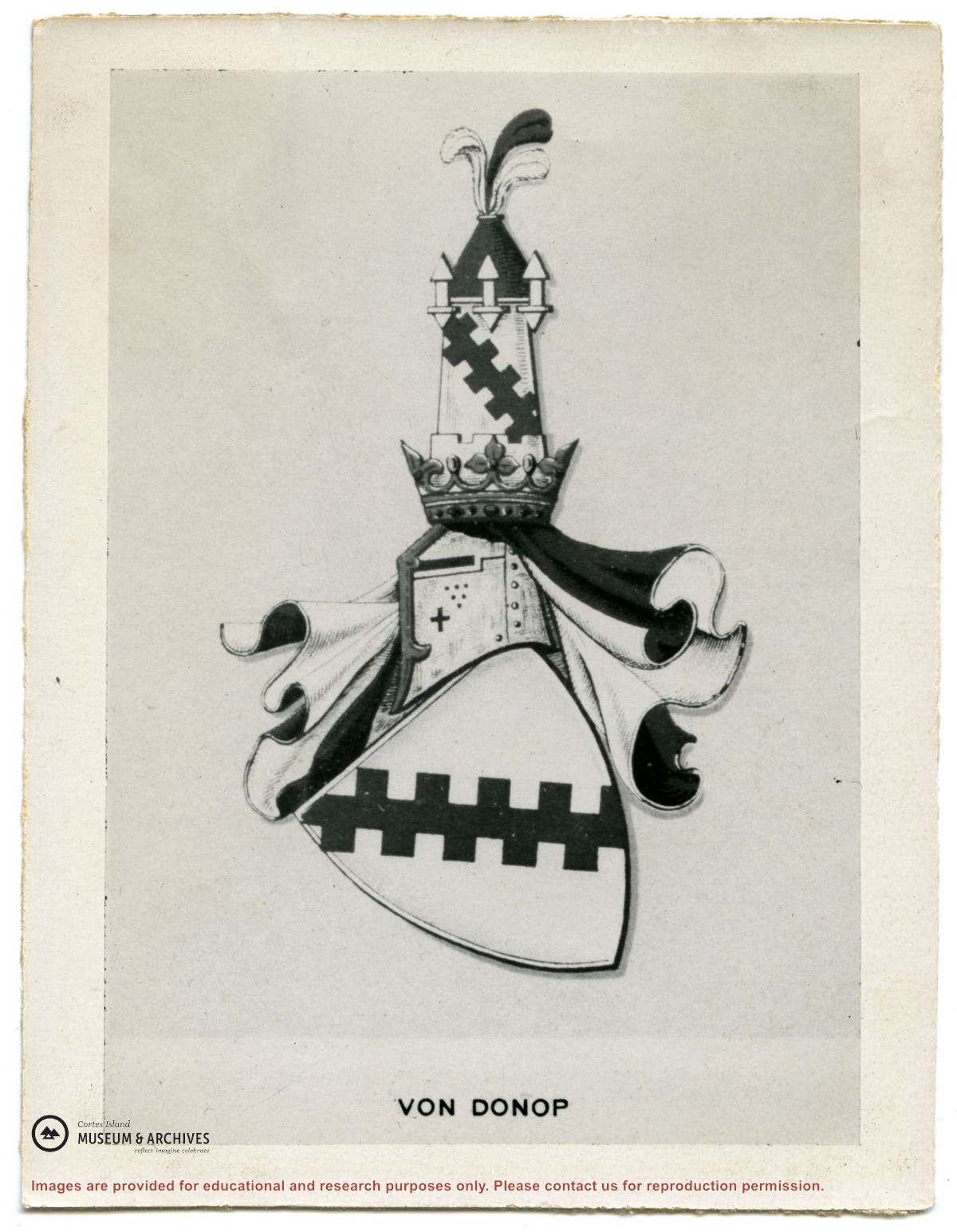
File contains hand-written notes on the history of different areas of Von Donop, a map of Cortes Island (1963), and a photocopy of a page from "British Columbia Place Names" about the inlet.
File contains hand-written notes on the history of different areas of Von Donop, a map of Cortes Island (1963), and a photocopy of a page from "British Columbia Place Names" about the inlet.
File contains May Ellingsen's notes on local history. Subjects include the Ratepayers' Association, Von Donop, Mike Manson, Whaletown people, Blind Creek and Refuge Cove. There is a transcription of a taped interview with George Griffin.
File contains May Ellingsen's notes on local history. Subjects include the Ratepayers' Association, Von Donop, Mike Manson, Whaletown people, Blind Creek and Refuge Cove. There is a transcription of a taped interview with George Griffin.
File contains minutes, agendas and other material relating to meetings of the Klahoose Table, attended by members of CILAC, Klahoose First Nations and government negotiators. It includes material relating to a proposed park at Carrington Bay.
File contains minutes, agendas and other material relating to meetings of the Klahoose Table, attended by members of CILAC, Klahoose First Nations and government negotiators. It includes material relating to a proposed park at Carrington Bay.
File contains a key map which was pasted on the front of the envelope indicating the areas researched for Files 12-16; notes on the titles; photocopies of Crown Grants and subsequent title information for:
BC Buildings Corp: 1982, Crown Grant for Block A of SW 1/4 of Sec. 25 (Highways Maintenance Yard)
District Lot 871 (40 acres between Carrington and Coulter Bays): to James Frederick McManus, 1919
To Ernest Henry Vaughn: 1922, Crown Grant for NE 1/4 and NW 1/4 of NE 1/4 of Sec. 24; SE 1/4 of SW 1/4 and SW 1/4 of SE 1/4 of Sec 31
Herbert Proctor: 1928 for fractional SW 1/4 of Sec. 41, bordering Tork Reserve; 159 acres for $159.00 (orig. Crown Grant to Herbert Proctor in 1922)
To William Cowan: 1937, E 1/2 of SE 1/4 of Sec. 26, 89 acres
(Files 12 through 16 are from the same envelope.)
DVD of a short film directed and shot by George Sirk at the Cortes Recycling Center and footage shot by Sirk of a performance by the Cortes Theatre Group.
Copyright George Sirk; to be used for display and research purposes only.
Copied from George Sirk's VHS tapes with his permission to use the contents for display and research purposes.
Scope and Content
DVD of a short film directed and shot by George Sirk at the Cortes Recycling Center and footage shot by Sirk of a performance by the Cortes Theatre Group.
Copyright George Sirk; to be used for display and research purposes only.
Fonds consists of sixteen photographs depicting people and scenes, primarily of the Manson's Landing area. Identification was provided by Fred Brooks Jr. in an interview with Cathy Jenks.
Alethea and Frederick (Fred) James Brooks Sr. and their two sons, Frederick (Fred) Earl, Jr. and Bob, lived on Cortes Island from ca. 1941 to 1944, near Manson's Landing. Fred Sr. logged in Cortes Bay and employed two of the Hawkins boys, Bill and George.
Fred Jr. attended grades three to six at Cortes Island school before the family moved to Pender Harbour. Some of the names he recalls are: the Christiansen kids (Robert, Jim, and a sister), the Tibers on the west side of Cortes Island, and the Jefferys of Smelt Bay.
Custodial History
Fred Brooks Jr. gave the photographs to Cathy Brooks of Pender Harbour Living Heritage Society, who facilitated the donation by collecting the photographs, donation form and information from Brooks and sending the materials to CIMAS.
Scope and Content
Fonds consists of sixteen photographs depicting people and scenes, primarily of the Manson's Landing area. Identification was provided by Fred Brooks Jr. in an interview with Cathy Jenks.
Pender Harbour Living Heritage holds related material from the Brooks family: https://penderharbourheritage.pastperfectonline.com/bysearchterm?keyword=Brooks+family
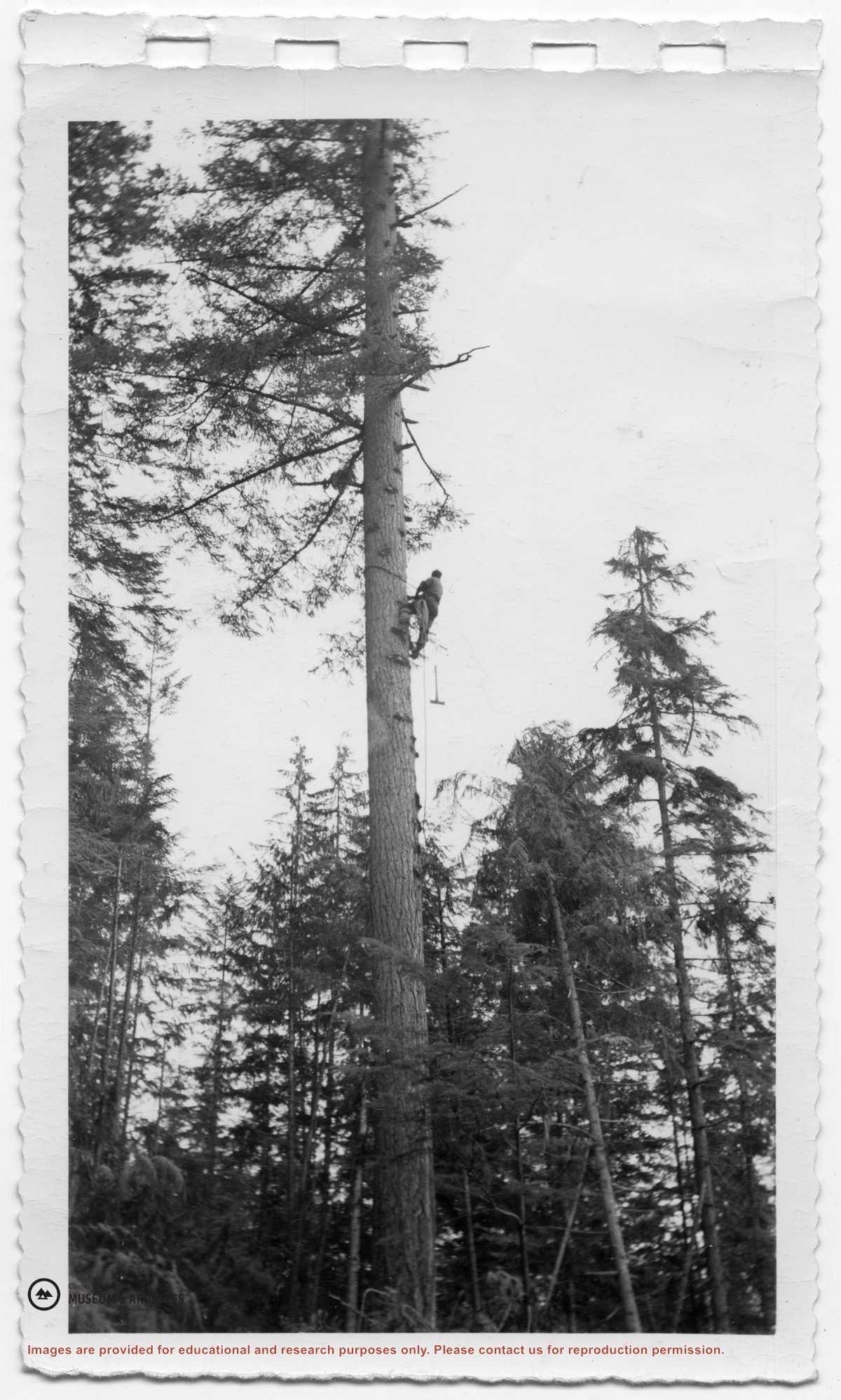
Fonds consists of ten photographs (nine black and white; 1 coloured) depicting members of the extended Byers/ Manson families, logging at Seaford and Von Donop Inlet, and the Union Steamship Chelohsin.
Henry and Ruth Byers, Ervin and Florence (Manson) McKay, Clarence and Etta (McKay) Byers, Ken and Hazel (McKay) Hansen, Scotty and Amy (Byers) McKenzie moved to Von Donop Inlet in 1939, where they ran a logging operation.
Custodial History
Found in Information Files folder (Byers family), August 1, 2020 and transferred to Archives.
Scope and Content
Fonds consists of ten photographs (nine black and white; 1 coloured) depicting members of the extended Byers/ Manson families, logging at Seaford and Von Donop Inlet, and the Union Steamship Chelohsin.


.jpg?width=1200&404=no-img.jpg&watermark=wmk)
.jpg?width=1200&404=no-img.jpg&watermark=wmk)
.jpg?width=180&404=no-img.jpg)