File contains a photocopied section map of the northern part of Cortes Island (from just south of Gorge Harbour), coloured to indicate areas for which a Crown Grant was located and areas of ungranted Crown land which still appear to be owned by the government. Scale is 1 mile to 1 inch.
File contains a photocopied section map of the northern part of Cortes Island (from just south of Gorge Harbour), coloured to indicate areas for which a Crown Grant was located and areas of ungranted Crown land which still appear to be owned by the government. Scale is 1 mile to 1 inch.
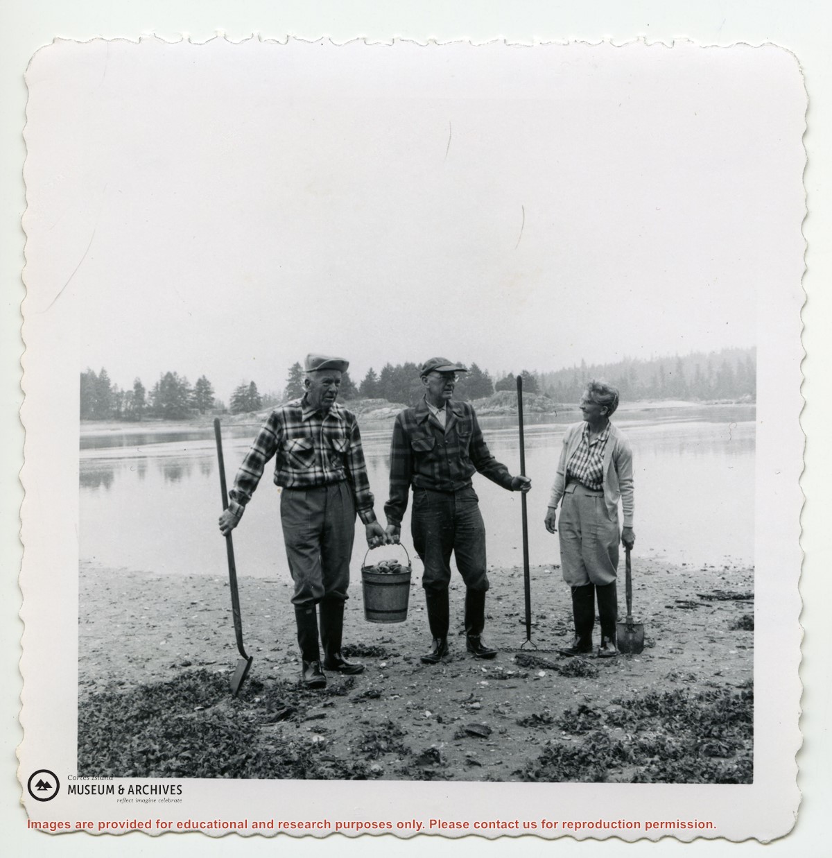
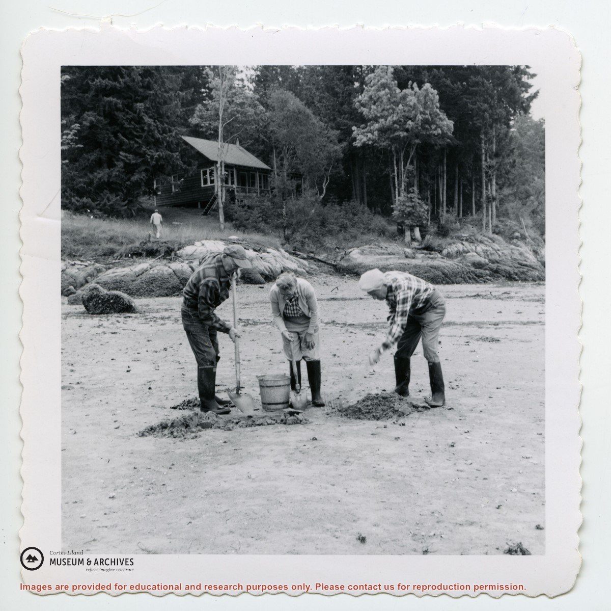
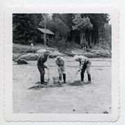
Photograph of three people gathering oysters in Manson's Lagoon. In the background is Buster and Mabel Christensen's house (L) and the Rickenbacker house (R).
Photograph of three people gathering oysters in Manson's Lagoon. In the background is Buster and Mabel Christensen's house (L) and the Rickenbacker house (R).
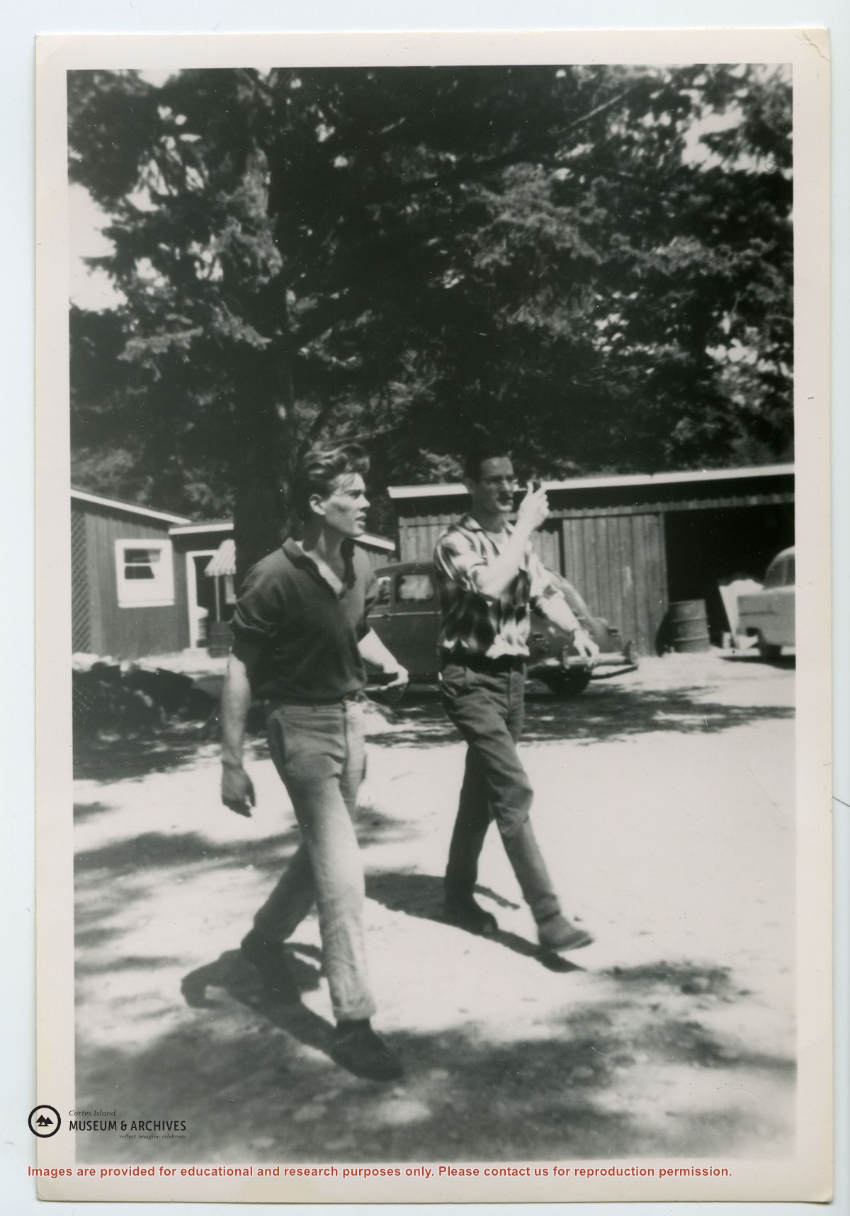
Photograph of Dennis Newsham (R) and David Ward, walking across the parking lot at the Manson's Landing wharf. Jack Summers' garage is behind and Mrs. Lowes' cafe to the left; the store was on the other side of the parking lot at the head of the wharf.
Photograph of Dennis Newsham (R) and David Ward, walking across the parking lot at the Manson's Landing wharf. Jack Summers' garage is behind and Mrs. Lowes' cafe to the left; the store was on the other side of the parking lot at the head of the wharf.


.jpg?width=1200&404=no-img.jpg&watermark=wmk)
.jpg?width=1200&404=no-img.jpg&watermark=wmk)
.jpg?width=180&404=no-img.jpg)


.jpg?width=1200&404=no-img.jpg&watermark=wmk)
.jpg?width=1200&404=no-img.jpg&watermark=wmk)
.jpg?width=180&404=no-img.jpg)
.jpg?width=1200&404=no-img.jpg&watermark=wmk)
.jpg?width=1200&404=no-img.jpg&watermark=wmk)
.jpg?width=180&404=no-img.jpg)