Various maps of Cortes Island and surrounding areas with tourist info, trails, provincial parks, local businesses, sites, property lines, topography, charts, etc, 1916-present. Info on Hiking and Orienteering Map of Cortes Island, 2003, and Cortes Island Community Mapping Project, 2011. Info on Discovery Islands Ecosystem Mapping (DIEM), 2012-2014.
Various maps of Cortes Island and surrounding areas with tourist info, trails, provincial parks, local businesses, sites, property lines, topography, charts, etc, 1916-present. Info on Hiking and Orienteering Map of Cortes Island, 2003, and Cortes Island Community Mapping Project, 2011. Info on Discovery Islands Ecosystem Mapping (DIEM), 2012-2014.
File contains a Cortes Island Visitor's Information hand-out with a map of the island and lists of businesses and services, published by the Whaletown Community Club; and a set of ticket book backs for the Cortes-Quadra and Quadra-Campbell River ferries.
File contains a Cortes Island Visitor's Information hand-out with a map of the island and lists of businesses and services, published by the Whaletown Community Club; and a set of ticket book backs for the Cortes-Quadra and Quadra-Campbell River ferries.
File contains a hand-drawn map of Hernando Island showing original pre-emptions, with information about settlement, schools and changes of title written on it.
File contains a hand-drawn map of Hernando Island showing original pre-emptions, with information about settlement, schools and changes of title written on it.
File contains a photocopied section map of the northern part of Cortes Island (from just south of Gorge Harbour), coloured to indicate areas for which a Crown Grant was located and areas of ungranted Crown land which still appear to be owned by the government. Scale is 1 mile to 1 inch.
File contains a photocopied section map of the northern part of Cortes Island (from just south of Gorge Harbour), coloured to indicate areas for which a Crown Grant was located and areas of ungranted Crown land which still appear to be owned by the government. Scale is 1 mile to 1 inch.
File contains a map key to the areas of Sections 17, 18, 19, 22 and 34 (south of Gorge Harbour) which were researched (Information in Files 3-7).
It contains photocopies of original land grants and subsequent conveyances for the following:
Reginald James Smith: 1946, Crown Grant 165414I for fractional SE 1/4 of Sec 23, 1946 (the Thunder Road subdivision at the eastern end of Gorge Harbour).
(Files 3 through 7 are from the same envelope.)
Clippings, emails, and written info on history, people, events, placenames, schools, post offices, libraries, churches, parks, SRD updates, and businesses in Whaletown, info from 1867-2018. Additional keywords: Columbia Coast Mission; Whaletown Commons; Trude's Cafe; Wee Park; WNE. Excerpt from Phillip Major's Diary, 1948. Excerpts from Chalkdust & Outhouses, West Coast Schools 1893-1950, Barbara Ann Lambert, and The Log of the Columbia, 1947-1950. A Tour Guide to Whaletown, K. Pemberton, 1999. Letters to Doreen Thompson from Mary M. McMillan, Etta Byers, D. Henderson, McKay, and Peggy Munro Anderson, 1999. Photos (copies) from Norma DeWolfe of Whaletown store, dock, post office, ferry, 1970s.
Clippings, emails, and written info on history, people, events, placenames, schools, post offices, libraries, churches, parks, SRD updates, and businesses in Whaletown, info from 1867-2018. Additional keywords: Columbia Coast Mission; Whaletown Commons; Trude's Cafe; Wee Park; WNE. Excerpt from Phillip Major's Diary, 1948. Excerpts from Chalkdust & Outhouses, West Coast Schools 1893-1950, Barbara Ann Lambert, and The Log of the Columbia, 1947-1950. A Tour Guide to Whaletown, K. Pemberton, 1999. Letters to Doreen Thompson from Mary M. McMillan, Etta Byers, D. Henderson, McKay, and Peggy Munro Anderson, 1999. Photos (copies) from Norma DeWolfe of Whaletown store, dock, post office, ferry, 1970s.
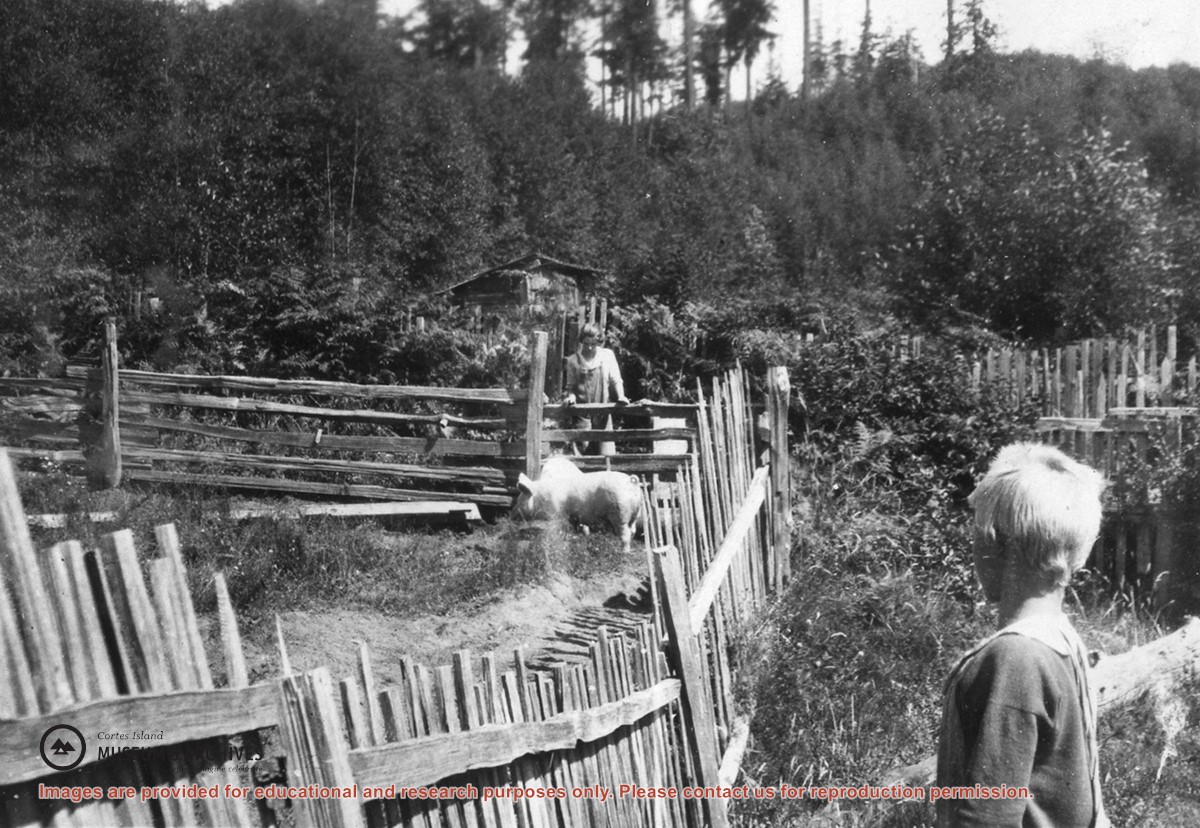
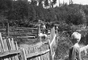
Photograph of two pigs in a pen with picket and rail fencing; a woman is leaning on the far line of fence and a boy is in the right foreground. A shed and fruit trees, and a forested hill, can be seen in the background. Photo is probably at Burnside.
Photograph of two pigs in a pen with picket and rail fencing; a woman is leaning on the far line of fence and a boy is in the right foreground. A shed and fruit trees, and a forested hill, can be seen in the background. Photo is probably at Burnside.
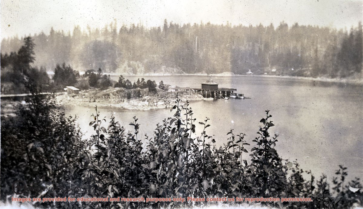
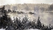
Photograph is an overview of Whaletown and Whaletown Bay, showing the dock and freight shed and the houses across the bay near the current site of the ferry dock.
Photograph is an overview of Whaletown and Whaletown Bay, showing the dock and freight shed and the houses across the bay near the current site of the ferry dock.