File contains information for the following properties:
Frederick James Smith: 1921, Crown Grant for SE 1/4 of Sec. 33; 160 acres for $1.00
Charles Allen: 1912, Crown Grant for SW 1/4 of Sec. 33; 160 acres for $160.
George Robson: 1907, Crown Grant for NW 1/4 of Sec. 21; $247.00 for 142 acres.
(Files 17 through 19 are from the same envelope.)
File contains information for the following properties:
E. H. Vaughn: 1893, Crown Grant for fractional N 1/2 of Sec. 22; 90 acres for $90.00.
James P. Allen: 1913, Crown Grant for NW 34 acres of Sec. 23; $170.00
Bernard Robinson Allen: 1919, Crown Grant for SW 1/4 of Sec. 23, 159 acres
Charles Allen: 1912, Crown Grant for SW 1/4 of Sec. 33; 160 acres for $160.00
Harold Marshall Wood: Crown Grant for E 1/2 of NE 1/4 of Sec. 46 (east of Carrington Bay); 81 acres for $1.00.
File contains the following maps, stored in the Map Cabinet:
Subdivision Plan of parcel C & E, NW 1/4 of Sec. 21, 1976
Subdivision of the fractional NE 1/4 of Sec 21, 1966; with names of property owners penciled in
Subdivision Plan of Parcel C and part of Parcel E of fractional NE 1/4 of Sec. 21, 1975
Subdivision Plan of fractional NE 1/4 of Sec. 21 and W 1/2 of SW 1/4 of Sec. 34
(Files 17 through 19 are from the same envelope.)
File contains a map key to the areas of Sections 17, 18, 19, 22 and 34 (south of Gorge Harbour) which were researched (Information in Files 3-7).
It contains photocopies of original land grants and subsequent conveyances for the following:
Reginald James Smith: 1946, Crown Grant 165414I for fractional SE 1/4 of Sec 23, 1946 (the Thunder Road subdivision at the eastern end of Gorge Harbour).
(Files 3 through 7 are from the same envelope.)
File contains a section map showing properties southeast of Gorge Harbour and title information on the property, later owned by Gilean Douglas, and known as Channel Rock.
To John Pool: 1930, Crown Grant of the W 1/2 of the SE 1/4 of Sec. 21 and fractional SW 1/4 of Sec. 21 and Crown Grant fo the fractional E 1/2 of fractional SE 1/4 of Sec. 21
File contains a photocopied part of a map showing the locations of researched property in the Whaletown Lagoon and Whaletown Harbour area. The map is glued to an envelope which has a list of Crown grants and other conveyances on the back.
It contains photocopies of original land grants and other conveyances for the following:
Moses Ireland: 1893, Crown Grant for the W 1/2 of SW 1/4 of Sec 35 and W 1/2 of the SW 1/4 of Section 34
Joseph Youart: 1900, Crown Grant for Fractional NE 1/4 of Sec 35 (sold to Alice Robertson in 1908; "Burnside" is still in the Robertson family).
Nicholas Thompson: 1920, Crown Grant for the Fractional SW 1/4 of Sec 35
Charles Strange: 1914, Crown Grant for the NW 1/4 of Sec 35
File contains a key map and list for the areas researched and information on the following:
George Herbert Wailes: 1920, Crown Grant for fractional SW 1/4 of Sec. 48; 48 acres for $217; with a tax sale notice, 1939
Ina Vernon Munro: 1920, Crown Grant for NE 1/4 of Sec. 37; 161 acres; includes a sale to Hawkins and a forfeit in 1939
Allan Olmsted: 1939, Crown Grant for SW 1/4 of Sec. 37
Ira Furry: 1911, Crown Grant for W 1/2 of SE 1/4 of Sec. 33
Walter Malcolm: 1919, Crown Grant for fractional SW 1/4 of Sec. 36
Frank Leslie Tooker: 1926, Crown Grant for N 1/2 of Sec. 36, 124 acres
Ira Furry: 1897, Crown Grant for SE 1/4 of Sec 36; 160 acres for $160.00.
Donald McDonald: 1926, Crown Grant for fractional NW 1/2 of Sec. 37; 144 acres for $1.00
File contains a coloured map with researched properties coloured in, and title information and photocopies of land grants and subsequent conveyances for the following:
Edward James Breeze: 1931, Crown Grant for District Lot 1373 (parts of Section 23 and Section 17, at the southeast end of Gorge Harbour by Anvil Lake)
Frank Harper: 1913, Crown Grant for the NE 96 acres of Section 23 (at the northeast end of Gorge Harbour)
(Files 3 through 7 are from the same envelope.)
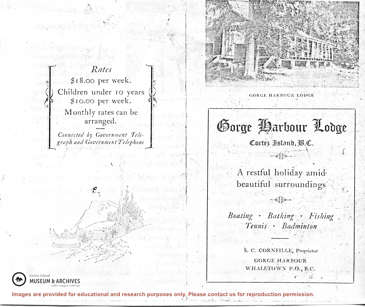
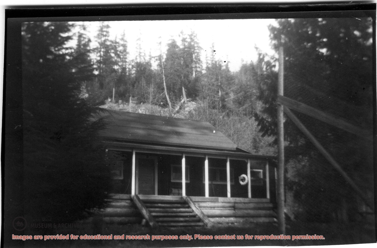
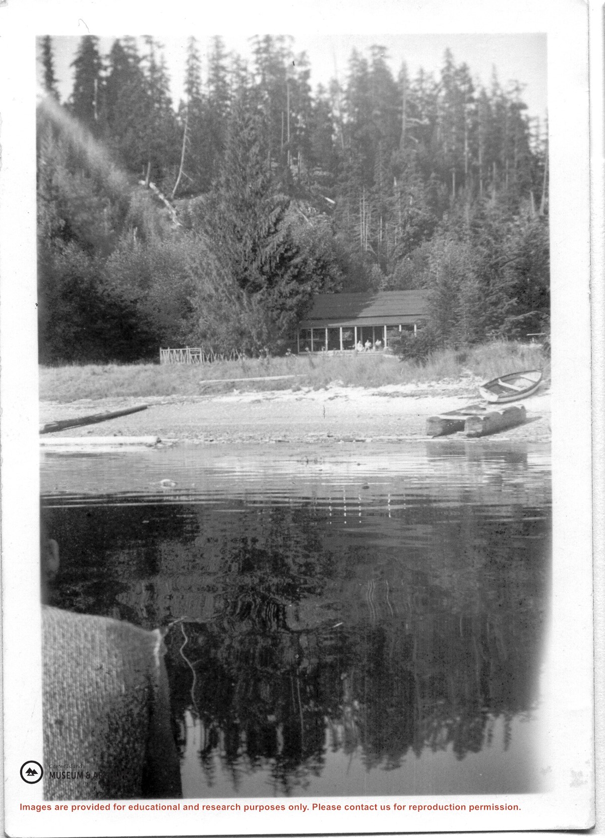
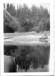
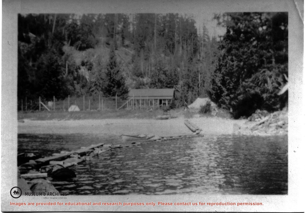
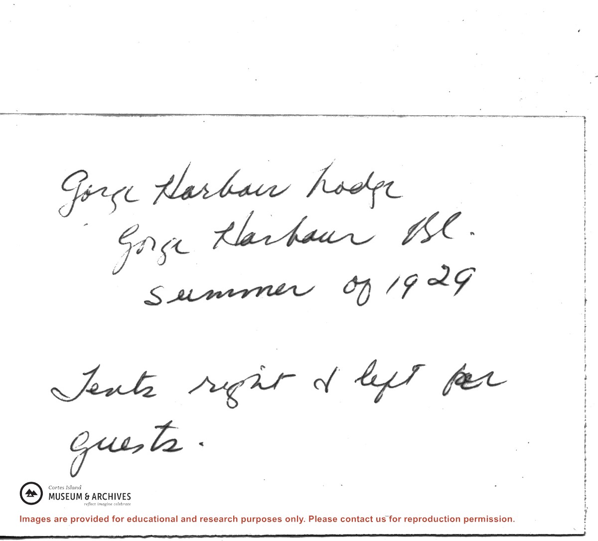
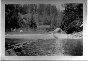
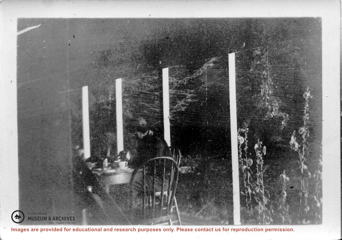
Historical information on Gorge Harbour, people, properties, info dating back to 1898. Clippings with tourist info, proposed Klahoose oyster license, Island Sea Farms aquaculture, and resort upgrades from Dr. Richard and Michelle Glickman, 2007-2019. Gorge Harbour map from Hubert Steghaus, 2008. Floathouse Restaurant menu, 2011. Obituary for Mrs S.E. Corneille, 2016. Info on Gorge Government dock and tree falling, 2017. Gorge Harbour brochures, undated. Poster for talk with sailors Amanda and Barry Glickman at Gorge gazebo, undated. Photos (copies) of Gorge Marina, store and restaurant,1974.
Historical information on Gorge Harbour, people, properties, info dating back to 1898. Clippings with tourist info, proposed Klahoose oyster license, Island Sea Farms aquaculture, and resort upgrades from Dr. Richard and Michelle Glickman, 2007-2019. Gorge Harbour map from Hubert Steghaus, 2008. Floathouse Restaurant menu, 2011. Obituary for Mrs S.E. Corneille, 2016. Info on Gorge Government dock and tree falling, 2017. Gorge Harbour brochures, undated. Poster for talk with sailors Amanda and Barry Glickman at Gorge gazebo, undated. Photos (copies) of Gorge Marina, store and restaurant,1974.
File contains a page of notes, and photocopies of a tax sale notice (1938) and list of properties forfeited for non-payment of taxes, Crown Grants and other title information for the following:
William Walter James: 1926, Crown Grant for NW 1/4 of Sec. 38; 156 acres for $1.00; forfeited to Crown in 1939
Tom Albinson: 1919, Crown Grant for Lot 867; forfeited in 1927
Sadie McMurray: 1917, NE 1/4 of Sec. 39; 160 acres for $160
Peter Police: 1925, fractional NW 1/4 of Sec. 39; 103 acres for $1.00
(Files 12 through 16 are from the same envelope.)
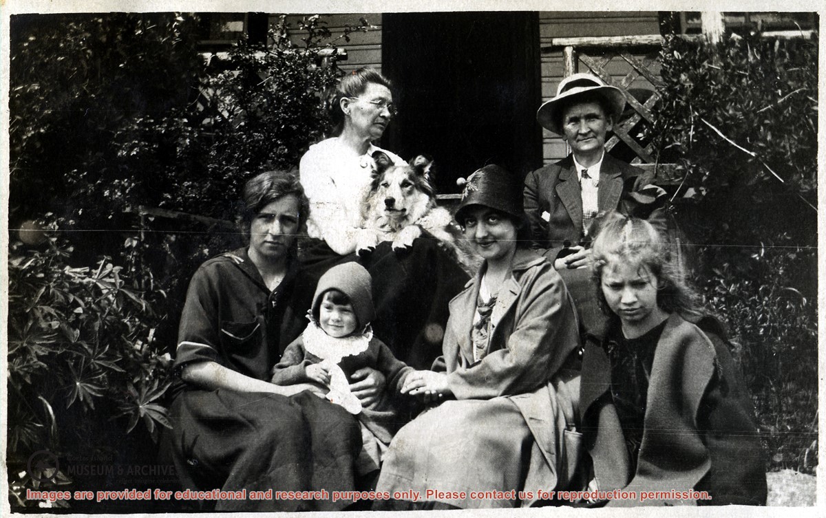
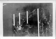
Photograph of a group of people seated on the steps of the home of Charles (Charlie) Allen in the Gorge Harbour (on the site of what is now the Gorge Harbour Marina.) The people are not identified.
Photograph of a group of people seated on the steps of the home of Charles (Charlie) Allen in the Gorge Harbour (on the site of what is now the Gorge Harbour Marina.) The people are not identified.
File contains a key map which was pasted on the front of the envelope indicating the areas researched for Files 12-16; notes on the titles; photocopies of Crown Grants and subsequent title information for:
BC Buildings Corp: 1982, Crown Grant for Block A of SW 1/4 of Sec. 25 (Highways Maintenance Yard)
District Lot 871 (40 acres between Carrington and Coulter Bays): to James Frederick McManus, 1919
To Ernest Henry Vaughn: 1922, Crown Grant for NE 1/4 and NW 1/4 of NE 1/4 of Sec. 24; SE 1/4 of SW 1/4 and SW 1/4 of SE 1/4 of Sec 31
Herbert Proctor: 1928 for fractional SW 1/4 of Sec. 41, bordering Tork Reserve; 159 acres for $159.00 (orig. Crown Grant to Herbert Proctor in 1922)
To William Cowan: 1937, E 1/2 of SE 1/4 of Sec. 26, 89 acres
(Files 12 through 16 are from the same envelope.)
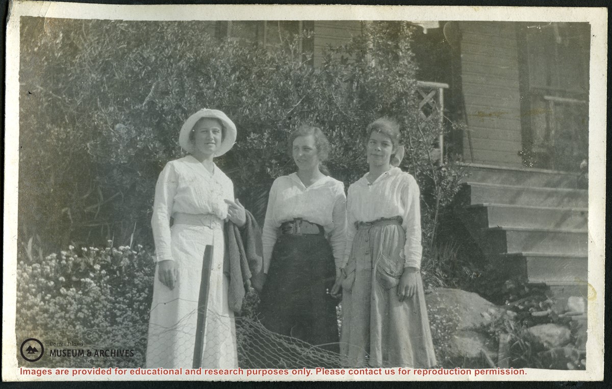
Photograph of Meg Robertson, Elsie Allen and Margaret (Pete) Middleton, standing in front of the stairs up to the Allen's house in Gorge Harbour (now the Gorge Harbour Marina).
Photograph of Meg Robertson, Elsie Allen and Margaret (Pete) Middleton, standing in front of the stairs up to the Allen's house in Gorge Harbour (now the Gorge Harbour Marina).