Coloured map of southwestern BC showing municipalities, geographical features, land and sea routes, natural resources, etc. The back of the map is fully printed with information about BC and suggested travel itineraries.
Map needs preservation: edges are frayed and there are several tears.
Coloured map of southwestern BC showing municipalities, geographical features, land and sea routes, natural resources, etc. The back of the map is fully printed with information about BC and suggested travel itineraries.
Map needs preservation: edges are frayed and there are several tears.
Identified on the verso (May Ellingsen's handwriting) as (L to R) Jack Manson, Anna Manson, Beatrice Hawkins, Meg Robertson, Mabel Hawkins.
Jack Manson has his arm in a sling; he had suffered an accident while working in the woods.
Found on shelf, November 2021, in an envelope labelled "Early Days Cortes Island. Enclosed Etta Byers' stuff including her typed story".
Scope and Content
Identified on the verso (May Ellingsen's handwriting) as (L to R) Jack Manson, Anna Manson, Beatrice Hawkins, Meg Robertson, Mabel Hawkins.
Jack Manson has his arm in a sling; he had suffered an accident while working in the woods.
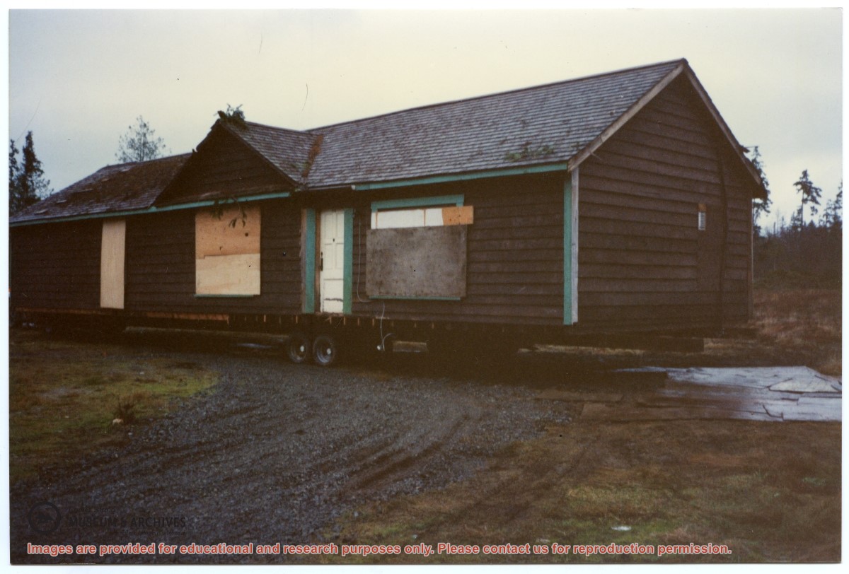
One of a series of 20 photographs documenting the move of the old Manson's Landing store from its position by the wharf in Mansons Landing Provincial Park to the present Museum site on Beasley Rd. The photographs are from an envelope labelled "Moving Museum, Dec. 1995. Moved by Able Transport. Paid for by Elmer and May Ellingsen."
Found in Information Files folder (Cortes Island Museum & Archives info"), Jan. 2021
Scope and Content
One of a series of 20 photographs documenting the move of the old Manson's Landing store from its position by the wharf in Mansons Landing Provincial Park to the present Museum site on Beasley Rd. The photographs are from an envelope labelled "Moving Museum, Dec. 1995. Moved by Able Transport. Paid for by Elmer and May Ellingsen."