Binder contains interviews, stories and pictures from Etta (McKay) Byers, Bert and Penny Hansen, Peggy Pyner, Frank Hayes, Vida (Trousdale) Hodgson, Bob Milton, Lorne Musclow, and Elton Anderson.
It was created as part of the Memories of Manson's Landing Exhibit, curated and mounted by Doreen Thompson.
Binder contains interviews, stories and pictures from Ginny and Bruce Ellingsen, the Lambert family, Dolly (Jeffery) Hansen and Maryann McCoy, with additional historic photographs of Smelt Bay from the early to the late 1900s at the back. It was created as part of the Memories of Manson's Landing Exhibit, curated and mounted by Doreen Thompson.
Binder contains interviews, stories and pictures from Ginny and Bruce Ellingsen, the Lambert family, Dolly (Jeffery) Hansen and Maryann McCoy, with additional historic photographs of Smelt Bay from the early to the late 1900s at the back. It was created as part of the Memories of Manson's Landing Exhibit, curated and mounted by Doreen Thompson.
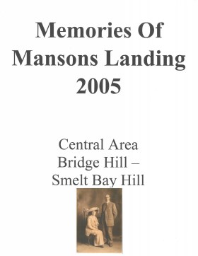
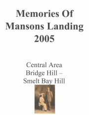
Memories of Mansons Landing 2005 – Central Area – Bridge Hill and Smelt Bay Hill
Binder contains interviews, stories and pictures from Mary and Bill Block, Larry Borland, May (Freeman) Ellingsen, Wilf Freeman, the Froud family, Robbie Graham, Bill Guthrie, Gloria Morrisette, Jean (Reford) MacDonald and Beth (Martin) Slater.
It was created as part of the Memories of Manson's Landing Exhibit, curated and mounted by Doreen Thompson.
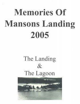
Memories of Mansons Landing 2005: The Landing and the Lagoon
Binder contains interviews, stories and pictures from Ken Summers, Bert and Victoria Summers, Ann Barton, Hiram (Buster) and Mabel Christiansen, Otis (Christiansen) Coulter, George and Rosemary (Gavin) Hawkins, Bob Martineau and Fred Reedel.
It was created as part of the Memories of Manson's Landing Exhibit, curated and mounted by Doreen Thompson.
Binder contains interviews, stories and photographs relating to Michael and John Manson and their families. It was created as part of the Memories of Manson's Landing Exhibit, curated and mounted by Doreen Thompson.
Binder contains interviews, stories and photographs relating to Michael and John Manson and their families. It was created as part of the Memories of Manson's Landing Exhibit, curated and mounted by Doreen Thompson.
File contains photocopies of original Crown Grants, subsequent title changes and maps for:
To Joseph Gregson: 1926, Crown Grant for fractional W 1/2 of Lot 899 and Lot 901 (between Coulter and Carrington Bays), with a water easement for Wailes
To John Nugent McIllree: 1957, Crown Grant of mineral rights to lots at Coulter Bay surveyed as the "Arrow" and "Bullseye" mineral claims
To Hilda Peterson: 1919, Crown Grant for Lot 878, Carrington Bay, 55 acres
(Files 12 through 16 are from the same envelope.)
Binder contains interviews, stories and photographs relating to schools in Mansons Landing. It was created as part of the Memories of Manson's Landing Exhibit, curated and mounted by Doreen Thompson.
Binder contains interviews, stories and photographs relating to schools in Mansons Landing. It was created as part of the Memories of Manson's Landing Exhibit, curated and mounted by Doreen Thompson.
File contains a page of notes, and photocopies of a tax sale notice (1938) and list of properties forfeited for non-payment of taxes, Crown Grants and other title information for the following:
William Walter James: 1926, Crown Grant for NW 1/4 of Sec. 38; 156 acres for $1.00; forfeited to Crown in 1939
Tom Albinson: 1919, Crown Grant for Lot 867; forfeited in 1927
Sadie McMurray: 1917, NE 1/4 of Sec. 39; 160 acres for $160
Peter Police: 1925, fractional NW 1/4 of Sec. 39; 103 acres for $1.00
(Files 12 through 16 are from the same envelope.)
File contains a key map which was pasted on the front of the envelope indicating the areas researched for Files 12-16; notes on the titles; photocopies of Crown Grants and subsequent title information for:
BC Buildings Corp: 1982, Crown Grant for Block A of SW 1/4 of Sec. 25 (Highways Maintenance Yard)
District Lot 871 (40 acres between Carrington and Coulter Bays): to James Frederick McManus, 1919
To Ernest Henry Vaughn: 1922, Crown Grant for NE 1/4 and NW 1/4 of NE 1/4 of Sec. 24; SE 1/4 of SW 1/4 and SW 1/4 of SE 1/4 of Sec 31
Herbert Proctor: 1928 for fractional SW 1/4 of Sec. 41, bordering Tork Reserve; 159 acres for $159.00 (orig. Crown Grant to Herbert Proctor in 1922)
To William Cowan: 1937, E 1/2 of SE 1/4 of Sec. 26, 89 acres
(Files 12 through 16 are from the same envelope.)
File contains a key map and list for the areas researched and information on the following:
George Herbert Wailes: 1920, Crown Grant for fractional SW 1/4 of Sec. 48; 48 acres for $217; with a tax sale notice, 1939
Ina Vernon Munro: 1920, Crown Grant for NE 1/4 of Sec. 37; 161 acres; includes a sale to Hawkins and a forfeit in 1939
Allan Olmsted: 1939, Crown Grant for SW 1/4 of Sec. 37
Ira Furry: 1911, Crown Grant for W 1/2 of SE 1/4 of Sec. 33
Walter Malcolm: 1919, Crown Grant for fractional SW 1/4 of Sec. 36
Frank Leslie Tooker: 1926, Crown Grant for N 1/2 of Sec. 36, 124 acres
Ira Furry: 1897, Crown Grant for SE 1/4 of Sec 36; 160 acres for $160.00.
Donald McDonald: 1926, Crown Grant for fractional NW 1/2 of Sec. 37; 144 acres for $1.00
Binder contains interviews, stories, clippings and photographs documenting the social history of the Coulter Bay and Carrington Bay areas. It was created as part of the Windows on Whaletown Exhibit, curated and mounted by Doreen Thompson.
Binder contains interviews, stories, clippings and photographs documenting the social history of the Coulter Bay and Carrington Bay areas. It was created as part of the Windows on Whaletown Exhibit, curated and mounted by Doreen Thompson.
File contains a photocopy image of the Peter Police homestead at Carrington Lagoon, handwritten stories by Bud Dewar, an article about Ned Breeze, a photocopy of Gary and Velma Bergman at the Whaletown store, and a list of Seaford School.
File contains a photocopy image of the Peter Police homestead at Carrington Lagoon, handwritten stories by Bud Dewar, an article about Ned Breeze, a photocopy of Gary and Velma Bergman at the Whaletown store, and a list of Seaford School.
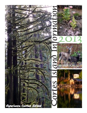
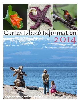
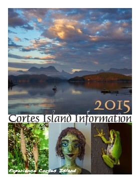
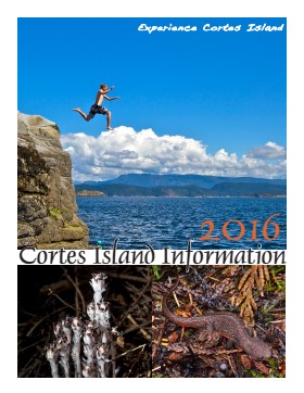
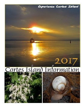
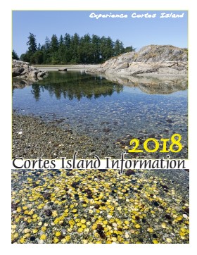
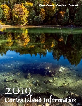
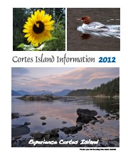
Series of 12 spiral-bound booklets containing information about activities, businesses, events, services and articles about various aspects of island life. There are two copies of 2015.
Cortes Island Information Books were initiated by Carol London, who wanted a handbook to give to guests at Tai Li Lodge. The first issues were created by Carina Verhoeve, and after 2012, by Gina Trzesicka.
Scope and Content
Series of 12 spiral-bound booklets containing information about activities, businesses, events, services and articles about various aspects of island life. There are two copies of 2015.
Series contains information on historic Crown Grants and subsequent title changes compiled by Doreen Thompson during her research for the CIMAS Windows on Whaletown exhibit in 1999. The area covered includes the northern part of Cortes Island, from just south of Gorge Harbour. Material includes maps, photocopies of original Crown Grants and other title documents, lists of subdivisions, and notes on changes of title.
Records were organized by Section or Plan number in large envelopes with a cover map and notes about the properties researched on the envelope back. They trace the ownership of parcels of land from the first grant or purchase from the Crown to 1999. Original order has been maintained.
This fonds contains textual records, photographs and other archival material relating to the history and functions of the Cortes Island Museum & Archives Society. It includes material created for exhibits and research on Cortes social and natural history.
This fonds contains textual records, photographs and other archival material relating to the history and functions of the Cortes Island Museum & Archives Society. It includes material created for exhibits and research on Cortes social and natural history.
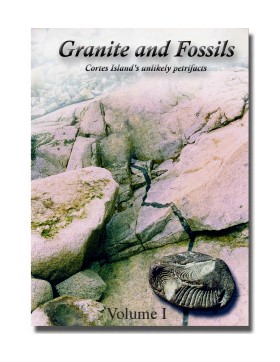
"Granite and Fossils" is a compilation of informatioin about Cortes Island fossils created by Christian Gronau for the Cortes Island Museum in 2002 and updated in 2016 and 2023. It has been digitized as Volume 1 and Volume 2.
Christian Gronau studied palaeontology and geology in Germany. He came to Canada in 1972 and
worked in the mining sector in the N.W.T. (among other places), where he met Aileen.
Christian and Aileen (C&A) moved together to Cortes Island in 1978, where they lived for 34 years on a
water-access-only property, without hydro or telephone (Swamp’s Edge), supporting themselves as beach-
only shellfish farmers (Last Farm Oysters). Throughout, C&A have been avid naturalists, continuing this
tradition from their present home at the south-end of Cortes Island (Tanglebank).
Scope and Content
"Granite and Fossils" is a compilation of informatioin about Cortes Island fossils created by Christian Gronau for the Cortes Island Museum in 2002 and updated in 2016 and 2023. It has been digitized as Volume 1 and Volume 2.
File contains title information and photocopies of land grants and subsequent conveyances for the following:
John Williams: 1914, Crown Grant for the fractional SW 1/4 of Sec 22 and fractional NW 1/4 of Sec 22 (east of Gorge Harbour entrance)
John Williams: 1914, Crown Grant for the fractional SW 1/4 of Sec 22 and frac. NW 1/4 of Sec 18 (west of the Gorge Harbour entrance)
File contains three oversize maps which are stored in the map cabinet: Map of Section 22, Plan VIP52378, Lots A,B,C (blueprint map; 85 cm x 54 cm, 1985); map of Plan 27966 (blueprint map; 55 cm x 43 cm, 1974); photocopy of map of fractional NW 1/4 Sec 17 (55 cm x 43 cm, 1973)
(Files 3 through 7 are from the same envelope.)