File contains a photocopied part of a map showing the locations of researched property in the Whaletown Lagoon and Whaletown Harbour area. The map is glued to an envelope which has a list of Crown grants and other conveyances on the back.
It contains photocopies of original land grants and other conveyances for the following:
Moses Ireland: 1893, Crown Grant for the W 1/2 of SW 1/4 of Sec 35 and W 1/2 of the SW 1/4 of Section 34
Joseph Youart: 1900, Crown Grant for Fractional NE 1/4 of Sec 35 (sold to Alice Robertson in 1908; "Burnside" is still in the Robertson family).
Nicholas Thompson: 1920, Crown Grant for the Fractional SW 1/4 of Sec 35
Charles Strange: 1914, Crown Grant for the NW 1/4 of Sec 35
File contains information on subdivision and title changes, and a photocopy of the original Crown grant, in the Whaletown Lagoon area, to:
Samuel Thompson: 1894, Crown Grant for SW 1/4 of Section 35 and NW 1/4 of Section 34, 160 acres
File also contains four maps (stored in the Map Cabinet):
1) Subdivision map of part of NE 1/4 of Sec. 34 and part of NE 1/4 of Sec. 34, 1995
2) Subdivision Plan of NW 1/4 of Sec. 34 and NE 1/4 of Sec. 34 and part of E 1/2 of SE 1/2 of Sec. 34, 1995
3) Subdivision Plan of Lot A, NW 1/4 of Sec. 34, 1976
4) Subdivision Plan of part of NW 1/4 of Section 34, 1994
(Files 9 and 10 are from the same envelope.)
File contains photocopies of the original Crown Grants and subsequent title changes with plan maps.
To Moses Ireland: 1893, Crown Grant for the W 1/2 of the SW 1/4 of Section 35 and the fractional SE 1/4 of Section 35 (161 acres around Whaletown Bay
To George Alderson: 1961, Crown Grant for Lot 3 of Section 34
File contains title information to 1991 and a photocopy of the original Crown Grant to:
Nicholas Thompson: 1920, Crown Grant of Fractional SW 1/4 of Section 35; 54 acres on the southwest of Whaletown Bay
File contains a small explanatory map if a 5.5 acre portion of fractional SW 1/4 of Sec. 35, 1949, and a Subdivision Plan map of part of fractional SW 1/4 of Sec. 35, 1957 (stored in the Map Cabinet).
(Files 9 and 10 are from the same envelope.)
This series consists of binders compiled by museum volunteers to document various aspects of Cortes Island history. The binders contain a mixture of photographs, correspondence and research.
This series consists of binders compiled by museum volunteers to document various aspects of Cortes Island history. The binders contain a mixture of photographs, correspondence and research.
File contains title information and photocopies of land grants and subsequent conveyances for the following:
John Williams: 1914, Crown Grant for the fractional SW 1/4 of Sec 22 and fractional NW 1/4 of Sec 22 (east of Gorge Harbour entrance)
John Williams: 1914, Crown Grant for the fractional SW 1/4 of Sec 22 and frac. NW 1/4 of Sec 18 (west of the Gorge Harbour entrance)
File contains three oversize maps which are stored in the map cabinet: Map of Section 22, Plan VIP52378, Lots A,B,C (blueprint map; 85 cm x 54 cm, 1985); map of Plan 27966 (blueprint map; 55 cm x 43 cm, 1974); photocopy of map of fractional NW 1/4 Sec 17 (55 cm x 43 cm, 1973)
(Files 3 through 7 are from the same envelope.)
File contains a photocopy of Crown Grant and documentation of subsequent changes in title for:
William Barrett Lennard: 1928, Crown Grant for the SE and SW 1/4s of Section 23 (on the SE shore of Gorge Harbour)
(Files 3 through 7 are from the same envelope.)
File contains a photocopy of Crown Grant and documentation of subsequent changes in title for:
William Barrett Lennard: 1928, Crown Grant for the SE and SW 1/4s of Section 23 (on the SE shore of Gorge Harbour)
(Files 3 through 7 are from the same envelope.)
File contains a photocopy of Crown Grant and documentation of subsequent changes in title for:
Eliza Breeze: 1920, Crown Grant for Fractional NW 1/4 of Section 18 (east of the entrance to Gorge Harbour)
(Files 3 through 7 are from the same envelope.)
File contains a photocopy of Crown Grant and documentation of subsequent changes in title for:
Eliza Breeze: 1920, Crown Grant for Fractional NW 1/4 of Section 18 (east of the entrance to Gorge Harbour)
(Files 3 through 7 are from the same envelope.)
File contains a section map showing properties southeast of Gorge Harbour and title information on the property, later owned by Gilean Douglas, and known as Channel Rock.
To John Pool: 1930, Crown Grant of the W 1/2 of the SE 1/4 of Sec. 21 and fractional SW 1/4 of Sec. 21 and Crown Grant fo the fractional E 1/2 of fractional SE 1/4 of Sec. 21
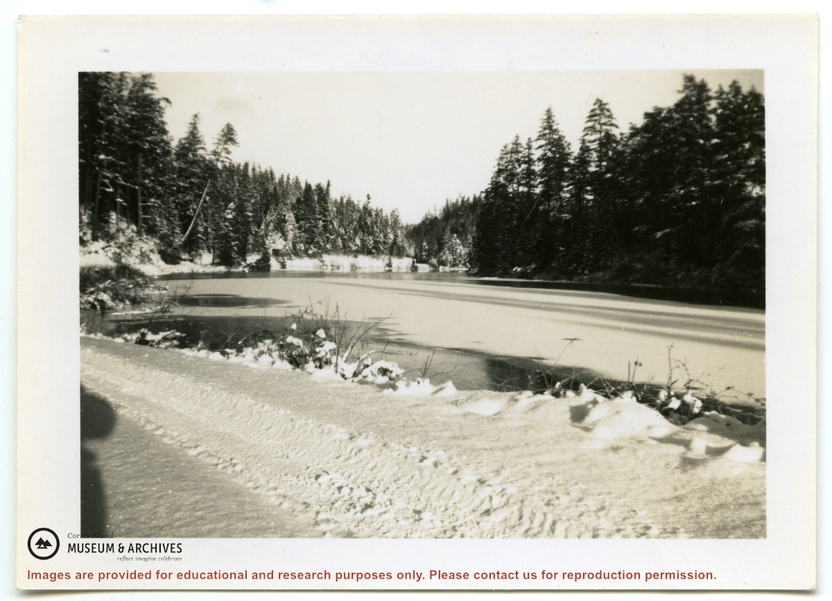
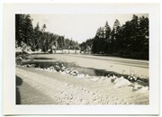
Binder contains interviews, stories and pictures. Binder contains interviews, stories and pictures. It was created in 2001 as part of the exhibit "The Von Donop Creek Story - 1920-1960", curated and mounted by Doreen Thompson.
Binder contains interviews, stories and pictures. Binder contains interviews, stories and pictures. It was created in 2001 as part of the exhibit "The Von Donop Creek Story - 1920-1960", curated and mounted by Doreen Thompson.
File contains a photocopied section map of the northern part of Cortes Island (from just south of Gorge Harbour), coloured to indicate areas for which a Crown Grant was located and areas of ungranted Crown land which still appear to be owned by the government. Scale is 1 mile to 1 inch.
File contains a photocopied section map of the northern part of Cortes Island (from just south of Gorge Harbour), coloured to indicate areas for which a Crown Grant was located and areas of ungranted Crown land which still appear to be owned by the government. Scale is 1 mile to 1 inch.
File contains information for Crown Grants and subsequent title changes for:
William John Sheepwash: 1916, Certificate of Title for District Lot 905 (on Von Donop Creek), 9.6 acres
William Black, Walter Black, William Reid Black and Marjory Black: 1930, Crown Grant for District Lot 1168, ca. 68 acres
William John Sheepwash: 1916, Crown Grant for fractional NE 1/4 of Sec. 45; 153 acres for $153.00
John Bruce Manson: 1942, Crown Grant for District Lot 903; 126 acres for $315.00
File also contains a photocopied map of Lot 903 and the NE 1/4 of Sec. 45, and a Subdivision Plan of Lot 1168 and part of blocks A & B, Lot 747 (1982; in the Map folder).
(Files 12 through 16 are from the same envelope.)
File contains a map key to the areas of Sections 17, 18, 19, 22 and 34 (south of Gorge Harbour) which were researched (Information in Files 3-7).
It contains photocopies of original land grants and subsequent conveyances for the following:
Reginald James Smith: 1946, Crown Grant 165414I for fractional SE 1/4 of Sec 23, 1946 (the Thunder Road subdivision at the eastern end of Gorge Harbour).
(Files 3 through 7 are from the same envelope.)
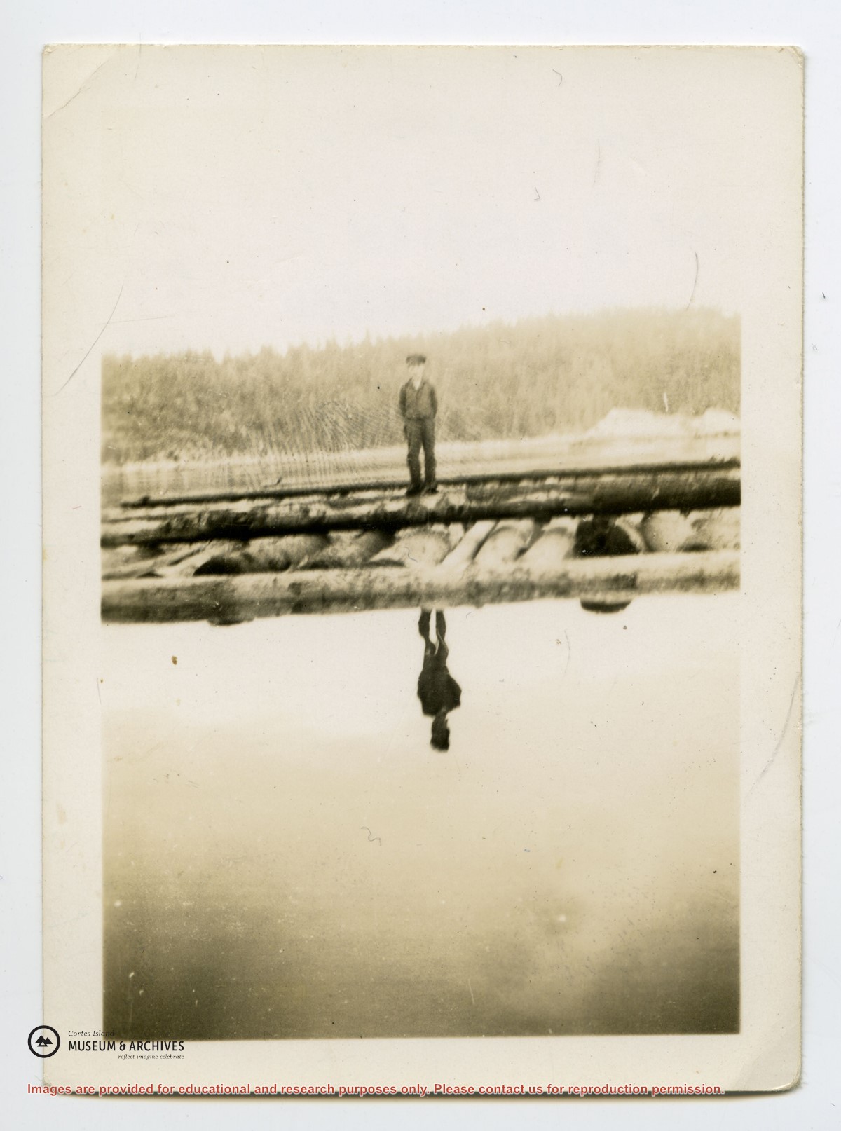
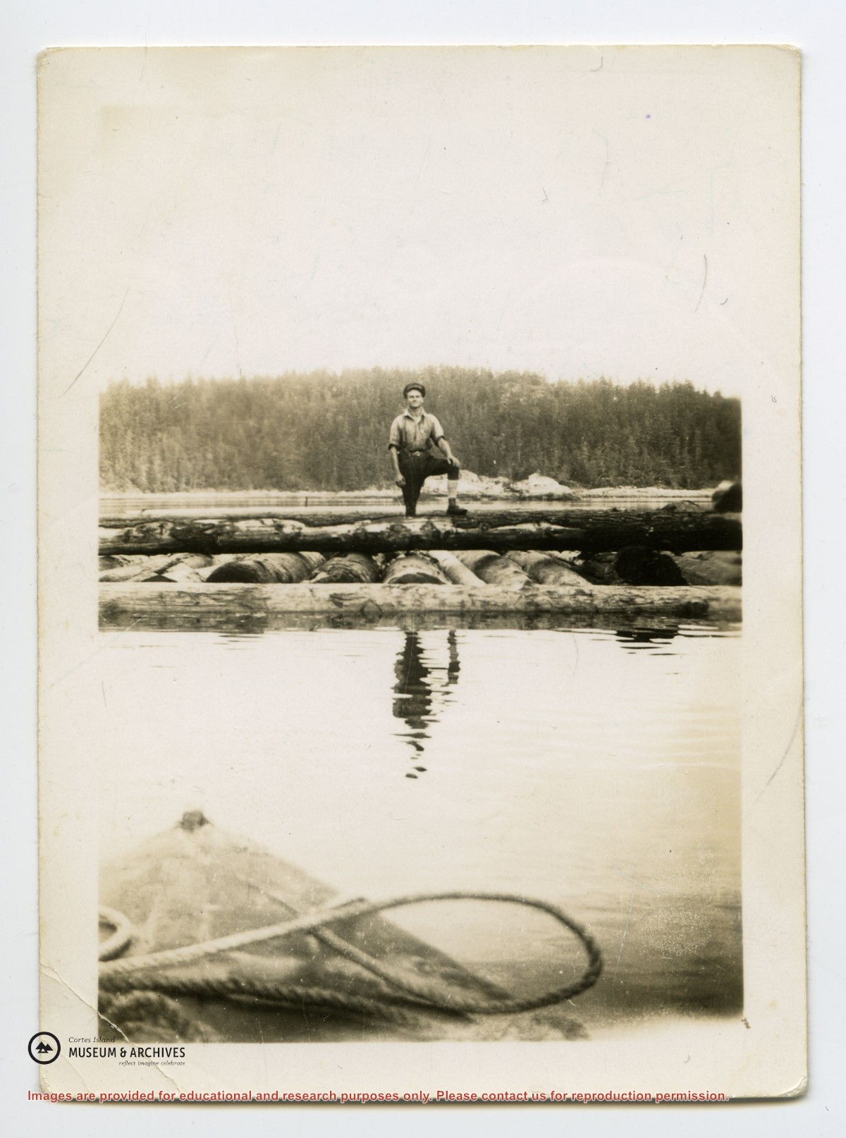
Binder contains interviews, stories and photographs documenting the social history of the Whaletown area from 1907-1930. It was created as part of the Windows on Whaletown Exhibit, curated and mounted by Doreen Thompson.
Binder contains interviews, stories and photographs documenting the social history of the Whaletown area from 1907-1930. It was created as part of the Windows on Whaletown Exhibit, curated and mounted by Doreen Thompson.
File contains a map and notes, and information on the following:
Mabel Huck: 1920, Crown Grant for NE 1/4 of Sec. 40; file shows the original grant, a tax sale forfeit in 1939, a regrant in 1957 with immediate sale to MacMillan/Bloedel.
William Barrett: 1916, Crown Grant for NW 1/4 of Sec. 40; $160 for 160 acres.
Herbert Benjamin Middleton: 1916, Crown Grant for SW 1/4 of Sec. 40, 168 acres for $168.00
August Teuber: 1904, Crown Grant for SE 14 of Sec. 40; 160 acres for $160.00.