Various maps of Cortes Island and surrounding areas with tourist info, trails, provincial parks, local businesses, sites, property lines, topography, charts, etc, 1916-present. Info on Hiking and Orienteering Map of Cortes Island, 2003, and Cortes Island Community Mapping Project, 2011. Info on Discovery Islands Ecosystem Mapping (DIEM), 2012-2014.
Various maps of Cortes Island and surrounding areas with tourist info, trails, provincial parks, local businesses, sites, property lines, topography, charts, etc, 1916-present. Info on Hiking and Orienteering Map of Cortes Island, 2003, and Cortes Island Community Mapping Project, 2011. Info on Discovery Islands Ecosystem Mapping (DIEM), 2012-2014.
Info on: wildfire emergency preparedness; Cortes Volunteer Fire Department and Fire Fighting Association; firehalls; fire trucks; by-laws and funding initiatives concerning fire services on Cortes; helipad and expansion of FD services to handle medical emergencies; fire protection equipement at Klahoose FN; fundraising; and posts relating to local fires and fire fighting responses, 1987-2016
Info on: wildfire emergency preparedness; Cortes Volunteer Fire Department and Fire Fighting Association; firehalls; fire trucks; by-laws and funding initiatives concerning fire services on Cortes; helipad and expansion of FD services to handle medical emergencies; fire protection equipement at Klahoose FN; fundraising; and posts relating to local fires and fire fighting responses, 1987-2016
File consists of planning notes for the annual Fiesta held at Manson's Spit, organized by the women of the three churches on the island, and a page from the Discovery Passage with an article and photographs of the event.
File consists of planning notes for the annual Fiesta held at Manson's Spit, organized by the women of the three churches on the island, and a page from the Discovery Passage with an article and photographs of the event.
Scan of Cortes Marketer 2011 containing Advisory Planning Commissions (APC) for local land use management; agenda from SRD Electoral Area Services Committee (EASC) meeting; and local advertisements on back
Scan of Cortes Marketer 2011 containing Advisory Planning Commissions (APC) for local land use management; agenda from SRD Electoral Area Services Committee (EASC) meeting; and local advertisements on back
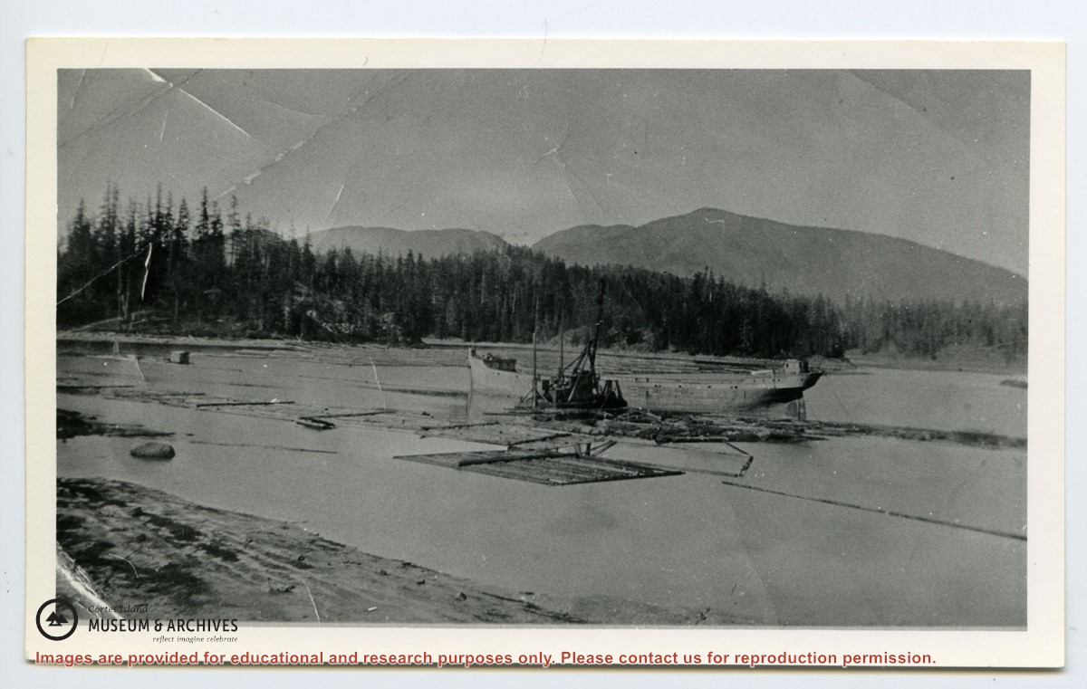
File contains maps of Bute Inlet (1970), Cortes Island/Read Island and surrounding area (ca. 1950), Powell River (1968) and Cortes Island zoning maps (Jan 1974).
File contains maps of Bute Inlet (1970), Cortes Island/Read Island and surrounding area (ca. 1950), Powell River (1968) and Cortes Island zoning maps (Jan 1974).
File contains hand-drawn maps from the early 1900s. There are two copies of the plan of part of SW 1/4 of Section 34; a plan of Gorge Harbour with names of owners written in; and a plan showing part of Read Island.
File contains hand-drawn maps from the early 1900s. There are two copies of the plan of part of SW 1/4 of Section 34; a plan of Gorge Harbour with names of owners written in; and a plan showing part of Read Island.
.pdf?width=280&404=no-doc.jpg)
.pdf?width=280&404=no-doc.jpg)
.pdf?width=180&404=no-doc.jpg)