Files are organized into the following folders: Aquaculture; Director's Reports (published in the Discovery Islander and the Howling Wolf); Ferry Advisory Committee; Island Sea Farms; Letter of Support; Restructuring; SMT (Senior Management Team) Agendas and Notes; and Whaletown Creek. There are also files relating to RDCS restructuring, APC minutes, and other RDCS business. The CD is stored in the CD Album and there is a print-out of the directory file in Folder 7-31.
Files are organized into the following folders: Aquaculture; Director's Reports (published in the Discovery Islander and the Howling Wolf); Ferry Advisory Committee; Island Sea Farms; Letter of Support; Restructuring; SMT (Senior Management Team) Agendas and Notes; and Whaletown Creek. There are also files relating to RDCS restructuring, APC minutes, and other RDCS business. The CD is stored in the CD Album and there is a print-out of the directory file in Folder 7-31.
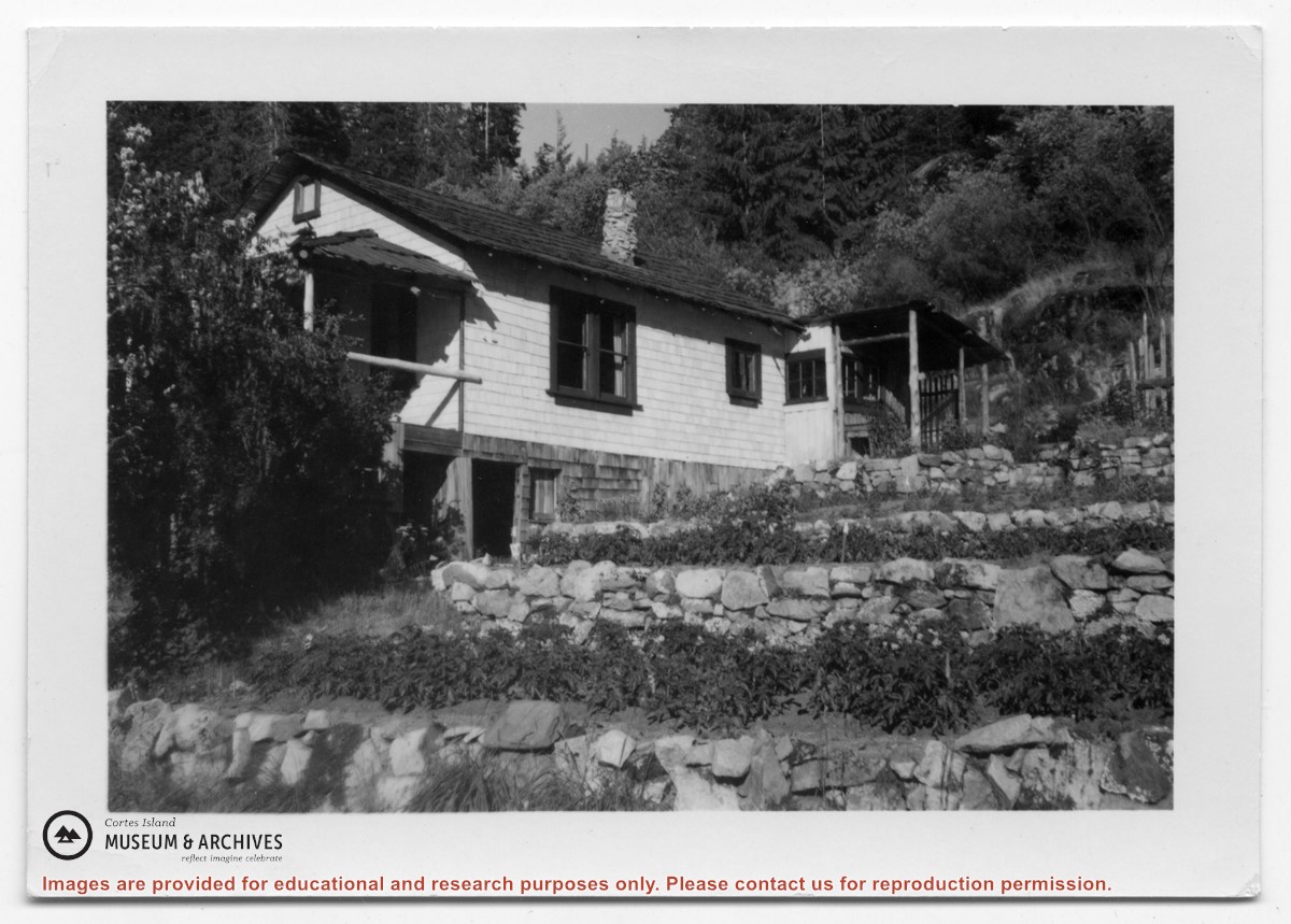
Photograph of a white house with rock-walled terraces to its right. This was Amy and Scotty McKenzie's float house, moved from Von Donop Inlet in 1951. Amy was daughter of Ruth and Henry Byers, who lived in the “Grey House” west of the ferry landing. (The "Grey House" was later moved to Squirrel Cove next to the Store.) The McKenzie house was between the Grey House and the ferry landing; it was torn down ca. 1974. The terraces may still be seen in the small park next to the ferry landing.
Photograph of a white house with rock-walled terraces to its right. This was Amy and Scotty McKenzie's float house, moved from Von Donop Inlet in 1951. Amy was daughter of Ruth and Henry Byers, who lived in the “Grey House” west of the ferry landing. (The "Grey House" was later moved to Squirrel Cove next to the Store.) The McKenzie house was between the Grey House and the ferry landing; it was torn down ca. 1974. The terraces may still be seen in the small park next to the ferry landing.
Photograph of Whaletown Bay taken from the water, showing the navigation marker at the entrance, and the houses to the left of the future site of the ferry landing.
Photograph of Whaletown Bay taken from the water, showing the navigation marker at the entrance, and the houses to the left of the future site of the ferry landing.