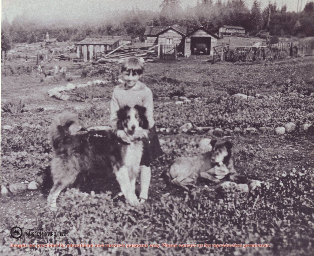
Dorothy Manson standing behind 'Ruff' the new sheepdog, 'Brindle' lying beside them. In the background, beyond the rail fence, is (left to right) a steam donkey, a storage shed, the main camp manager's house (now the home of Mike Manson), a garage for the car and a barn.
Dorothy Manson standing behind 'Ruff' the new sheepdog, 'Brindle' lying beside them. In the background, beyond the rail fence, is (left to right) a steam donkey, a storage shed, the main camp manager's house (now the home of Mike Manson), a garage for the car and a barn.
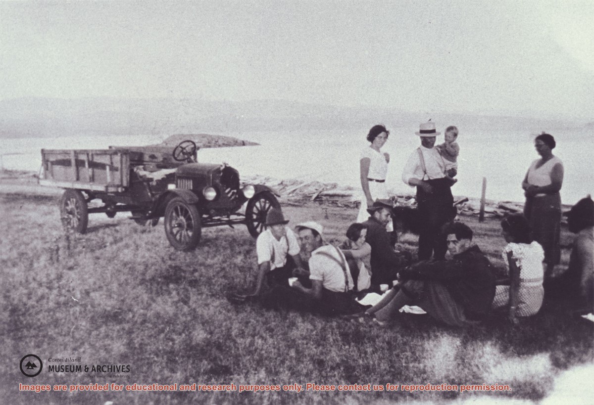
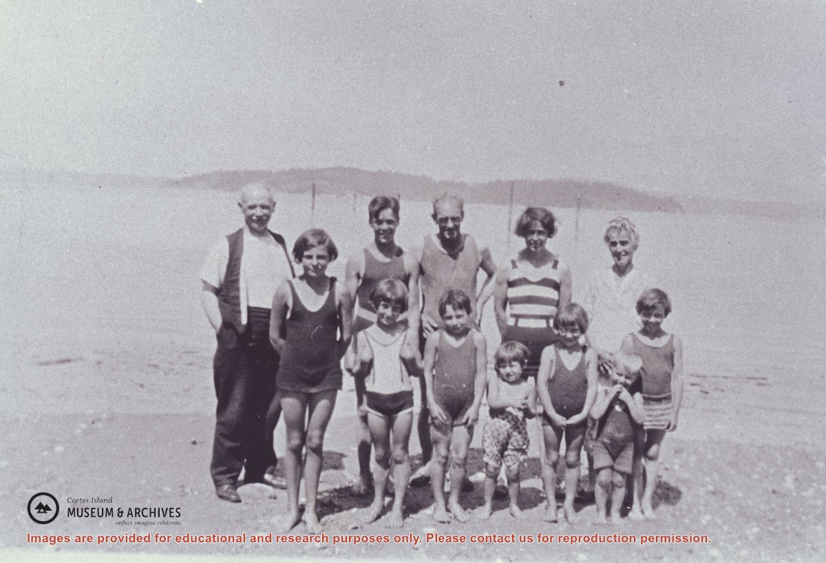
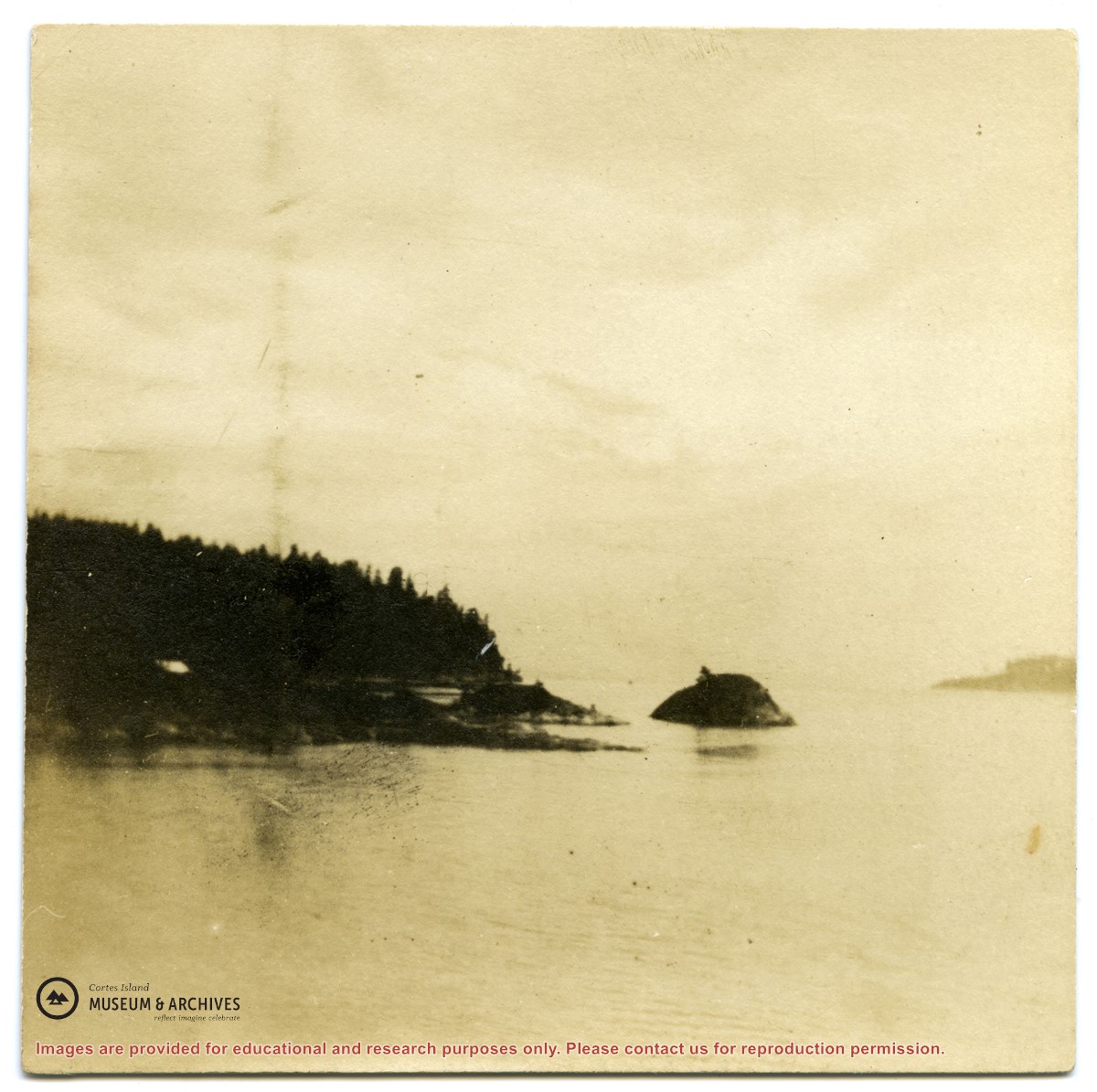
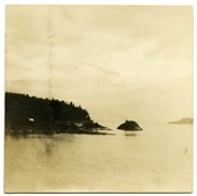
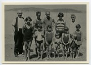
A group of people on the beach at Stag Bay, Hernando Island. Twin Islands can be seen in the background.
Back row, L to R: Mr. Niven, Jim Niven, Dick Parker, Jean Manson, Mrs. Niven
Front row, L to R: Muriel Hurreen, Thelma Campbell, Audrey and Eileen Kenny, Minerva and Lorne Campbell, Dorothy Manson
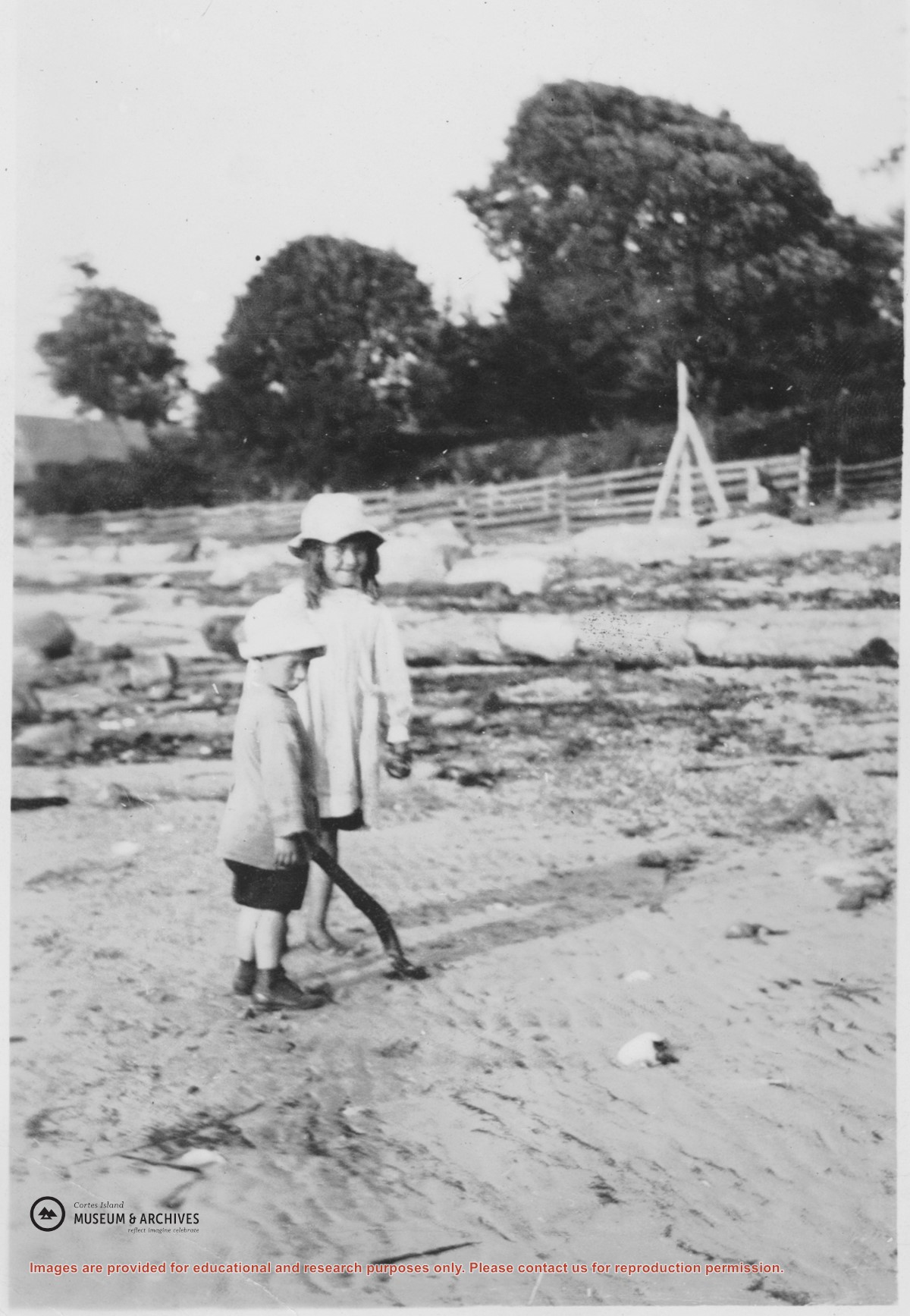
May and Wilfred Freeman on the beach near the Hidalgo Point end of Stag Bay, Hernando Island. The building at the left end of the fence was known as the Rorison house. In 1915-16 a fisherman named Bisnet lived there and in 1917 the Mike Manson family moved in. The fence had been built earlier and protected some fruit trees.
May and Wilfred Freeman on the beach near the Hidalgo Point end of Stag Bay, Hernando Island. The building at the left end of the fence was known as the Rorison house. In 1915-16 a fisherman named Bisnet lived there and in 1917 the Mike Manson family moved in. The fence had been built earlier and protected some fruit trees.
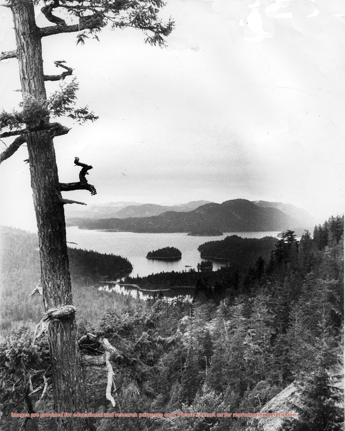
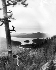
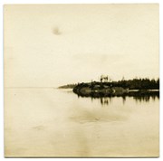
Looking north from Green Mountain over Carrington Lagoon and Carrington Bay (tidal falls in between) across 5 miles of water to Read Island, with a slew of islands to the north.
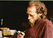
Part of a series of 5 photographs taken by a couple from Germany who were visiting Hans Dolezol (also known as Hans Croker), who lived in the Round House on the property of Paula Snow (now 1474 Robertson Rd.) during the late 1970s until his death in 1982.
Part of a series of 5 photographs taken by a couple from Germany who were visiting Hans Dolezol (also known as Hans Croker), who lived in the Round House on the property of Paula Snow (now 1474 Robertson Rd.) during the late 1970s until his death in 1982.
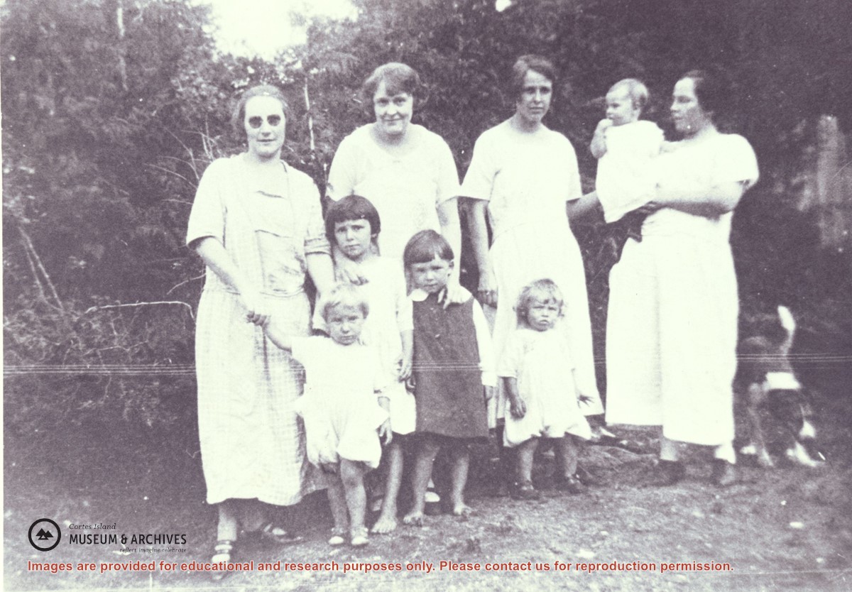
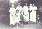
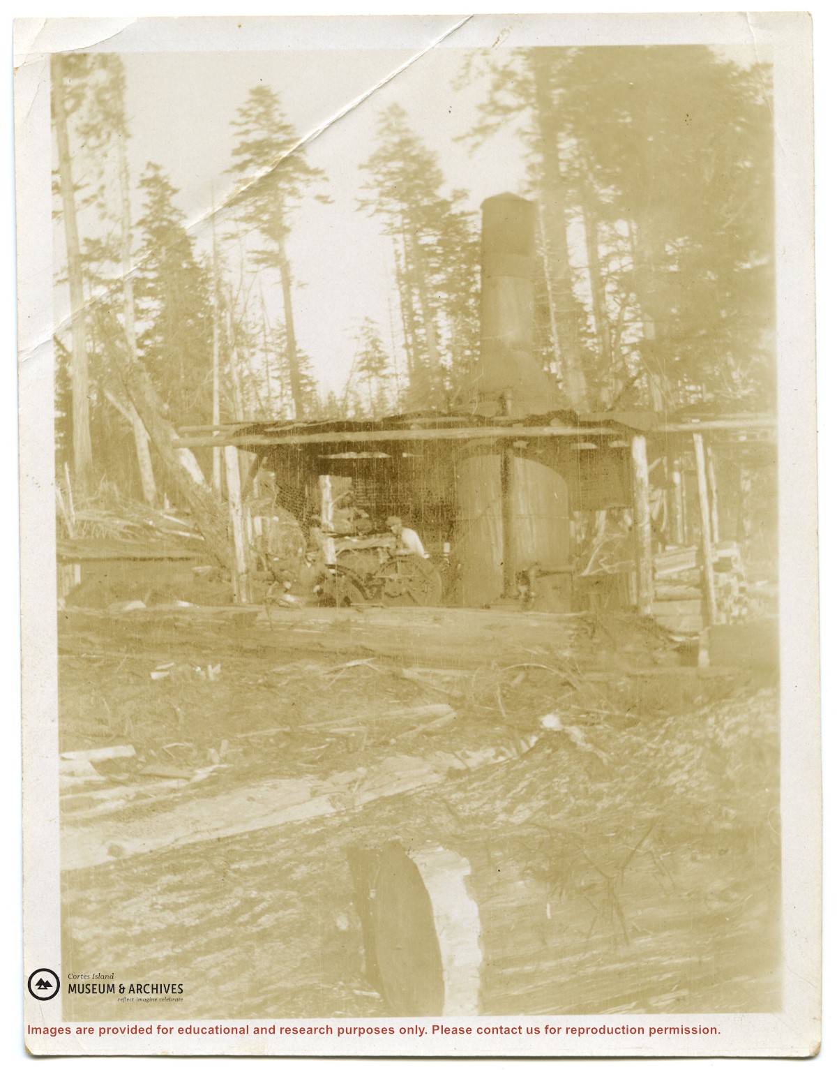
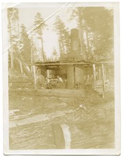
Families of Hernando Island men who worked together in a very small logging enterprise.
L to R: Mrs. Gwen (Fraser) Campbell holding Thelma's hand, Mrs. C. Owen (friend) behind Etta and Hazel McKay, Mrs. Jean (Wilfred) Manson behind Dorothy, Mrs. Florence (Ervin) McKay holding Minerva Campbell.
Families of Hernando Island men who worked together in a very small logging enterprise.
L to R: Mrs. Gwen (Fraser) Campbell holding Thelma's hand, Mrs. C. Owen (friend) behind Etta and Hazel McKay, Mrs. Jean (Wilfred) Manson behind Dorothy, Mrs. Florence (Ervin) McKay holding Minerva Campbell.
File contains a hand-drawn map of Hernando Island showing original pre-emptions, with information about settlement, schools and changes of title written on it.
File contains a hand-drawn map of Hernando Island showing original pre-emptions, with information about settlement, schools and changes of title written on it.
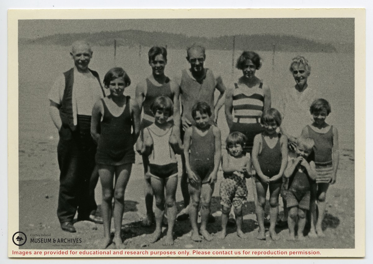
Photograph shows members of the Michael Manson extended family in bathing costumes. The are identified as Mr. Niven, Muriel Hurren, Jim Niven, Dick Parker, Thelma Campbell, Audrey Kenny, Jean Manson, Eileen Kenny, Minerva Campbell, Mrs. Niven, Dorothy Manson and Lorne Campbell.
Photograph shows members of the Michael Manson extended family in bathing costumes. The are identified as Mr. Niven, Muriel Hurren, Jim Niven, Dick Parker, Thelma Campbell, Audrey Kenny, Jean Manson, Eileen Kenny, Minerva Campbell, Mrs. Niven, Dorothy Manson and Lorne Campbell.
File contains five maps of Hernando Island: two showing plans of pre-emptions, 1891-1892; two copies of an old hand-drawn map, 1955; and one map of a later proposed development (undated). Some maps have notes on homesteads.
File contains five maps of Hernando Island: two showing plans of pre-emptions, 1891-1892; two copies of an old hand-drawn map, 1955; and one map of a later proposed development (undated). Some maps have notes on homesteads.
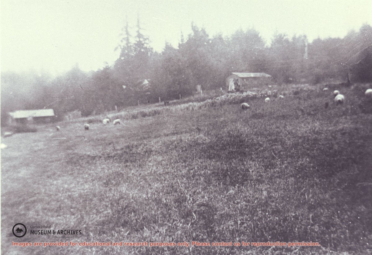
Manson's sheep grazing in the field on Hernando Island which was created by removing the old logging camp buildings. On the left is a one-time camp family house and on the right is the former cookhouse, now a barn.
Manson's sheep grazing in the field on Hernando Island which was created by removing the old logging camp buildings. On the left is a one-time camp family house and on the right is the former cookhouse, now a barn.