The base map is a zoning map produced by the Regional District of Comox-
Strathcona for the Cortes Island Land Use Project (Aug 1969). Edwards used
coloured pencil to show land and foreshore zones, and transferred information
about early preemptions and old roads and trails from an earlier map (see
Donald Palmer fonds, 2020.002.011, map of Cortes Island, Sayward District, ca.
1915).
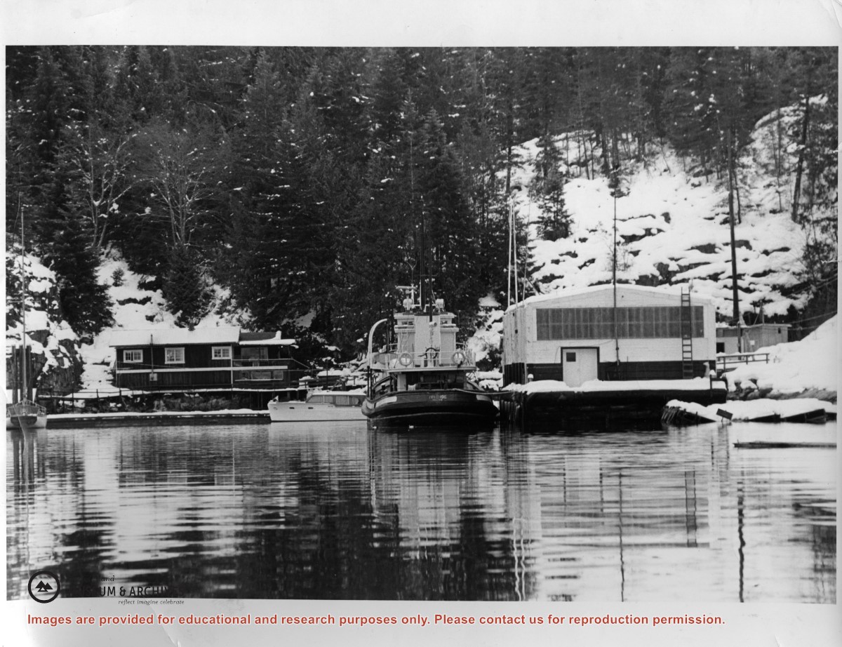
Photograph of Doris Hope's house at left, and the new store that MacMillan Bloedel barged in to replace the old one that had burned down. The tug that towed it in is beside it.
Photograph of Doris Hope's house at left, and the new store that MacMillan Bloedel barged in to replace the old one that had burned down. The tug that towed it in is beside it.
The man on the left is a guest, Peter Kuyt, who kayaked up from Lasqueti Island. He built a cabin by the lagoon at Refuge Cove, but drowned while kayaking back to Lasqueti. Barry Ketchison was a co-op member.
The man on the left is a guest, Peter Kuyt, who kayaked up from Lasqueti Island. He built a cabin by the lagoon at Refuge Cove, but drowned while kayaking back to Lasqueti. Barry Ketchison was a co-op member.
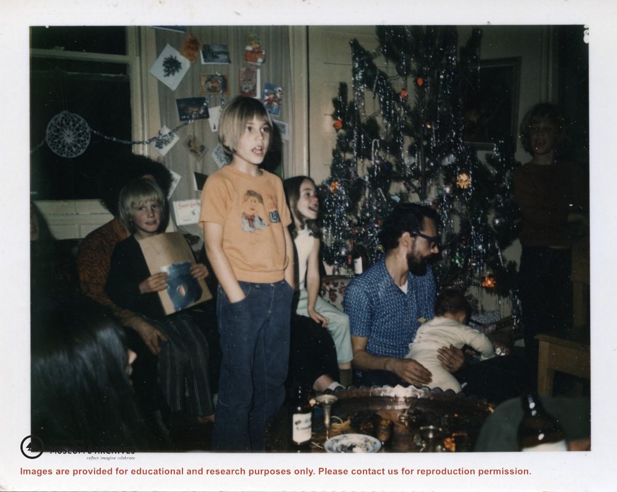
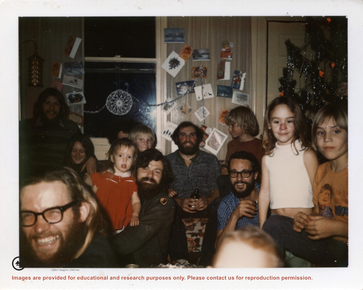
People are gathered around a Christmas tree in the Gibbons' home, a building later used as a schoolhouse.
L to R: Chris Hall (on lap of hidden person), Michael and Lisa Gibbons, Ken Ferguson with son Andrew, Denise Gibbons in the shadow
People are gathered around a Christmas tree in the Gibbons' home, a building later used as a schoolhouse.
L to R: Chris Hall (on lap of hidden person), Michael and Lisa Gibbons, Ken Ferguson with son Andrew, Denise Gibbons in the shadow
L to R: (man in corner needs ID); (?) Frucktinart (sp?) with his daughter behind; (ID man holding girl in red); Ken Ferguson with Chris Hall behind him; Lisa and Michael Gibbons
L to R: (man in corner needs ID); (?) Frucktinart (sp?) with his daughter behind; (ID man holding girl in red); Ken Ferguson with Chris Hall behind him; Lisa and Michael Gibbons
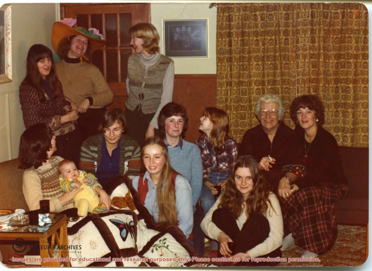
Standing, L to R: Inez White, Judith Williams, Sherry Hall
Seated, L to R: Bonnie MacDonald holding daughter Lucy, Ann Ferguson, Pat Lovell, Judy White, (? ID), Doris Hope, Denise Gibbons,
In front of Doris Hope: (? - lived in Teakerne Arm)
Standing, L to R: Inez White, Judith Williams, Sherry Hall
Seated, L to R: Bonnie MacDonald holding daughter Lucy, Ann Ferguson, Pat Lovell, Judy White, (? ID), Doris Hope, Denise Gibbons,
In front of Doris Hope: (? - lived in Teakerne Arm)
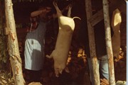
Ernst Hoge, Rheinhold Hoge's father, ran a slaughterhouse in Germany (or Austria?). He and his wife directed the processing of the pigs raised for meat.
Ernst Hoge, Rheinhold Hoge's father, ran a slaughterhouse in Germany (or Austria?). He and his wife directed the processing of the pigs raised for meat.
File contains zoning maps for Bylaw 41, Electoral Area I, Schedules A1-A7 with revisions to 1999. There is a map of the whole island and larger scale maps of island areas.
File contains a photocopied section map of the northern part of Cortes Island (from just south of Gorge Harbour), coloured to indicate areas for which a Crown Grant was located and areas of ungranted Crown land which still appear to be owned by the government. Scale is 1 mile to 1 inch.
File contains a photocopied section map of the northern part of Cortes Island (from just south of Gorge Harbour), coloured to indicate areas for which a Crown Grant was located and areas of ungranted Crown land which still appear to be owned by the government. Scale is 1 mile to 1 inch.
File contains a photocopied part of a map showing the locations of researched property in the Whaletown Lagoon and Whaletown Harbour area. The map is glued to an envelope which has a list of Crown grants and other conveyances on the back.
It contains photocopies of original land grants and other conveyances for the following:
Moses Ireland: 1893, Crown Grant for the W 1/2 of SW 1/4 of Sec 35 and W 1/2 of the SW 1/4 of Section 34
Joseph Youart: 1900, Crown Grant for Fractional NE 1/4 of Sec 35 (sold to Alice Robertson in 1908; "Burnside" is still in the Robertson family).
Nicholas Thompson: 1920, Crown Grant for the Fractional SW 1/4 of Sec 35
Charles Strange: 1914, Crown Grant for the NW 1/4 of Sec 35