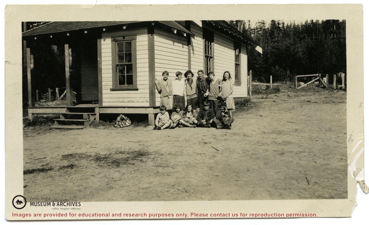
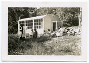
Photographs depict the pupils at the second Whaletown school standing beside the school. The photograph was taken by Evelyn Dow, who taught there from February 1928 to June 1929. This school was built in 1918 near the corner of Coulter Bay Road and Carrington Bay Road, and was used (with improvements) until 1950. The front, side and surroundings of the school are clearly shown.
Front row third from left is Marion Borden; Vernon Borden next to her fourth from left.
Top row, far right: Lorna Borden
(IDs by Terrill Marlow, Marion’s daughter, and Rob Borden, Vernon’s son).
Photographs are from an album created by Evelyn Dow and were donated to CIMAS by her niece, Sharon Thomas.
Scope and Content
Photographs depict the pupils at the second Whaletown school standing beside the school. The photograph was taken by Evelyn Dow, who taught there from February 1928 to June 1929. This school was built in 1918 near the corner of Coulter Bay Road and Carrington Bay Road, and was used (with improvements) until 1950. The front, side and surroundings of the school are clearly shown.
Front row third from left is Marion Borden; Vernon Borden next to her fourth from left.
Top row, far right: Lorna Borden
(IDs by Terrill Marlow, Marion’s daughter, and Rob Borden, Vernon’s son).
File contains minutes, agendas and other material relating to meetings of the Klahoose Table, attended by members of CILAC, Klahoose First Nations and government negotiators. It includes material relating to a proposed park at Carrington Bay.
File contains minutes, agendas and other material relating to meetings of the Klahoose Table, attended by members of CILAC, Klahoose First Nations and government negotiators. It includes material relating to a proposed park at Carrington Bay.
Fonds consists of a minute book and an accounts book of the Whaletown Church Hall Building Fund Committee, documents written by Canon Alan Greene setting out the history, responsibility and terms of use for the Church Hall, and a cover letter for the Certificate of Title from the Land Registry Office.
In 1919, the settlers of Whaletown decided to raise the funds necessary to erect a combined church and hall, to be used for both secular and religious purposes. The new building was attached to the first Whaletown school building, which was then used as a kitchen and dressing room. At this time, the parcel of land on which the school stood, at the corner of present-day Carrington Bay and Harbour Rd. in Whaletown, was deeded to the Diocese of Columbia by Mrs. Alice Robertson, and part of the property was set aside for a cemetery.
After a church was built in Whaletown in 1950, the Church Hall continued to be used for social events. In 1952 the Whaletown Community Club took over responsibility for the Gorge Hall, which then replaced the Church Hall as the main venue for weddings, dances, meetings and parties for both the Whaletown and Gorge Harbour communities. In 1953, the Whaletown Women's Institute signed agreements with both the Whaletown Community Club and the Columbia Coast Mission to assume responsibility for the use and upkeep of the Church Hall and cemetery. The Church Hall was used for a few more years. It was decommissioned in about 1957 and later dismantled.
Custodial History
Canon Alan Greene of the Columbia Coast Mission was involved in the project to build a new Church Hall, and wrote the document setting forth its history and terms of use; envelopes indicate the material was in his possession. Found in a box on the archives shelves; provenance unknown.
Scope and Content
Fonds consists of a minute book and an accounts book of the Whaletown Church Hall Building Fund Committee, documents written by Canon Alan Greene setting out the history, responsibility and terms of use for the Church Hall, and a cover letter for the Certificate of Title from the Land Registry Office.
1999.002 Whaletown Women's Institute fonds
2003.003 Whaletown Community Club fonds
2009.001 Island Women's Club fonds
2011.001 Dorothy Huck Whalley fonds
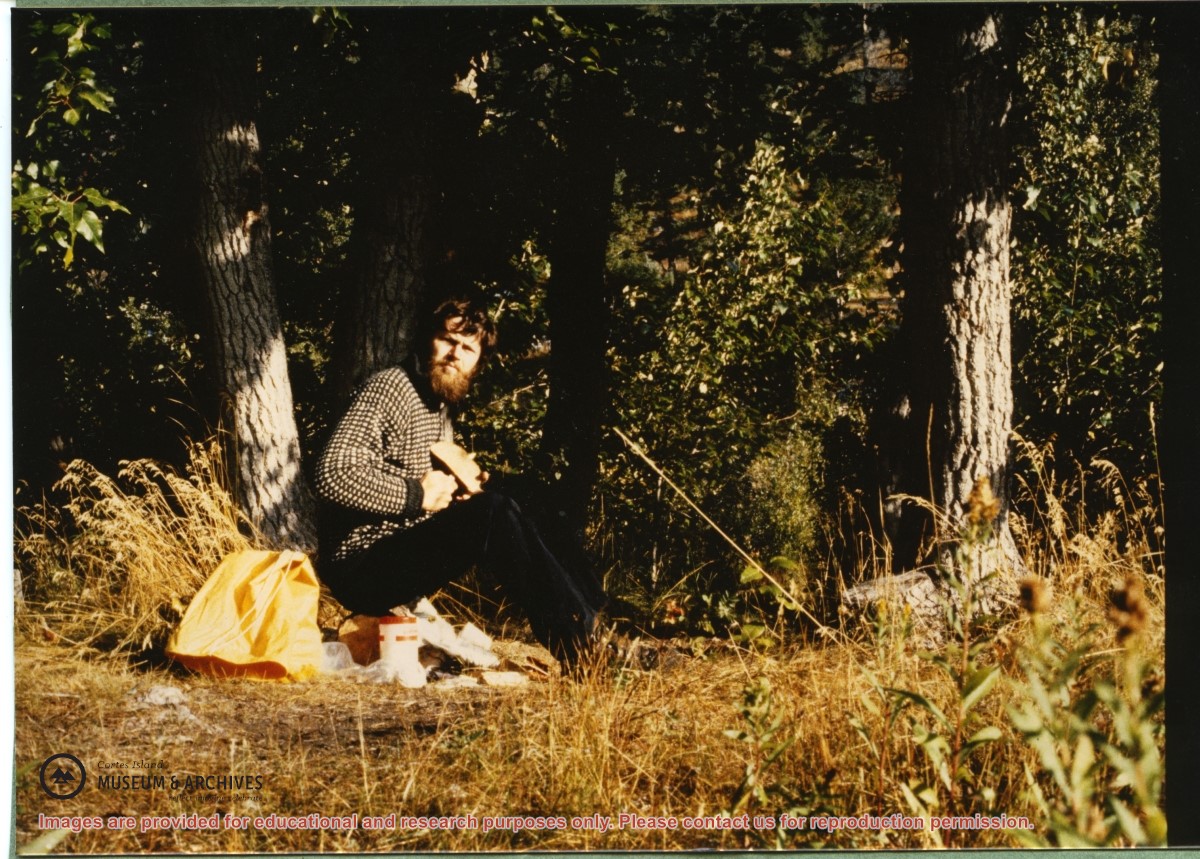
Part of a series of 5 photographs taken by a couple from Germany who were visiting Hans Dolezol (also known as Hans Croker), who lived in the Round House on the property of Paula Snow (now 1474 Robertson Rd.) during the late 1970s until his death in 1982.
Part of a series of 5 photographs taken by a couple from Germany who were visiting Hans Dolezol (also known as Hans Croker), who lived in the Round House on the property of Paula Snow (now 1474 Robertson Rd.) during the late 1970s until his death in 1982.
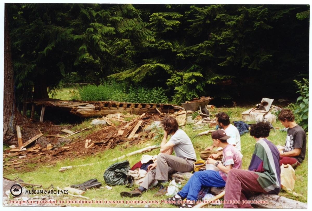
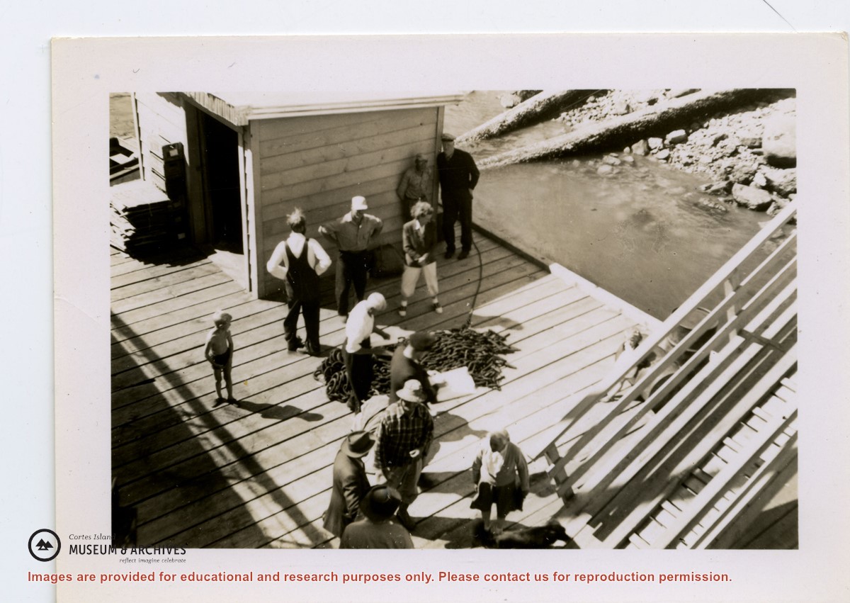
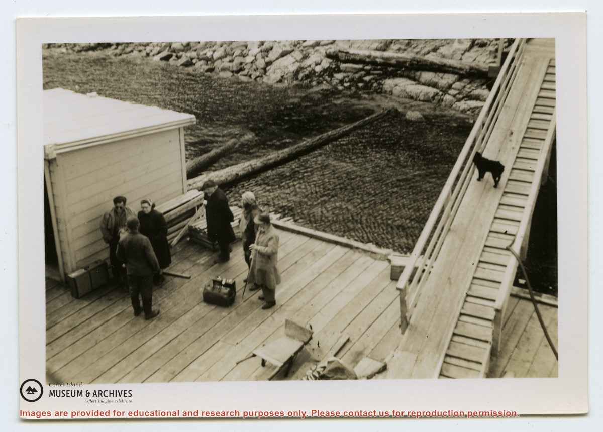
One of a series of photographs of volunteers removing the remains of shacks at Carrington Bay when Carrington Bay Marine Park was established.
L to R: John Shook, Justin Stirn, Pierre DeTrey, Kiyoshi Kosky, Cedar DeTrey.
One of a series of photographs of volunteers removing the remains of shacks at Carrington Bay when Carrington Bay Marine Park was established.
L to R: John Shook, Justin Stirn, Pierre DeTrey, Kiyoshi Kosky, Cedar DeTrey.
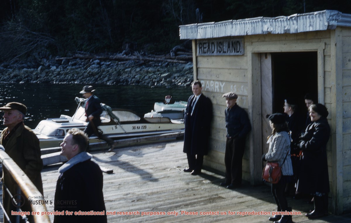
Photograph of the "Rendezvous" with caption: "Rendezvous Patrol. The good ship is taking a heavy southeast'r; heading into it, off Viner Point, Read Island. This is the had of the Gulf of Georgia."
Photograph of the "Rendezvous" with caption: "Rendezvous Patrol. The good ship is taking a heavy southeast'r; heading into it, off Viner Point, Read Island. This is the had of the Gulf of Georgia."
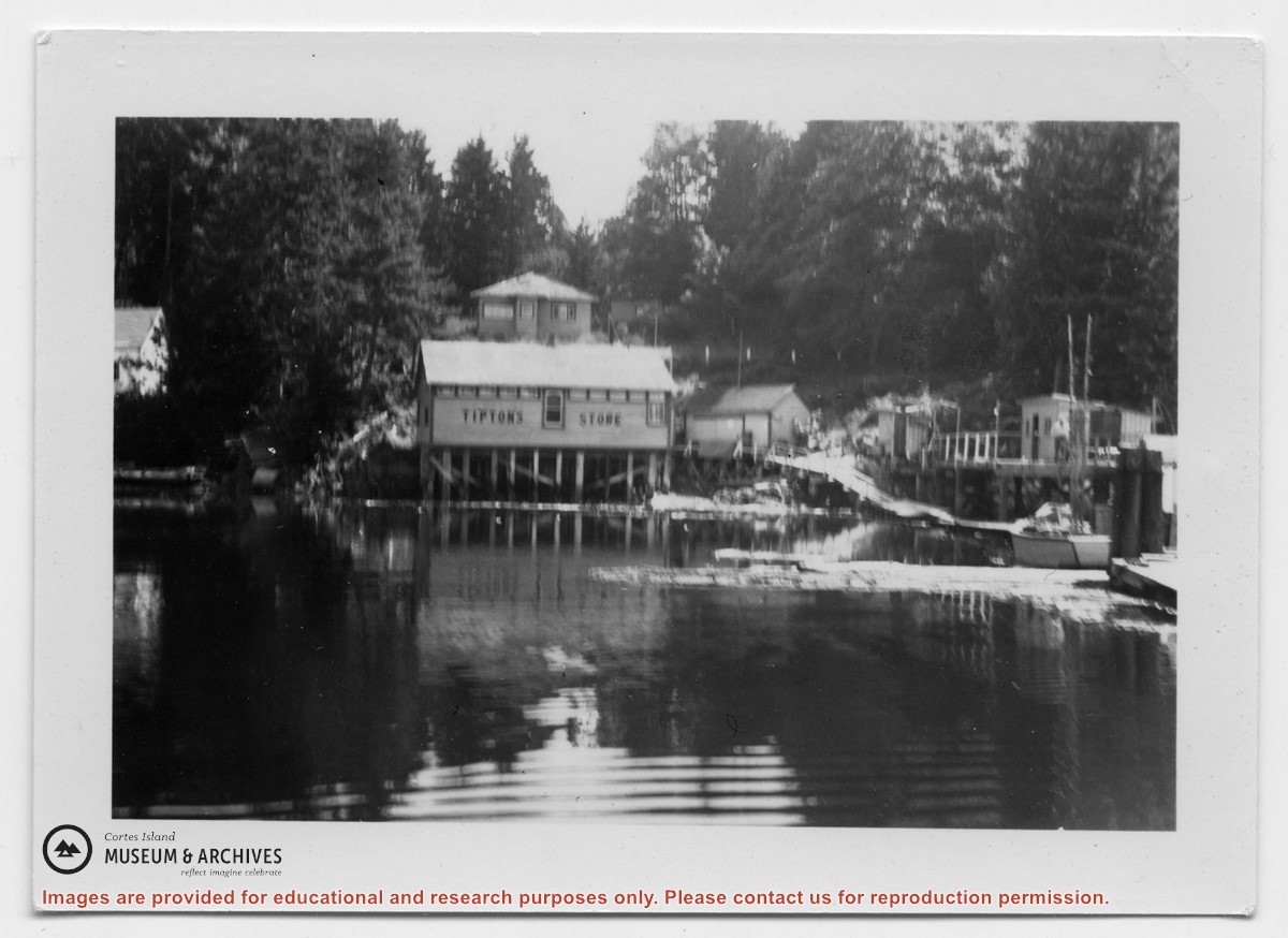
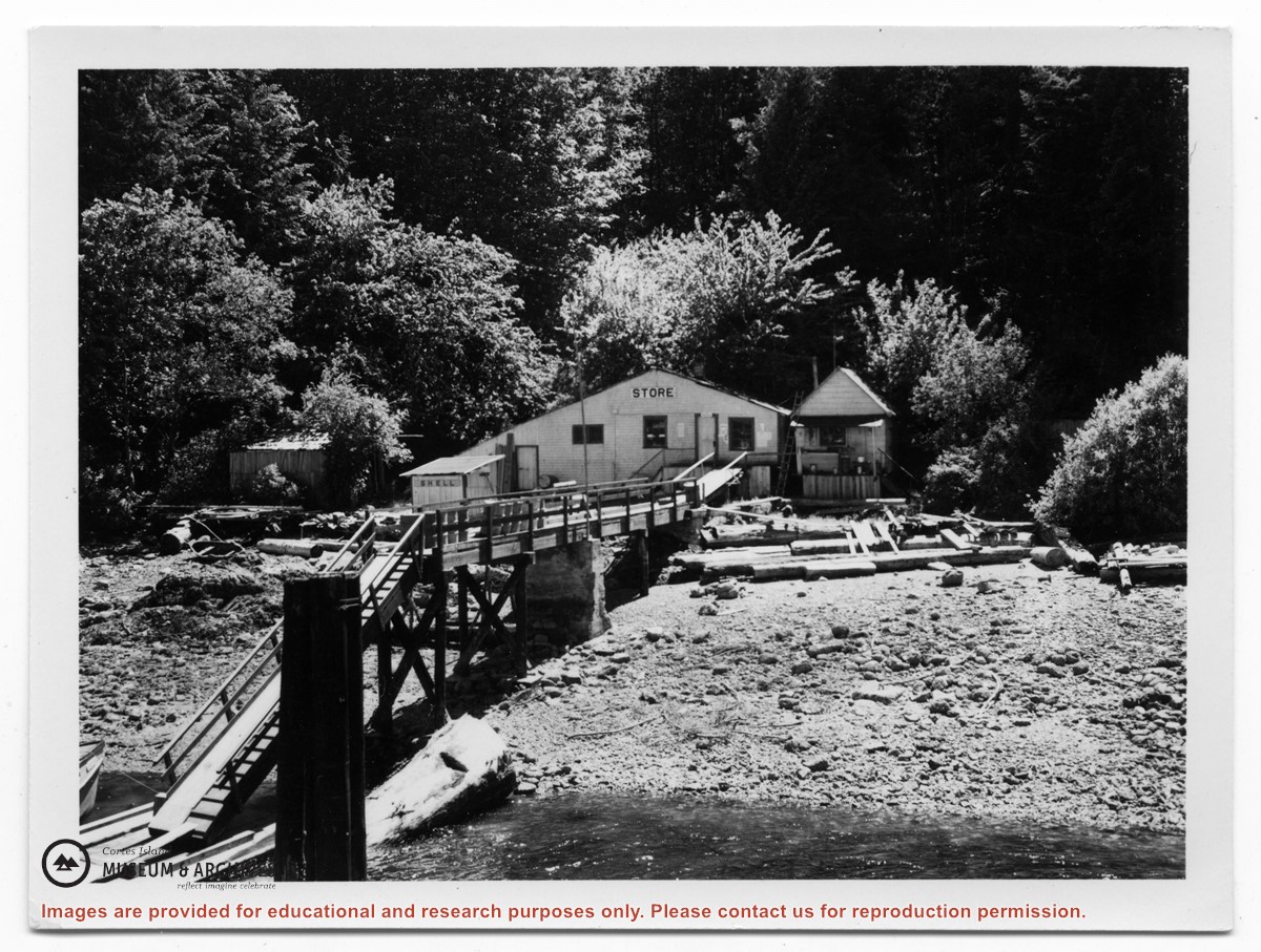
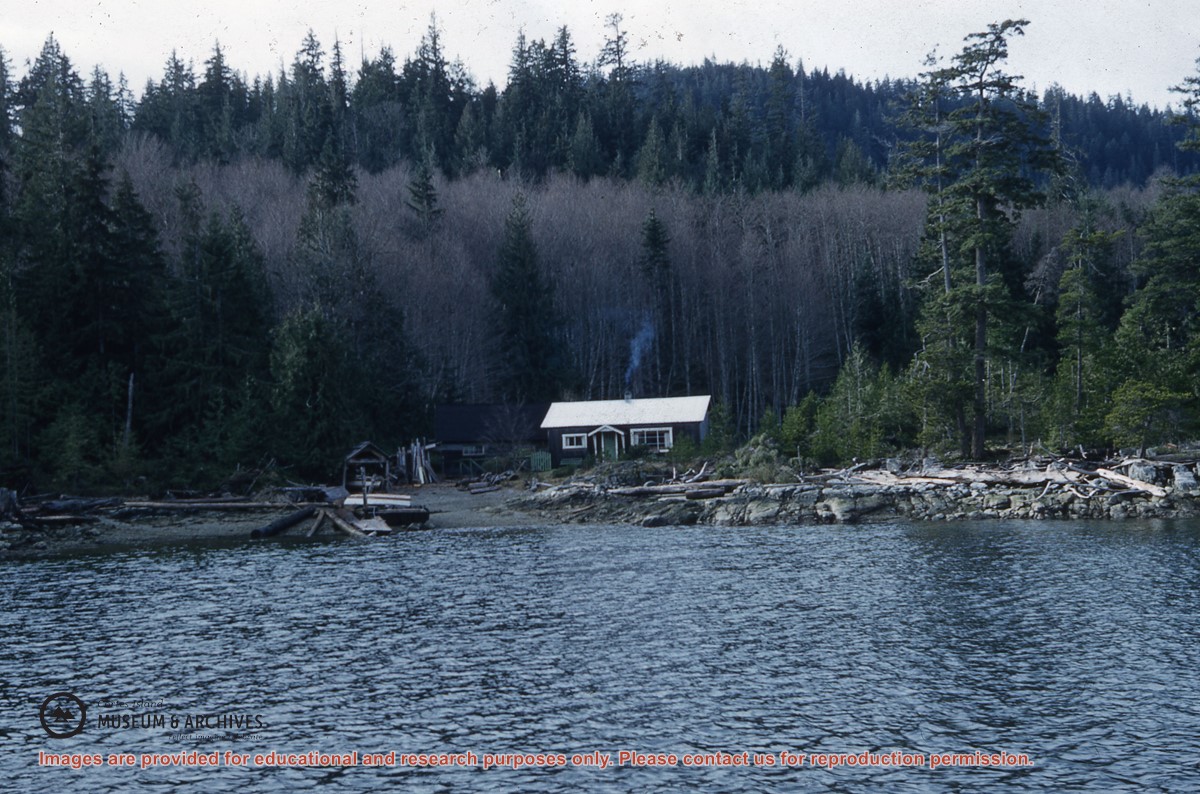
Photograph of Tipton's store at Surge Narrows, Read Island, from the water. A house is above it and to the right, the wharf, walkway and sheds may be seen.
Photograph of Tipton's store at Surge Narrows, Read Island, from the water. A house is above it and to the right, the wharf, walkway and sheds may be seen.
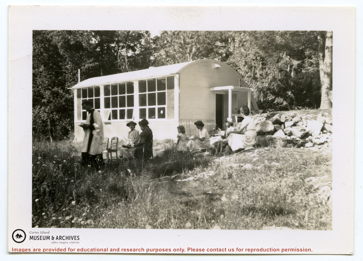
Photograph of Rev. Rollo Boas leading a church service just outside the school building at Surge Narrows on Read Island. Five women and a girl are seated in chairs or on the grass.
Photograph of Rev. Rollo Boas leading a church service just outside the school building at Surge Narrows on Read Island. Five women and a girl are seated in chairs or on the grass.
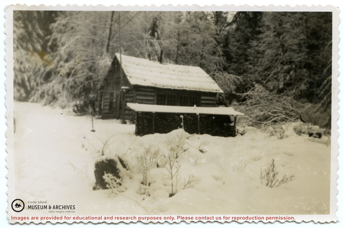
Photograph of the old log school on Read Island, which was about a mile back from the water .A woodshed is to its side; the ground and roofs are covered in snow.
Photograph of the old log school on Read Island, which was about a mile back from the water .A woodshed is to its side; the ground and roofs are covered in snow.
Photograph of a store at the end of a dock. On the back of the photo, Douglas had identified it as "Tipton's store, Surge Narrow, Read Island", but had crossed that out. (ID)
Photograph of a store at the end of a dock. On the back of the photo, Douglas had identified it as "Tipton's store, Surge Narrow, Read Island", but had crossed that out. (ID)
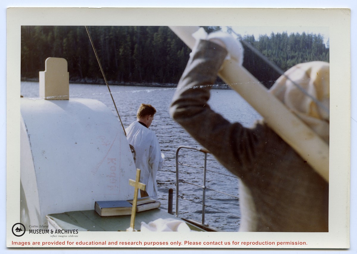
Photograph of Rev. Williams casting the ashes of Richard Symons of Evans Bay, Read Island, from the Columbia Coast Mission boat (same as slide #1999.001.2238)
Photograph of Rev. Williams casting the ashes of Richard Symons of Evans Bay, Read Island, from the Columbia Coast Mission boat (same as slide #1999.001.2238)