File contains photocopies of original Crown Grants, subsequent title changes and maps for:
To Joseph Gregson: 1926, Crown Grant for fractional W 1/2 of Lot 899 and Lot 901 (between Coulter and Carrington Bays), with a water easement for Wailes
To John Nugent McIllree: 1957, Crown Grant of mineral rights to lots at Coulter Bay surveyed as the "Arrow" and "Bullseye" mineral claims
To Hilda Peterson: 1919, Crown Grant for Lot 878, Carrington Bay, 55 acres
(Files 12 through 16 are from the same envelope.)
File contains a page of notes, and photocopies of a tax sale notice (1938) and list of properties forfeited for non-payment of taxes, Crown Grants and other title information for the following:
William Walter James: 1926, Crown Grant for NW 1/4 of Sec. 38; 156 acres for $1.00; forfeited to Crown in 1939
Tom Albinson: 1919, Crown Grant for Lot 867; forfeited in 1927
Sadie McMurray: 1917, NE 1/4 of Sec. 39; 160 acres for $160
Peter Police: 1925, fractional NW 1/4 of Sec. 39; 103 acres for $1.00
(Files 12 through 16 are from the same envelope.)
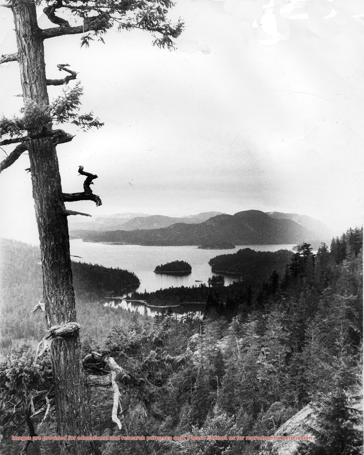
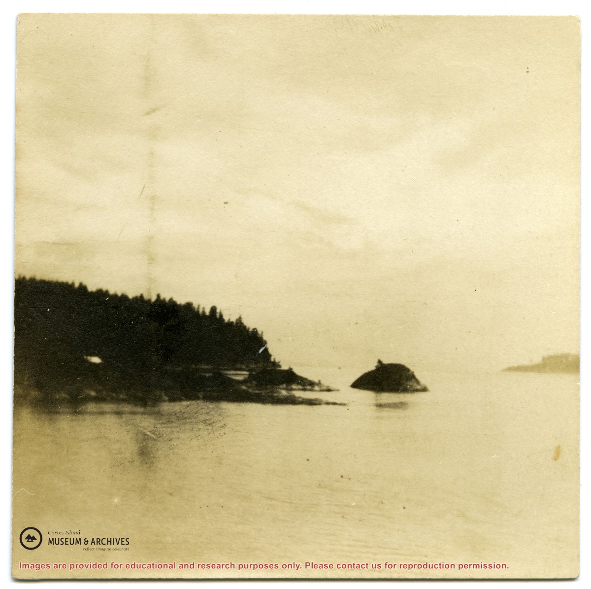
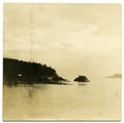
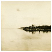
Looking north from Green Mountain over Carrington Lagoon and Carrington Bay (tidal falls in between) across 5 miles of water to Read Island, with a slew of islands to the north.
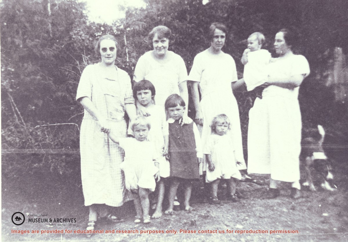
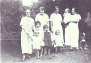
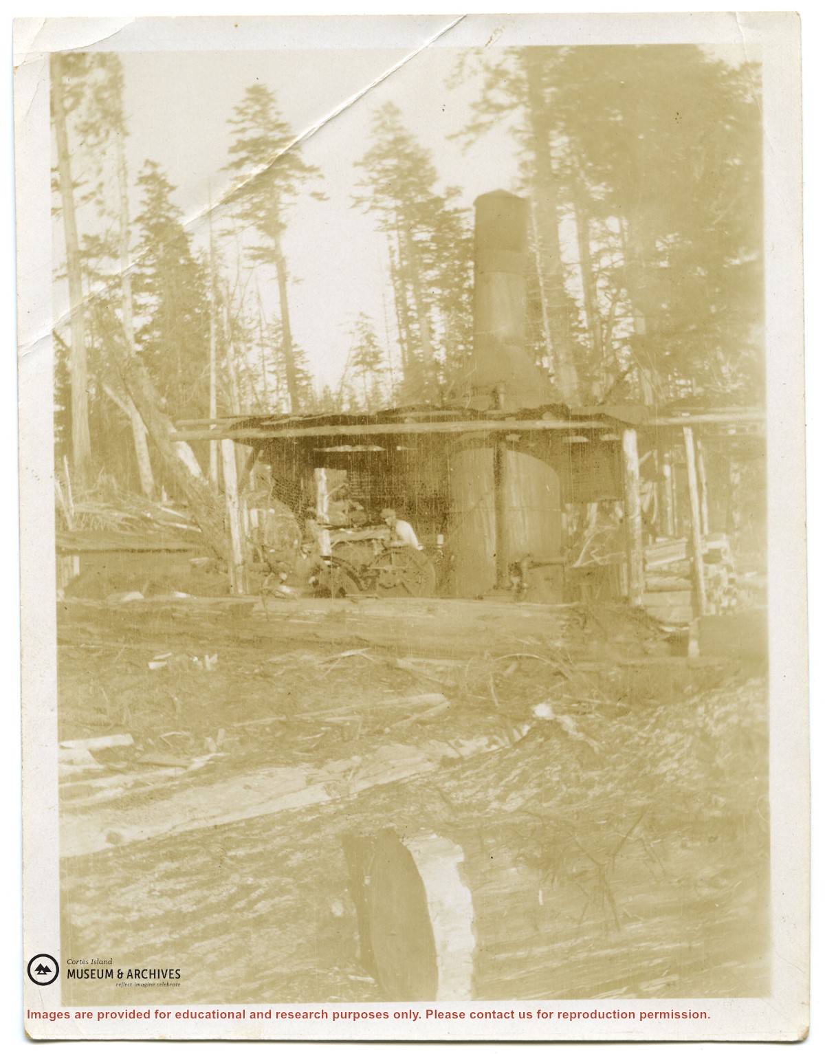
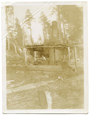
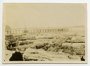
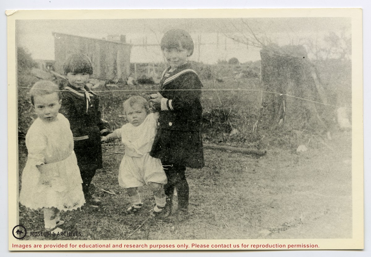
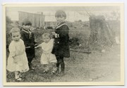
Families of Hernando Island men who worked together in a very small logging enterprise.
L to R: Mrs. Gwen (Fraser) Campbell holding Thelma's hand, Mrs. C. Owen (friend) behind Etta and Hazel McKay, Mrs. Jean (Wilfred) Manson behind Dorothy, Mrs. Florence (Ervin) McKay holding Minerva Campbell.
Families of Hernando Island men who worked together in a very small logging enterprise.
L to R: Mrs. Gwen (Fraser) Campbell holding Thelma's hand, Mrs. C. Owen (friend) behind Etta and Hazel McKay, Mrs. Jean (Wilfred) Manson behind Dorothy, Mrs. Florence (Ervin) McKay holding Minerva Campbell.
File contains a hand-drawn map of Hernando Island showing original pre-emptions, with information about settlement, schools and changes of title written on it.
File contains a hand-drawn map of Hernando Island showing original pre-emptions, with information about settlement, schools and changes of title written on it.
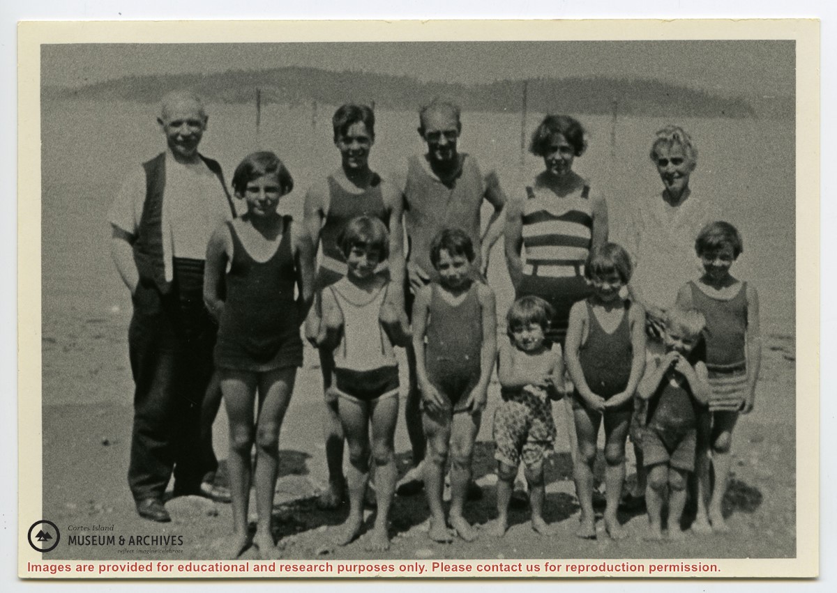
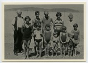
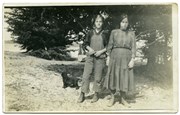
Photograph shows members of the Michael Manson extended family in bathing costumes. The are identified as Mr. Niven, Muriel Hurren, Jim Niven, Dick Parker, Thelma Campbell, Audrey Kenny, Jean Manson, Eileen Kenny, Minerva Campbell, Mrs. Niven, Dorothy Manson and Lorne Campbell.
Photograph shows members of the Michael Manson extended family in bathing costumes. The are identified as Mr. Niven, Muriel Hurren, Jim Niven, Dick Parker, Thelma Campbell, Audrey Kenny, Jean Manson, Eileen Kenny, Minerva Campbell, Mrs. Niven, Dorothy Manson and Lorne Campbell.
File contains five maps of Hernando Island: two showing plans of pre-emptions, 1891-1892; two copies of an old hand-drawn map, 1955; and one map of a later proposed development (undated). Some maps have notes on homesteads.
File contains five maps of Hernando Island: two showing plans of pre-emptions, 1891-1892; two copies of an old hand-drawn map, 1955; and one map of a later proposed development (undated). Some maps have notes on homesteads.
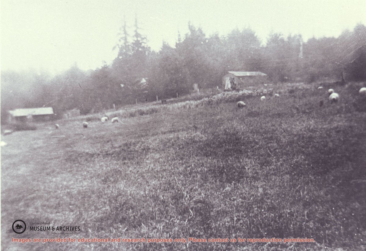
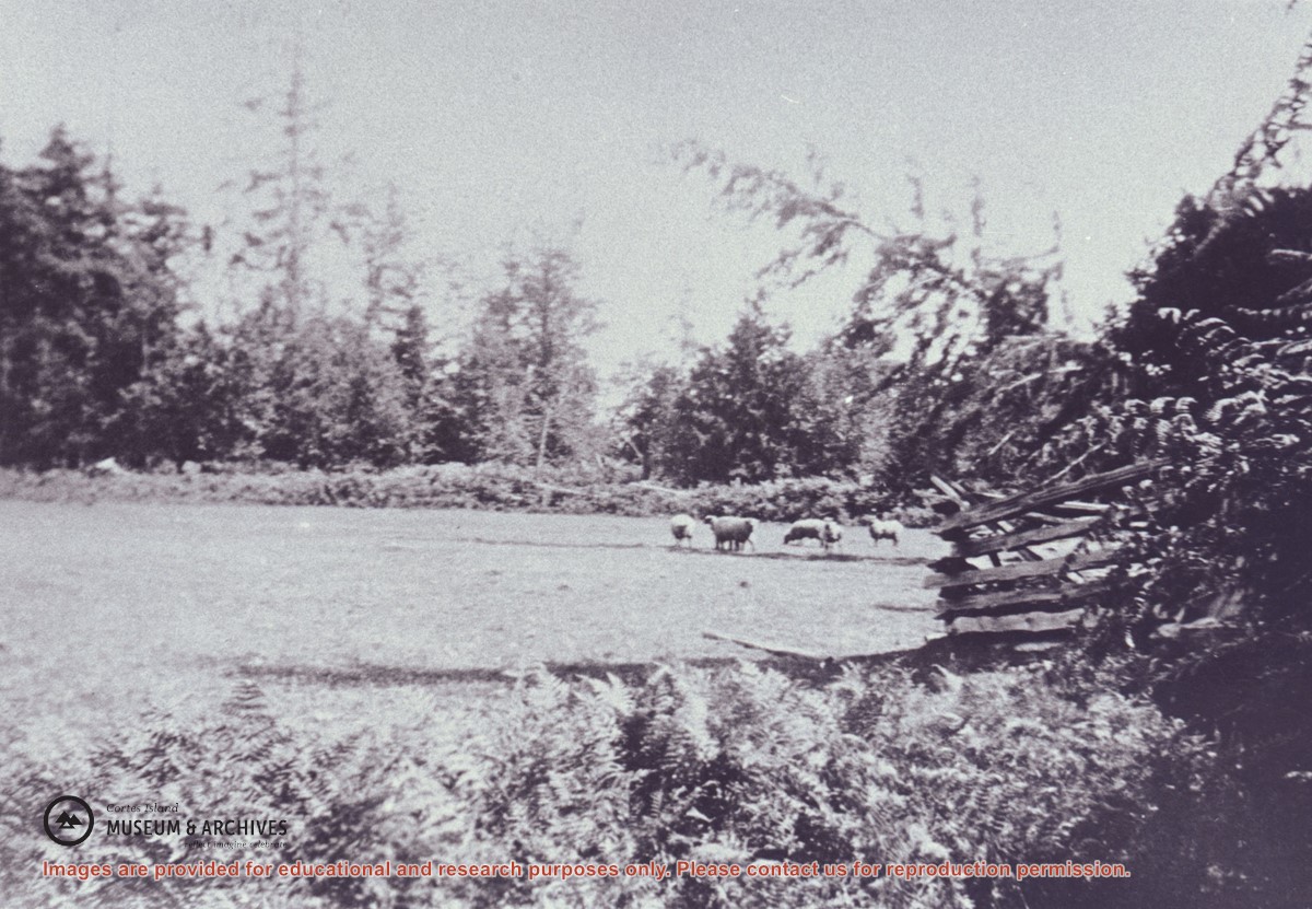
Manson's sheep grazing in the field on Hernando Island which was created by removing the old logging camp buildings. On the left is a one-time camp family house and on the right is the former cookhouse, now a barn.
Manson's sheep grazing in the field on Hernando Island which was created by removing the old logging camp buildings. On the left is a one-time camp family house and on the right is the former cookhouse, now a barn.
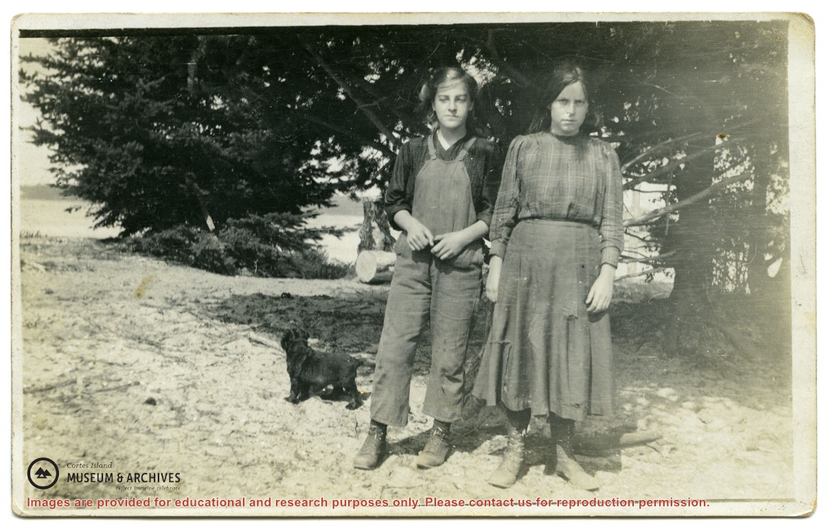
Rose (L) in overalls and her cousin Florence standing with a dog standing by trees at the John Manson home, Sunny Brae farm.
Rose was the daughter of John and Margaret Manson; Florence was the daughter of Michael and Jane Manson.
Rose (L) in overalls and her cousin Florence standing with a dog standing by trees at the John Manson home, Sunny Brae farm.
Rose was the daughter of John and Margaret Manson; Florence was the daughter of Michael and Jane Manson.
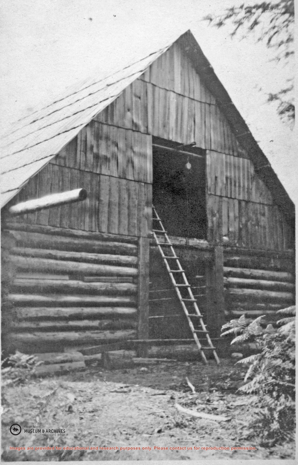
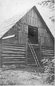
The log barn at Big Meadow on Hernando Island. The barn is built of logs and hand-split cedar shakes. While the railroad logging was still operating, Victor Berg and his partner lived at the Meadow and logged poles using horses.
The log barn at Big Meadow on Hernando Island. The barn is built of logs and hand-split cedar shakes. While the railroad logging was still operating, Victor Berg and his partner lived at the Meadow and logged poles using horses.