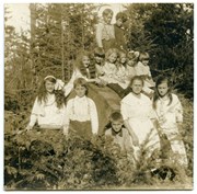
Group photo showing Manson's Landing school students sitting on and standing next to a huge log near the school.
Front row, left to right: Betty Hayes, Nicol Manson, Jack Hayes, Alice Marquette, Marjorie Hayes.
Centre left to right: Florence Hayes, Ethel Tiber, Dorothy Hayes, Nora Hayes, Helen Marquette, Veronica Tiber.
Back Row left to right: George Quimby and George Marquette.
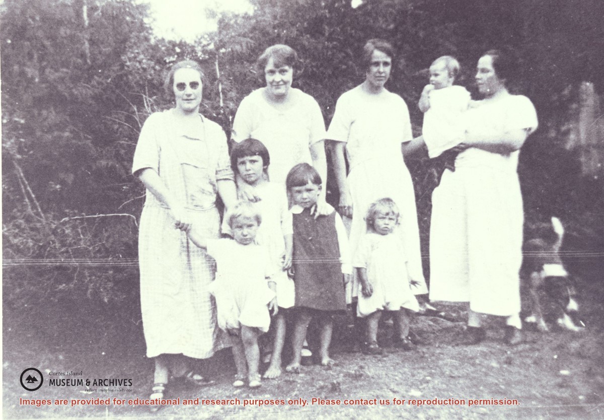
Families of Hernando Island men who worked together in a very small logging enterprise.
L to R: Mrs. Gwen (Fraser) Campbell holding Thelma's hand, Mrs. C. Owen (friend) behind Etta and Hazel McKay, Mrs. Jean (Wilfred) Manson behind Dorothy, Mrs. Florence (Ervin) McKay holding Minerva Campbell.
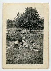
Families of Hernando Island men who worked together in a very small logging enterprise.
L to R: Mrs. Gwen (Fraser) Campbell holding Thelma's hand, Mrs. C. Owen (friend) behind Etta and Hazel McKay, Mrs. Jean (Wilfred) Manson behind Dorothy, Mrs. Florence (Ervin) McKay holding Minerva Campbell.
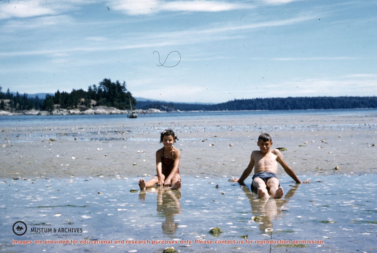
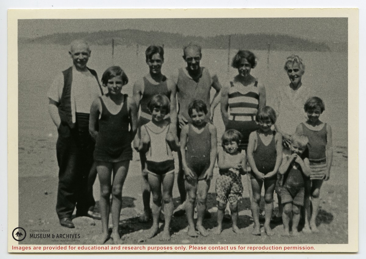
Photograph shows members of the Michael Manson extended family in bathing costumes. The are identified as Mr. Niven, Muriel Hurren, Jim Niven, Dick Parker, Thelma Campbell, Audrey Kenny, Jean Manson, Eileen Kenny, Minerva Campbell, Mrs. Niven, Dorothy Manson and Lorne Campbell.
Photograph shows members of the Michael Manson extended family in bathing costumes. The are identified as Mr. Niven, Muriel Hurren, Jim Niven, Dick Parker, Thelma Campbell, Audrey Kenny, Jean Manson, Eileen Kenny, Minerva Campbell, Mrs. Niven, Dorothy Manson and Lorne Campbell.
File contains five maps of Hernando Island: two showing plans of pre-emptions, 1891-1892; two copies of an old hand-drawn map, 1955; and one map of a later proposed development (undated). Some maps have notes on homesteads.
File contains five maps of Hernando Island: two showing plans of pre-emptions, 1891-1892; two copies of an old hand-drawn map, 1955; and one map of a later proposed development (undated). Some maps have notes on homesteads.
File contains a hand-drawn map of Hernando Island showing original pre-emptions, with information about settlement, schools and changes of title written on it.
File contains a hand-drawn map of Hernando Island showing original pre-emptions, with information about settlement, schools and changes of title written on it.