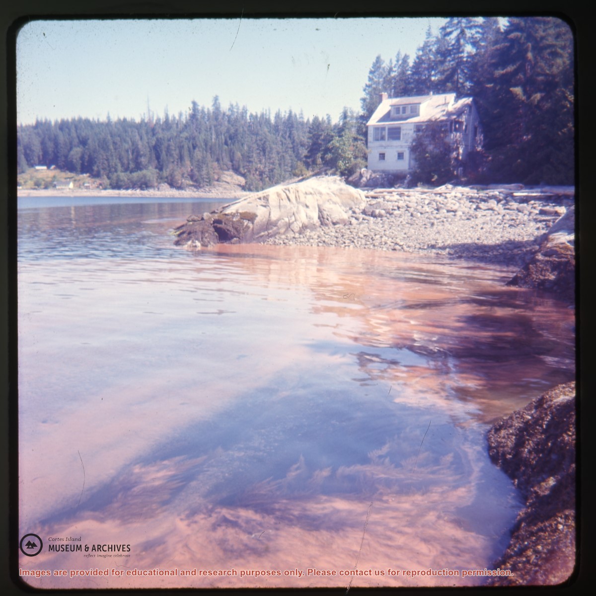
Photograph of Whaletown Bay taken from the water, showing the navigation marker at the entrance, and the houses to the left of the future site of the ferry landing.
Photograph of Whaletown Bay taken from the water, showing the navigation marker at the entrance, and the houses to the left of the future site of the ferry landing.
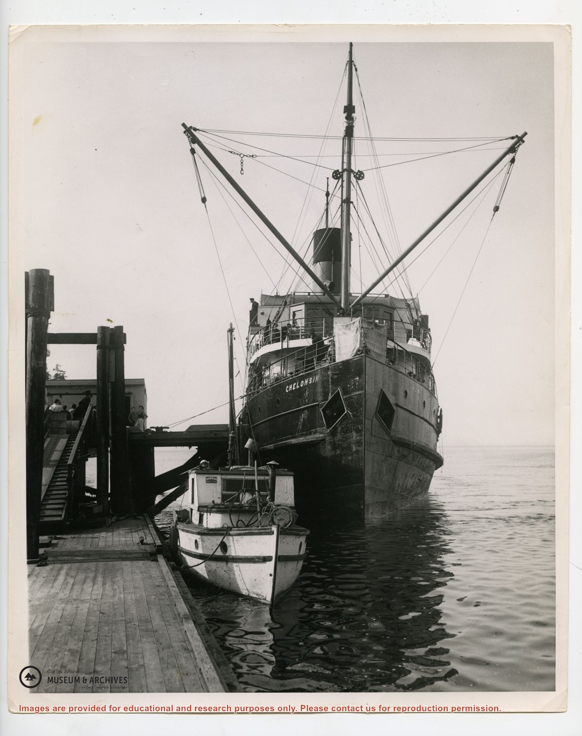
Photograph of the Union steamship "Chelohsin" alongside Manson's wharf. The photograph is taken from down on the floats; there is a local fish boat tied in front of the Chelohsin, and the ramp and freight shed are visible to the left.
Photograph of the Union steamship "Chelohsin" alongside Manson's wharf. The photograph is taken from down on the floats; there is a local fish boat tied in front of the Chelohsin, and the ramp and freight shed are visible to the left.
Album 8, "Harbours and Marinas on Cortes Island", contains photographs of wharves and their surroundings in Whaletown, Manson's Landing, Cortes Bay, Marina Island, Camp/Subtle Island, and other nearby coastal areas.
Album 8, "Harbours and Marinas on Cortes Island", contains photographs of wharves and their surroundings in Whaletown, Manson's Landing, Cortes Bay, Marina Island, Camp/Subtle Island, and other nearby coastal areas.


.jpg?width=1200&404=no-img.jpg&watermark=wmk)
.jpg?width=1200&404=no-img.jpg&watermark=wmk)
.jpg?width=180&404=no-img.jpg)