Binder contains interviews, stories and pictures from Etta (McKay) Byers, Bert and Penny Hansen, Peggy Pyner, Frank Hayes, Vida (Trousdale) Hodgson, Bob Milton, Lorne Musclow, and Elton Anderson.
It was created as part of the Memories of Manson's Landing Exhibit, curated and mounted by Doreen Thompson.
Binder contains interviews, stories, clippings and photographs documenting the social history of the Coulter Bay and Carrington Bay areas. It was created as part of the Windows on Whaletown Exhibit, curated and mounted by Doreen Thompson.
Binder contains interviews, stories, clippings and photographs documenting the social history of the Coulter Bay and Carrington Bay areas. It was created as part of the Windows on Whaletown Exhibit, curated and mounted by Doreen Thompson.
File contains a report by Fred and Ruth Zwickel ("Fauna and Flora Associated with Manson's Lagoon", with photographs); correspondence about water quality in Hague Lake and aquaculture in park boundaries; a Memorandum of Understanding with Klahoose re a marine park in Von Donop Inlet.
File contains a report by Fred and Ruth Zwickel ("Fauna and Flora Associated with Manson's Lagoon", with photographs); correspondence about water quality in Hague Lake and aquaculture in park boundaries; a Memorandum of Understanding with Klahoose re a marine park in Von Donop Inlet.
The base map is a zoning map produced by the Regional District of Comox-
Strathcona for the Cortes Island Land Use Project (Aug 1969). Edwards used
coloured pencil to show land and foreshore zones, and transferred information
about early preemptions and old roads and trails from an earlier map (see
Donald Palmer fonds, 2020.002.011, map of Cortes Island, Sayward District, ca.
1915).
File contains zoning maps for Bylaw 41, Electoral Area I, Schedules A1-A7 with revisions to 1999. There is a map of the whole island and larger scale maps of island areas.
File contains Plan Map Schedule A-1, Development Proposal Referral forms about changing the zoning bylaw designations to reflect the Official Community Plan of 1995, the agenda for an APC meeting and photocopies of FOCI/CIFC maps of Cortes Island land tenure.
File contains Plan Map Schedule A-1, Development Proposal Referral forms about changing the zoning bylaw designations to reflect the Official Community Plan of 1995, the agenda for an APC meeting and photocopies of FOCI/CIFC maps of Cortes Island land tenure.
File contains correspondence re Aquaculture bylaw #2300, a draft Cortes Island zoning bylaw (2001), and a map, the Official Community Plan Map Schedule A, 1993 and Bylaw 1896 to amend the OCP if 1995.
File contains correspondence re Aquaculture bylaw #2300, a draft Cortes Island zoning bylaw (2001), and a map, the Official Community Plan Map Schedule A, 1993 and Bylaw 1896 to amend the OCP if 1995.
Binder contains interviews, stories and pictures from Ginny and Bruce Ellingsen, the Lambert family, Dolly (Jeffery) Hansen and Maryann McCoy, with additional historic photographs of Smelt Bay from the early to the late 1900s at the back. It was created as part of the Memories of Manson's Landing Exhibit, curated and mounted by Doreen Thompson.
Binder contains interviews, stories and pictures from Ginny and Bruce Ellingsen, the Lambert family, Dolly (Jeffery) Hansen and Maryann McCoy, with additional historic photographs of Smelt Bay from the early to the late 1900s at the back. It was created as part of the Memories of Manson's Landing Exhibit, curated and mounted by Doreen Thompson.
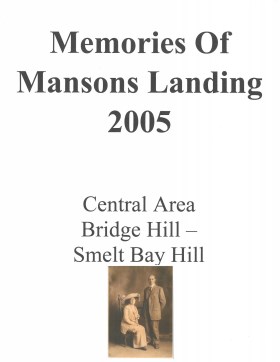
Memories of Mansons Landing 2005 – Central Area – Bridge Hill and Smelt Bay Hill
Binder contains interviews, stories and pictures from Mary and Bill Block, Larry Borland, May (Freeman) Ellingsen, Wilf Freeman, the Froud family, Robbie Graham, Bill Guthrie, Gloria Morrisette, Jean (Reford) MacDonald and Beth (Martin) Slater.
It was created as part of the Memories of Manson's Landing Exhibit, curated and mounted by Doreen Thompson.
File contains title information and photocopies of land grants and subsequent conveyances for the following:
John Williams: 1914, Crown Grant for the fractional SW 1/4 of Sec 22 and fractional NW 1/4 of Sec 22 (east of Gorge Harbour entrance)
John Williams: 1914, Crown Grant for the fractional SW 1/4 of Sec 22 and frac. NW 1/4 of Sec 18 (west of the Gorge Harbour entrance)
File contains three oversize maps which are stored in the map cabinet: Map of Section 22, Plan VIP52378, Lots A,B,C (blueprint map; 85 cm x 54 cm, 1985); map of Plan 27966 (blueprint map; 55 cm x 43 cm, 1974); photocopy of map of fractional NW 1/4 Sec 17 (55 cm x 43 cm, 1973)
(Files 3 through 7 are from the same envelope.)