L to R: Kiyoshi Kosky, Justin Stirn, Mike ?, John Shook
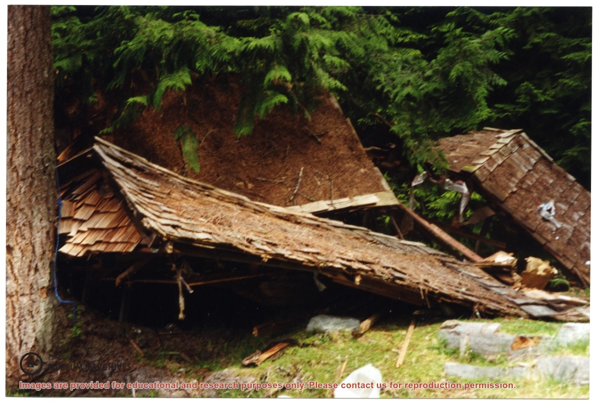
Part of a series of 8 photographs which document a clean-up at the proposed Carrington Bay Park site. The squatters' cabin was built in the 1970s, on the east side of Carrington Bay.
L to R: Kiyoshi Kosky, Justin Stirn, Mike ?, John Shook
Part of a series of 8 photographs which document a clean-up at the proposed Carrington Bay Park site. The squatters' cabin was built in the 1970s, on the east side of Carrington Bay.
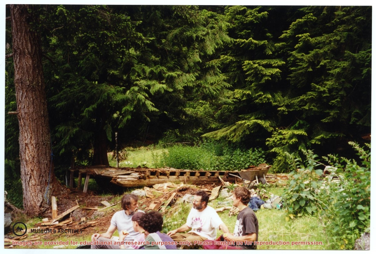
L to R: John Shook, Justin Stirn, Pierre DeTrey, Kiyoshi Kosky, Cedar DeTrey
Part of a series of 8 photographs which document a clean-up at the proposed Carrington Bay Park site. The squatters' cabin was built in the 1970s, on the east side of Carrington Bay.
L to R: John Shook, Justin Stirn, Pierre DeTrey, Kiyoshi Kosky, Cedar DeTrey
Part of a series of 8 photographs which document a clean-up at the proposed Carrington Bay Park site. The squatters' cabin was built in the 1970s, on the east side of Carrington Bay.
L to R: Cedar DeTrey, Mike ?, John Shook
Part of a series of 8 photographs which document a clean-up at the proposed Carrington Bay Park site. The squatters' cabin was built in the 1970s, on the east side of Carrington Bay.
L to R: Cedar DeTrey, Mike ?, John Shook
Part of a series of 8 photographs which document a clean-up at the proposed Carrington Bay Park site. The squatters' cabin was built in the 1970s, on the east side of Carrington Bay.
Part of a series of 8 photographs which document a clean-up at the proposed Carrington Bay Park site. The squatters' cabin was built in the 1970s, on the east side of Carrington Bay.
Part of a series of 8 photographs which document a clean-up at the proposed Carrington Bay Park site. The squatters' cabin was built in the 1970s, on the east side of Carrington Bay.
Note the log bulwark in the background designed to stop erosion of the bank.
This is one of five photographs with an accompanying letter brought to the Museum from the Manson's Landing fire hall. The photos were used in a display and have been removed from a paper backing. The letter is in the Small Fonds box.
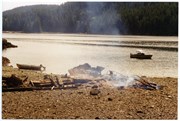
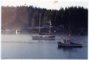
One of a series of photographs of volunteers removing the remains of shacks at Carrington Bay when Carrington Bay Marine Park was established.
L to R: Kiyoshi Kosky, Pierre DeTrey, Cedar DeTrey
One of a series of photographs of volunteers removing the remains of shacks at Carrington Bay when Carrington Bay Marine Park was established.
L to R: Kiyoshi Kosky, Pierre DeTrey, Cedar DeTrey
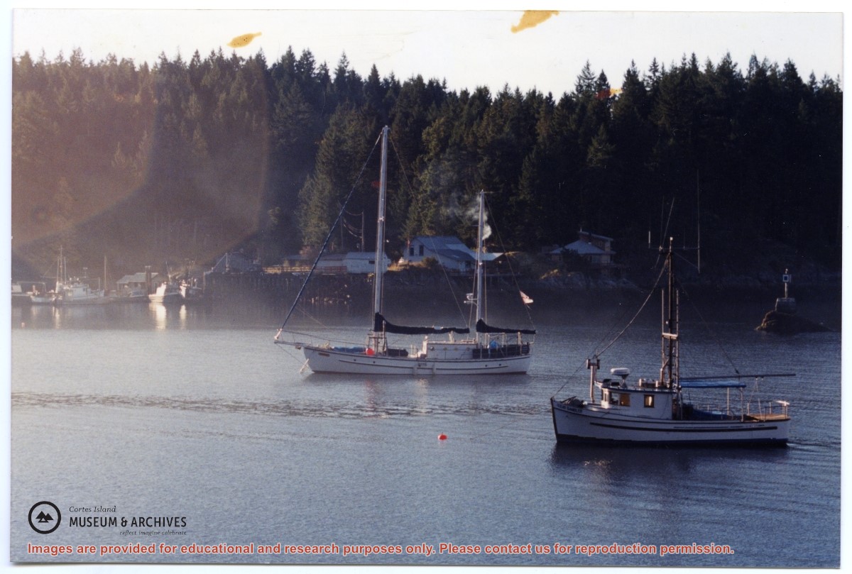
Dr. Dale Anderson's Marine Dental Clinic provided dental services for Cortes Island and nearby islands from 1995 - 2020. The dental office was originally in this sailboat and then moved into the float house clinic at the Whaletown dock (seen at the bottom of the ramp).
Dr. Dale Anderson's Marine Dental Clinic provided dental services for Cortes Island and nearby islands from 1995 - 2020. The dental office was originally in this sailboat and then moved into the float house clinic at the Whaletown dock (seen at the bottom of the ramp).
Part of a series of 8 photographs which document a clean-up at the proposed Carrington Bay Park site. The squatters' cabin was built in the 1970s, on the east side of Carrington Bay.
Part of a series of 8 photographs which document a clean-up at the proposed Carrington Bay Park site. The squatters' cabin was built in the 1970s, on the east side of Carrington Bay.
The base map is a zoning map produced by the Regional District of Comox-
Strathcona for the Cortes Island Land Use Project (Aug 1969). Edwards used
coloured pencil to show land and foreshore zones, and transferred information
about early preemptions and old roads and trails from an earlier map (see
Donald Palmer fonds, 2020.002.011, map of Cortes Island, Sayward District, ca.
1915).
File contains zoning maps for Bylaw 41, Electoral Area I, Schedules A1-A7 with revisions to 1999. There is a map of the whole island and larger scale maps of island areas.
File contains Plan Map Schedule A-1, Development Proposal Referral forms about changing the zoning bylaw designations to reflect the Official Community Plan of 1995, the agenda for an APC meeting and photocopies of FOCI/CIFC maps of Cortes Island land tenure.
File contains Plan Map Schedule A-1, Development Proposal Referral forms about changing the zoning bylaw designations to reflect the Official Community Plan of 1995, the agenda for an APC meeting and photocopies of FOCI/CIFC maps of Cortes Island land tenure.
File contains correspondence re Aquaculture bylaw #2300, a draft Cortes Island zoning bylaw (2001), and a map, the Official Community Plan Map Schedule A, 1993 and Bylaw 1896 to amend the OCP if 1995.
File contains correspondence re Aquaculture bylaw #2300, a draft Cortes Island zoning bylaw (2001), and a map, the Official Community Plan Map Schedule A, 1993 and Bylaw 1896 to amend the OCP if 1995.
L to R: Kyoshi Kosky, Justin Stirn
Part of a series of 8 photographs which document a clean-up at the proposed Carrington Bay Park site. The squatters' cabin was built in the 1970s, on the east side of Carrington Bay.
L to R: Kyoshi Kosky, Justin Stirn
Part of a series of 8 photographs which document a clean-up at the proposed Carrington Bay Park site. The squatters' cabin was built in the 1970s, on the east side of Carrington Bay.