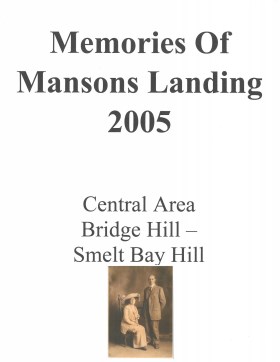
Memories of Mansons Landing 2005 – Central Area – Bridge Hill and Smelt Bay Hill
Binder contains interviews, stories and pictures from Mary and Bill Block, Larry Borland, May (Freeman) Ellingsen, Wilf Freeman, the Froud family, Robbie Graham, Bill Guthrie, Gloria Morrisette, Jean (Reford) MacDonald and Beth (Martin) Slater.
It was created as part of the Memories of Manson's Landing Exhibit, curated and mounted by Doreen Thompson.
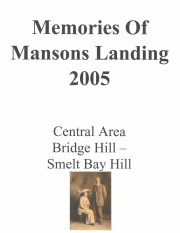
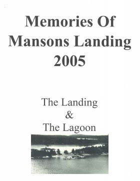
Memories of Mansons Landing 2005: The Landing and the Lagoon
Binder contains interviews, stories and pictures from Ken Summers, Bert and Victoria Summers, Ann Barton, Hiram (Buster) and Mabel Christiansen, Otis (Christiansen) Coulter, George and Rosemary (Gavin) Hawkins, Bob Martineau and Fred Reedel.
It was created as part of the Memories of Manson's Landing Exhibit, curated and mounted by Doreen Thompson.
Binder contains interviews, stories and photographs relating to schools in Mansons Landing. It was created as part of the Memories of Manson's Landing Exhibit, curated and mounted by Doreen Thompson.
Binder contains interviews, stories and photographs relating to schools in Mansons Landing. It was created as part of the Memories of Manson's Landing Exhibit, curated and mounted by Doreen Thompson.
Binder contains interviews, stories, clippings and photographs documenting the social history of the Coulter Bay and Carrington Bay areas. It was created as part of the Windows on Whaletown Exhibit, curated and mounted by Doreen Thompson.
Binder contains interviews, stories, clippings and photographs documenting the social history of the Coulter Bay and Carrington Bay areas. It was created as part of the Windows on Whaletown Exhibit, curated and mounted by Doreen Thompson.
Binder contains interviews, stories, clippings and photographs documenting the social history of the Green Valley/Bluejay Lake area. It was created as part of the Windows on Whaletown Exhibit, curated and mounted by Doreen Thompson.
Binder contains interviews, stories, clippings and photographs documenting the social history of the Green Valley/Bluejay Lake area. It was created as part of the Windows on Whaletown Exhibit, curated and mounted by Doreen Thompson.
Binder contains interviews, stories and pictures from Etta (McKay) Byers, Bert and Penny Hansen, Peggy Pyner, Frank Hayes, Vida (Trousdale) Hodgson, Bob Milton, Lorne Musclow, and Elton Anderson.
It was created as part of the Memories of Manson's Landing Exhibit, curated and mounted by Doreen Thompson.
Binder contains interviews, stories and photographs relating to Michael and John Manson and their families. It was created as part of the Memories of Manson's Landing Exhibit, curated and mounted by Doreen Thompson.
Binder contains interviews, stories and photographs relating to Michael and John Manson and their families. It was created as part of the Memories of Manson's Landing Exhibit, curated and mounted by Doreen Thompson.
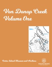
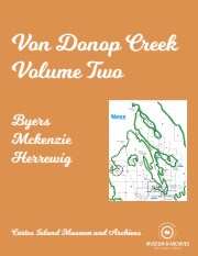
Binder contains interviews, stories and pictures. Binder contains interviews, stories and pictures. It was created in 2001 as part of the exhibit "The Von Donop Creek Story - 1920-1960", curated and mounted by Doreen Thompson.
Binder contains interviews, stories and pictures. Binder contains interviews, stories and pictures. It was created in 2001 as part of the exhibit "The Von Donop Creek Story - 1920-1960", curated and mounted by Doreen Thompson.
Binder contains interviews, stories and pictures. Binder contains interviews, stories and pictures. It was created in 2001 as part of the exhibit "The Von Donop Creek Story - 1920-1960", curated and mounted by Doreen Thompson.
Binder contains interviews, stories and pictures. Binder contains interviews, stories and pictures. It was created in 2001 as part of the exhibit "The Von Donop Creek Story - 1920-1960", curated and mounted by Doreen Thompson.
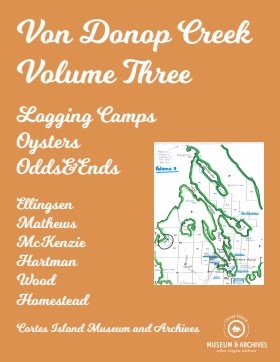
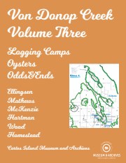
Binder contains interviews, stories and pictures. It was created in 2001 as part of the exhibit "The Von Donop Creek Story - 1920-1960", curated and mounted by Doreen Thompson. Binder contains interviews, stories and pictures.
Binder contains interviews, stories and pictures. It was created in 2001 as part of the exhibit "The Von Donop Creek Story - 1920-1960", curated and mounted by Doreen Thompson. Binder contains interviews, stories and pictures.
File contains text of the Memorandum of Understanding developed by Cortes Ecoforestry Society and Klahoose First Nation. Also includes twenty-nine (29) color photographic prints and eleven (11) color inkjet prints, which depict the signing of the MoU at Squirrel Cove and an Ecoforestry display at Smelt Bay. Photographs are stored in Photo Box #3.
File contains text of the Memorandum of Understanding developed by Cortes Ecoforestry Society and Klahoose First Nation. Also includes twenty-nine (29) color photographic prints and eleven (11) color inkjet prints, which depict the signing of the MoU at Squirrel Cove and an Ecoforestry display at Smelt Bay. Photographs are stored in Photo Box #3.
File contains a photocopied section map of the northern part of Cortes Island (from just south of Gorge Harbour), coloured to indicate areas for which a Crown Grant was located and areas of ungranted Crown land which still appear to be owned by the government. Scale is 1 mile to 1 inch.
File contains a photocopied section map of the northern part of Cortes Island (from just south of Gorge Harbour), coloured to indicate areas for which a Crown Grant was located and areas of ungranted Crown land which still appear to be owned by the government. Scale is 1 mile to 1 inch.
File contains a photocopied part of a map showing the locations of researched property in the Whaletown Lagoon and Whaletown Harbour area. The map is glued to an envelope which has a list of Crown grants and other conveyances on the back.
It contains photocopies of original land grants and other conveyances for the following:
Moses Ireland: 1893, Crown Grant for the W 1/2 of SW 1/4 of Sec 35 and W 1/2 of the SW 1/4 of Section 34
Joseph Youart: 1900, Crown Grant for Fractional NE 1/4 of Sec 35 (sold to Alice Robertson in 1908; "Burnside" is still in the Robertson family).
Nicholas Thompson: 1920, Crown Grant for the Fractional SW 1/4 of Sec 35
Charles Strange: 1914, Crown Grant for the NW 1/4 of Sec 35
File contains a map key to the areas of Sections 17, 18, 19, 22 and 34 (south of Gorge Harbour) which were researched (Information in Files 3-7).
It contains photocopies of original land grants and subsequent conveyances for the following:
Reginald James Smith: 1946, Crown Grant 165414I for fractional SE 1/4 of Sec 23, 1946 (the Thunder Road subdivision at the eastern end of Gorge Harbour).
(Files 3 through 7 are from the same envelope.)
File contains title information and photocopies of land grants and subsequent conveyances for the following:
John Williams: 1914, Crown Grant for the fractional SW 1/4 of Sec 22 and fractional NW 1/4 of Sec 22 (east of Gorge Harbour entrance)
John Williams: 1914, Crown Grant for the fractional SW 1/4 of Sec 22 and frac. NW 1/4 of Sec 18 (west of the Gorge Harbour entrance)
File contains three oversize maps which are stored in the map cabinet: Map of Section 22, Plan VIP52378, Lots A,B,C (blueprint map; 85 cm x 54 cm, 1985); map of Plan 27966 (blueprint map; 55 cm x 43 cm, 1974); photocopy of map of fractional NW 1/4 Sec 17 (55 cm x 43 cm, 1973)
(Files 3 through 7 are from the same envelope.)
File contains a coloured map with researched properties coloured in, and title information and photocopies of land grants and subsequent conveyances for the following:
Edward James Breeze: 1931, Crown Grant for District Lot 1373 (parts of Section 23 and Section 17, at the southeast end of Gorge Harbour by Anvil Lake)
Frank Harper: 1913, Crown Grant for the NE 96 acres of Section 23 (at the northeast end of Gorge Harbour)
(Files 3 through 7 are from the same envelope.)
File contains information for the following properties:
E. H. Vaughn: 1893, Crown Grant for fractional N 1/2 of Sec. 22; 90 acres for $90.00.
James P. Allen: 1913, Crown Grant for NW 34 acres of Sec. 23; $170.00
Bernard Robinson Allen: 1919, Crown Grant for SW 1/4 of Sec. 23, 159 acres
Charles Allen: 1912, Crown Grant for SW 1/4 of Sec. 33; 160 acres for $160.00
Harold Marshall Wood: Crown Grant for E 1/2 of NE 1/4 of Sec. 46 (east of Carrington Bay); 81 acres for $1.00.
File contains the following maps, stored in the Map Cabinet:
Subdivision Plan of parcel C & E, NW 1/4 of Sec. 21, 1976
Subdivision of the fractional NE 1/4 of Sec 21, 1966; with names of property owners penciled in
Subdivision Plan of Parcel C and part of Parcel E of fractional NE 1/4 of Sec. 21, 1975
Subdivision Plan of fractional NE 1/4 of Sec. 21 and W 1/2 of SW 1/4 of Sec. 34
(Files 17 through 19 are from the same envelope.)