Binder contains interviews, stories and pictures from Ginny and Bruce Ellingsen, the Lambert family, Dolly (Jeffery) Hansen and Maryann McCoy, with additional historic photographs of Smelt Bay from the early to the late 1900s at the back. It was created as part of the Memories of Manson's Landing Exhibit, curated and mounted by Doreen Thompson.
Binder contains interviews, stories and pictures from Ginny and Bruce Ellingsen, the Lambert family, Dolly (Jeffery) Hansen and Maryann McCoy, with additional historic photographs of Smelt Bay from the early to the late 1900s at the back. It was created as part of the Memories of Manson's Landing Exhibit, curated and mounted by Doreen Thompson.
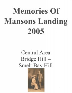
Memories of Mansons Landing 2005 – Central Area – Bridge Hill and Smelt Bay Hill
Binder contains interviews, stories and pictures from Mary and Bill Block, Larry Borland, May (Freeman) Ellingsen, Wilf Freeman, the Froud family, Robbie Graham, Bill Guthrie, Gloria Morrisette, Jean (Reford) MacDonald and Beth (Martin) Slater.
It was created as part of the Memories of Manson's Landing Exhibit, curated and mounted by Doreen Thompson.
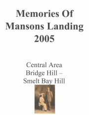
Binder contains interviews, stories, clippings and photographs documenting the social history of the Coulter Bay and Carrington Bay areas. It was created as part of the Windows on Whaletown Exhibit, curated and mounted by Doreen Thompson.
Binder contains interviews, stories, clippings and photographs documenting the social history of the Coulter Bay and Carrington Bay areas. It was created as part of the Windows on Whaletown Exhibit, curated and mounted by Doreen Thompson.
The base map is a zoning map produced by the Regional District of Comox-
Strathcona for the Cortes Island Land Use Project (Aug 1969). Edwards used
coloured pencil to show land and foreshore zones, and transferred information
about early preemptions and old roads and trails from an earlier map (see
Donald Palmer fonds, 2020.002.011, map of Cortes Island, Sayward District, ca.
1915).
File contains maps of Bute Inlet (1970), Cortes Island/Read Island and surrounding area (ca. 1950), Powell River (1968) and Cortes Island zoning maps (Jan 1974).
File contains maps of Bute Inlet (1970), Cortes Island/Read Island and surrounding area (ca. 1950), Powell River (1968) and Cortes Island zoning maps (Jan 1974).
File contains hand-drawn maps from the early 1900s. There are two copies of the plan of part of SW 1/4 of Section 34; a plan of Gorge Harbour with names of owners written in; and a plan showing part of Read Island.
File contains hand-drawn maps from the early 1900s. There are two copies of the plan of part of SW 1/4 of Section 34; a plan of Gorge Harbour with names of owners written in; and a plan showing part of Read Island.