Fonds consists of photographs and records of the Cortes Walking Group. Photographs depict walks and social activities and are arranged in two albums and one printed photo book. Textual records include two small notebooks with notes of walk routes, times and participants; membership lists; and accounts of activities with associated photographs, including a history of the Walking Group. A copy of the cerlox-bound "Listings of the Cortes Island Cemeteries" contains annotations up to 2020, mostly concerning the Mansons Landing cemetery.
The Cortes Walking Group was started in September of 2000 when Ann Dewar and Gail Ringwood decided to meet every Tuesday and Thursday at 9 AM to walk and put up a sign announcing their intention. The days were changed to the still-current schedule of Monday, Wednesday and Friday, and soon incorporated a visit to a coffee shop following the outings.
Walking Group activities are ongoing (2024). Walks leave from the parking lot at Manson's Hall at 9 AM sharp and are open to everyone. The route is decided just before the walks, which last anywhere from 45 minutes to 4 hours, but are usually one to two hours long.
Custodial History
The photo albums were mostly assembled by Gail Ringwood using photographs taken by Richard Trueman, Jurek and Gina Trzesicka and other group members. They were kept in the Pioneer Room at Manson's Hall and then at the Co-op Cafe. They were donated to the Museum by Sue Ellingsen and Myrna Kerr, members of the Walking Group, in 2022.
Scope and Content
Fonds consists of photographs and records of the Cortes Walking Group. Photographs depict walks and social activities and are arranged in two albums and one printed photo book. Textual records include two small notebooks with notes of walk routes, times and participants; membership lists; and accounts of activities with associated photographs, including a history of the Walking Group. A copy of the cerlox-bound "Listings of the Cortes Island Cemeteries" contains annotations up to 2020, mostly concerning the Mansons Landing cemetery.
Scanned photograph of Baron & Nellie Jeffery home at Smelt Bay, 1982. Smelt Bay Master Plan, Province of British Columbia, Ministry of Environment and Parks, 1987. Full issue of The Cottage Magazine, article featuring Smelt Bay midden sites, 1997. Excerpt from Seven Knot Summers, Beth Hill. Post cards and greeting cards featuring Smelt Bay, undated.
Scanned photograph of Baron & Nellie Jeffery home at Smelt Bay, 1982. Smelt Bay Master Plan, Province of British Columbia, Ministry of Environment and Parks, 1987. Full issue of The Cottage Magazine, article featuring Smelt Bay midden sites, 1997. Excerpt from Seven Knot Summers, Beth Hill. Post cards and greeting cards featuring Smelt Bay, undated.
File contains one bound photo book containing a selection of photographs of the Walking Group through the years; a charcoal drawing by Gail Ringwood with a letter on the back; three postcards.
File contains one bound photo book containing a selection of photographs of the Walking Group through the years; a charcoal drawing by Gail Ringwood with a letter on the back; three postcards.
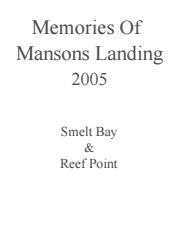
Binder contains interviews, stories and pictures from Ginny and Bruce Ellingsen, the Lambert family, Dolly (Jeffery) Hansen and Maryann McCoy, with additional historic photographs of Smelt Bay from the early to the late 1900s at the back. It was created as part of the Memories of Manson's Landing Exhibit, curated and mounted by Doreen Thompson.
Binder contains interviews, stories and pictures from Ginny and Bruce Ellingsen, the Lambert family, Dolly (Jeffery) Hansen and Maryann McCoy, with additional historic photographs of Smelt Bay from the early to the late 1900s at the back. It was created as part of the Memories of Manson's Landing Exhibit, curated and mounted by Doreen Thompson.
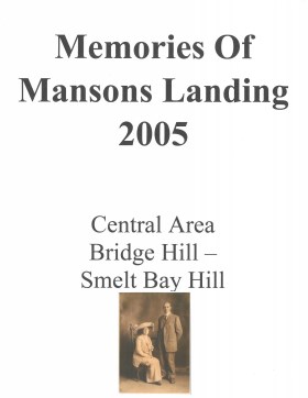
Memories of Mansons Landing 2005 – Central Area – Bridge Hill and Smelt Bay Hill
Binder contains interviews, stories and pictures from Mary and Bill Block, Larry Borland, May (Freeman) Ellingsen, Wilf Freeman, the Froud family, Robbie Graham, Bill Guthrie, Gloria Morrisette, Jean (Reford) MacDonald and Beth (Martin) Slater.
It was created as part of the Memories of Manson's Landing Exhibit, curated and mounted by Doreen Thompson.
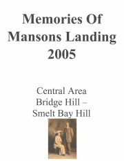
File contains a key map and list for the areas researched and information on the following:
George Herbert Wailes: 1920, Crown Grant for fractional SW 1/4 of Sec. 48; 48 acres for $217; with a tax sale notice, 1939
Ina Vernon Munro: 1920, Crown Grant for NE 1/4 of Sec. 37; 161 acres; includes a sale to Hawkins and a forfeit in 1939
Allan Olmsted: 1939, Crown Grant for SW 1/4 of Sec. 37
Ira Furry: 1911, Crown Grant for W 1/2 of SE 1/4 of Sec. 33
Walter Malcolm: 1919, Crown Grant for fractional SW 1/4 of Sec. 36
Frank Leslie Tooker: 1926, Crown Grant for N 1/2 of Sec. 36, 124 acres
Ira Furry: 1897, Crown Grant for SE 1/4 of Sec 36; 160 acres for $160.00.
Donald McDonald: 1926, Crown Grant for fractional NW 1/2 of Sec. 37; 144 acres for $1.00
Emails and clippings from Tideline on history of Tiber Bay, including preemptions, Tiber/Teuber family, Manson's Landing cemetery, and the CIMAS driving tour booklet, info from early 1900s-2016.
Emails and clippings from Tideline on history of Tiber Bay, including preemptions, Tiber/Teuber family, Manson's Landing cemetery, and the CIMAS driving tour booklet, info from early 1900s-2016.
Info on Carrington Bay history and early settler homesteaders from late 1800s onward; scans from Whaletown to 1930 album; scan of location for Department of Energy, Mines and Resources, 1945; park brochure; clippings about Carrington from 1982-2014; excerpt from interview with Clarence and Etta Byers, 2001; notes from exhibit curation (labels, photo captions, etc); excerpts rom June Cameron's Destination Cortez; topographic map of Green Mountain; emails about exhibit; printed photographs for exhibit. Keywords: drowing, Island Timberland, Coulter Bay, stream keepers
Info on Carrington Bay history and early settler homesteaders from late 1800s onward; scans from Whaletown to 1930 album; scan of location for Department of Energy, Mines and Resources, 1945; park brochure; clippings about Carrington from 1982-2014; excerpt from interview with Clarence and Etta Byers, 2001; notes from exhibit curation (labels, photo captions, etc); excerpts rom June Cameron's Destination Cortez; topographic map of Green Mountain; emails about exhibit; printed photographs for exhibit. Keywords: drowing, Island Timberland, Coulter Bay, stream keepers
Writing, emails and excerpts with info on early homesteaders, early postmasters, the first post box in Cortes Bay, Frabjous Bay/Frabjous Day, The Columbia Coast Mission, and the Rendezvous. Map of lots with some names of early homesteaders near Cortes Bay. Old postcard of Cortes Bay
Writing, emails and excerpts with info on early homesteaders, early postmasters, the first post box in Cortes Bay, Frabjous Bay/Frabjous Day, The Columbia Coast Mission, and the Rendezvous. Map of lots with some names of early homesteaders near Cortes Bay. Old postcard of Cortes Bay
Written info on Carrington Bay and Coulter Bay with info from late 1800s; info from Doris (Houghton-Brown) Henderson on Cortes Island early history, late 1920s. Ian and Mary McMillan's island in Coulter Bay listing, early 1950s. Info about Rendezvous Rock in Coulter Bay, 1953, from CIMAS photo albums. Excerpt from The Columbia is Coming!, Doris Anderson, 1982. Clippings from WNE with info on Coulter Bay, 1982-1992. Typed transcript of written letter from Mary McMillen to Doreen Thompson, undated.
Written info on Carrington Bay and Coulter Bay with info from late 1800s; info from Doris (Houghton-Brown) Henderson on Cortes Island early history, late 1920s. Ian and Mary McMillan's island in Coulter Bay listing, early 1950s. Info about Rendezvous Rock in Coulter Bay, 1953, from CIMAS photo albums. Excerpt from The Columbia is Coming!, Doris Anderson, 1982. Clippings from WNE with info on Coulter Bay, 1982-1992. Typed transcript of written letter from Mary McMillen to Doreen Thompson, undated.
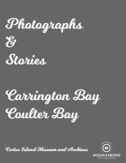
Binder contains interviews, stories, clippings and photographs documenting the social history of the Coulter Bay and Carrington Bay areas. It was created as part of the Windows on Whaletown Exhibit, curated and mounted by Doreen Thompson.
Binder contains interviews, stories, clippings and photographs documenting the social history of the Coulter Bay and Carrington Bay areas. It was created as part of the Windows on Whaletown Exhibit, curated and mounted by Doreen Thompson.
File contains photocopies of original Crown Grants, subsequent title changes and maps for:
To Joseph Gregson: 1926, Crown Grant for fractional W 1/2 of Lot 899 and Lot 901 (between Coulter and Carrington Bays), with a water easement for Wailes
To John Nugent McIllree: 1957, Crown Grant of mineral rights to lots at Coulter Bay surveyed as the "Arrow" and "Bullseye" mineral claims
To Hilda Peterson: 1919, Crown Grant for Lot 878, Carrington Bay, 55 acres
(Files 12 through 16 are from the same envelope.)