Fonds consists of photographs and records of the Cortes Walking Group. Photographs depict walks and social activities and are arranged in two albums and one printed photo book. Textual records include two small notebooks with notes of walk routes, times and participants; membership lists; and accounts of activities with associated photographs, including a history of the Walking Group. A copy of the cerlox-bound "Listings of the Cortes Island Cemeteries" contains annotations up to 2020, mostly concerning the Mansons Landing cemetery.
The Cortes Walking Group was started in September of 2000 when Ann Dewar and Gail Ringwood decided to meet every Tuesday and Thursday at 9 AM to walk and put up a sign announcing their intention. The days were changed to the still-current schedule of Monday, Wednesday and Friday, and soon incorporated a visit to a coffee shop following the outings.
Walking Group activities are ongoing (2024). Walks leave from the parking lot at Manson's Hall at 9 AM sharp and are open to everyone. The route is decided just before the walks, which last anywhere from 45 minutes to 4 hours, but are usually one to two hours long.
Custodial History
The photo albums were mostly assembled by Gail Ringwood using photographs taken by Richard Trueman, Jurek and Gina Trzesicka and other group members. They were kept in the Pioneer Room at Manson's Hall and then at the Co-op Cafe. They were donated to the Museum by Sue Ellingsen and Myrna Kerr, members of the Walking Group, in 2022.
Scope and Content
Fonds consists of photographs and records of the Cortes Walking Group. Photographs depict walks and social activities and are arranged in two albums and one printed photo book. Textual records include two small notebooks with notes of walk routes, times and participants; membership lists; and accounts of activities with associated photographs, including a history of the Walking Group. A copy of the cerlox-bound "Listings of the Cortes Island Cemeteries" contains annotations up to 2020, mostly concerning the Mansons Landing cemetery.
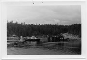
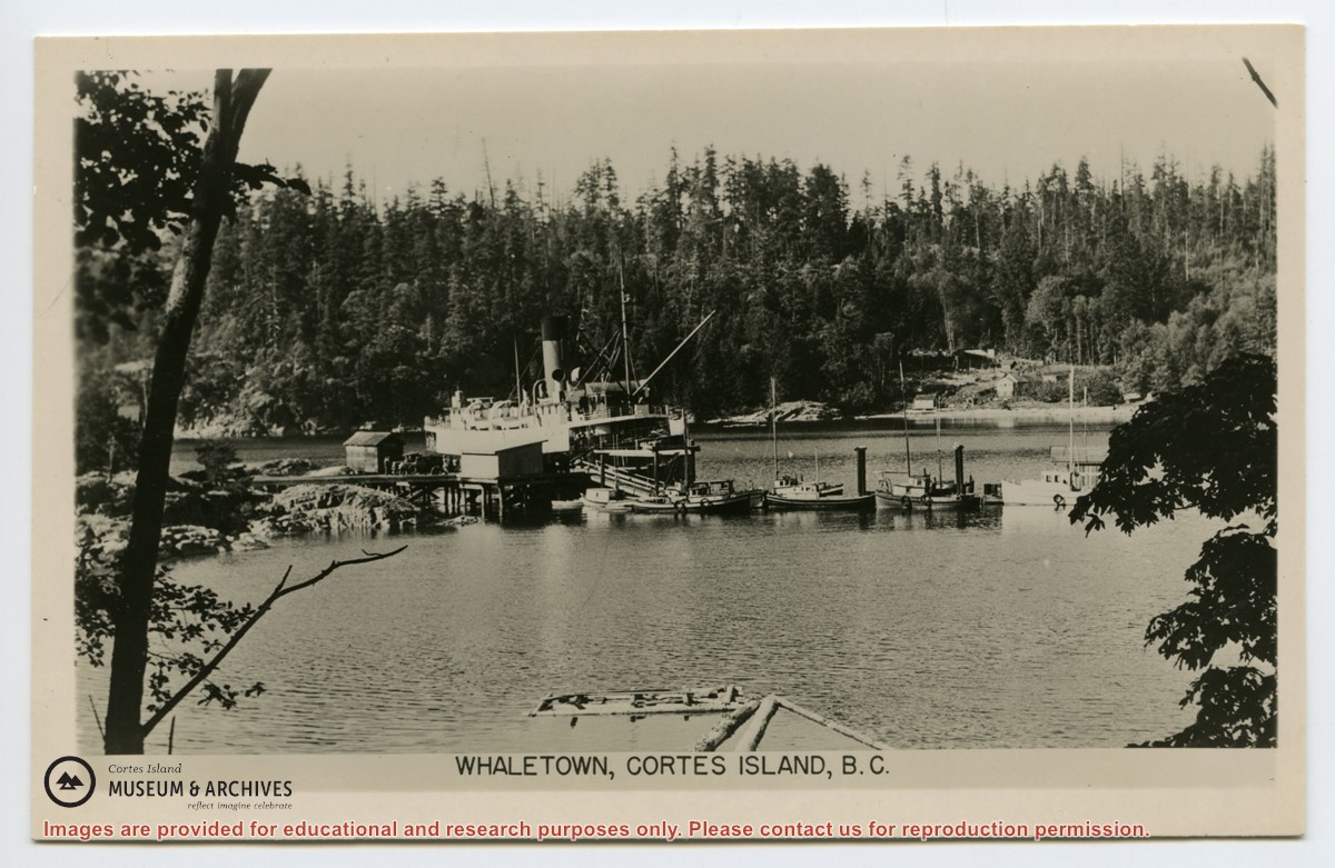
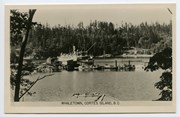
Photograph depicts the Whaletown wharf with a Union Steamship beside it. There is a truck parked on the wharf with several people standing beside it. The sheds on the wharf, the boat dock and the buildings across the bay at the present site of the ferry dock may be clearly seen.
Photograph depicts the Whaletown wharf with a Union Steamship beside it. There is a truck parked on the wharf with several people standing beside it. The sheds on the wharf, the boat dock and the buildings across the bay at the present site of the ferry dock may be clearly seen.
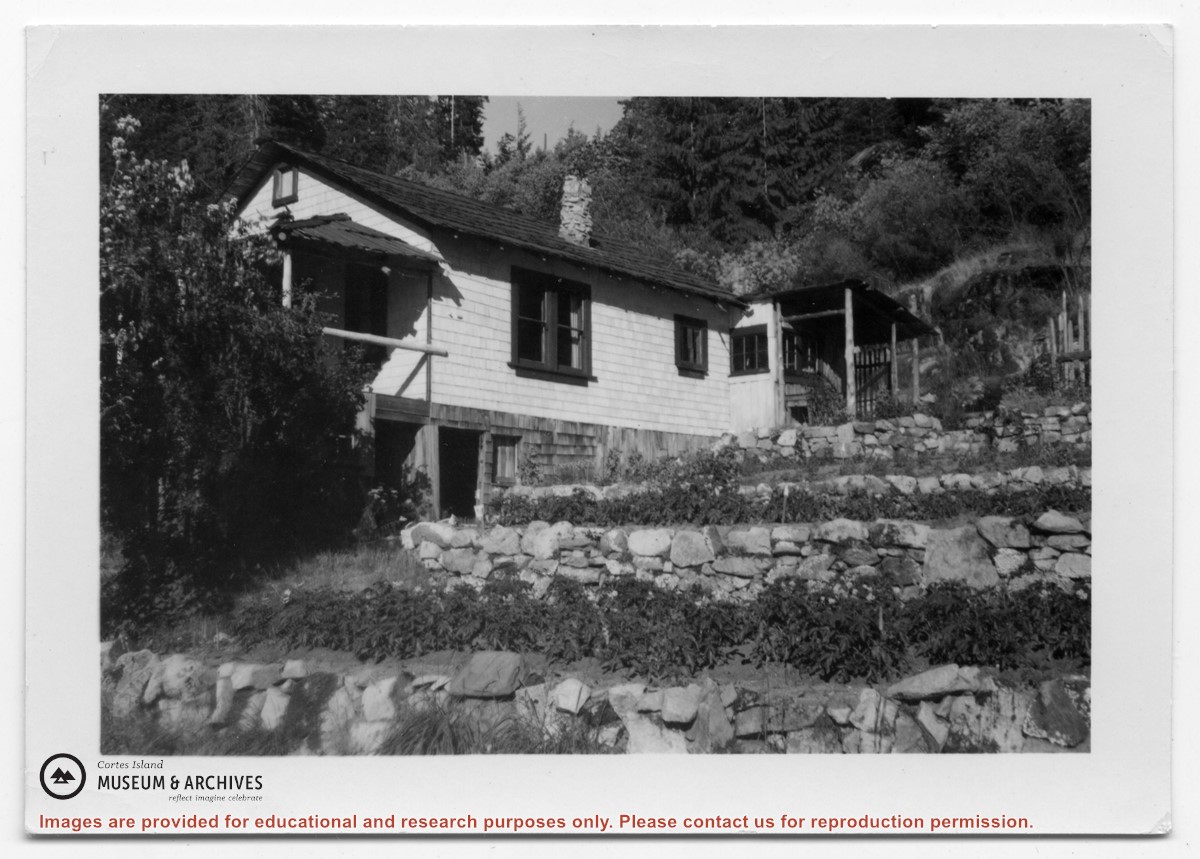
Photograph of a white house with rock-walled terraces to its right. This was Amy and Scotty McKenzie's float house, moved from Von Donop Inlet in 1951. Amy was daughter of Ruth and Henry Byers, who lived in the “Grey House” west of the ferry landing. (The "Grey House" was later moved to Squirrel Cove next to the Store.) The McKenzie house was between the Grey House and the ferry landing; it was torn down ca. 1974. The terraces may still be seen in the small park next to the ferry landing.
Photograph of a white house with rock-walled terraces to its right. This was Amy and Scotty McKenzie's float house, moved from Von Donop Inlet in 1951. Amy was daughter of Ruth and Henry Byers, who lived in the “Grey House” west of the ferry landing. (The "Grey House" was later moved to Squirrel Cove next to the Store.) The McKenzie house was between the Grey House and the ferry landing; it was torn down ca. 1974. The terraces may still be seen in the small park next to the ferry landing.
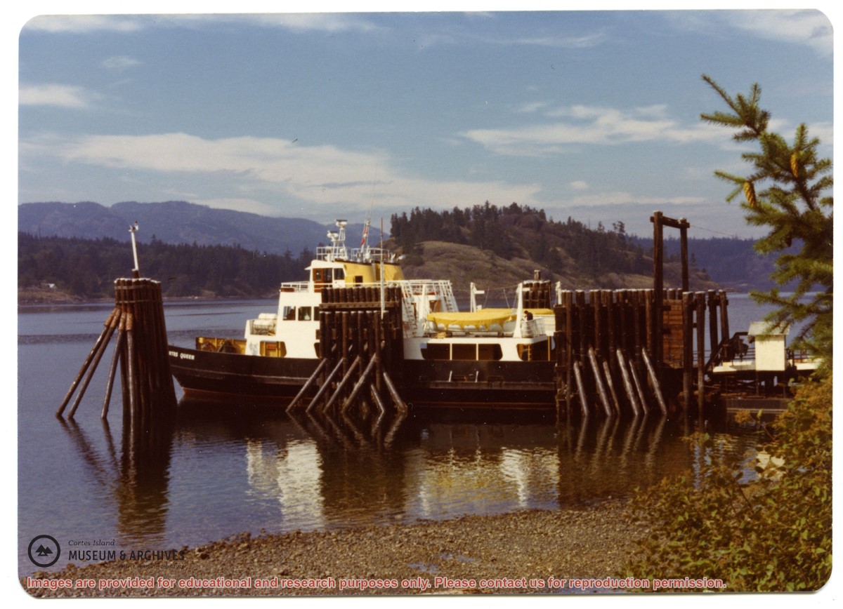
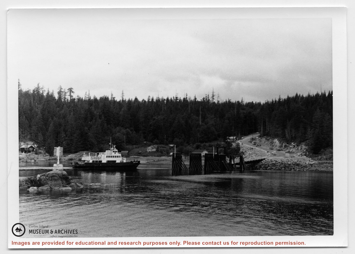
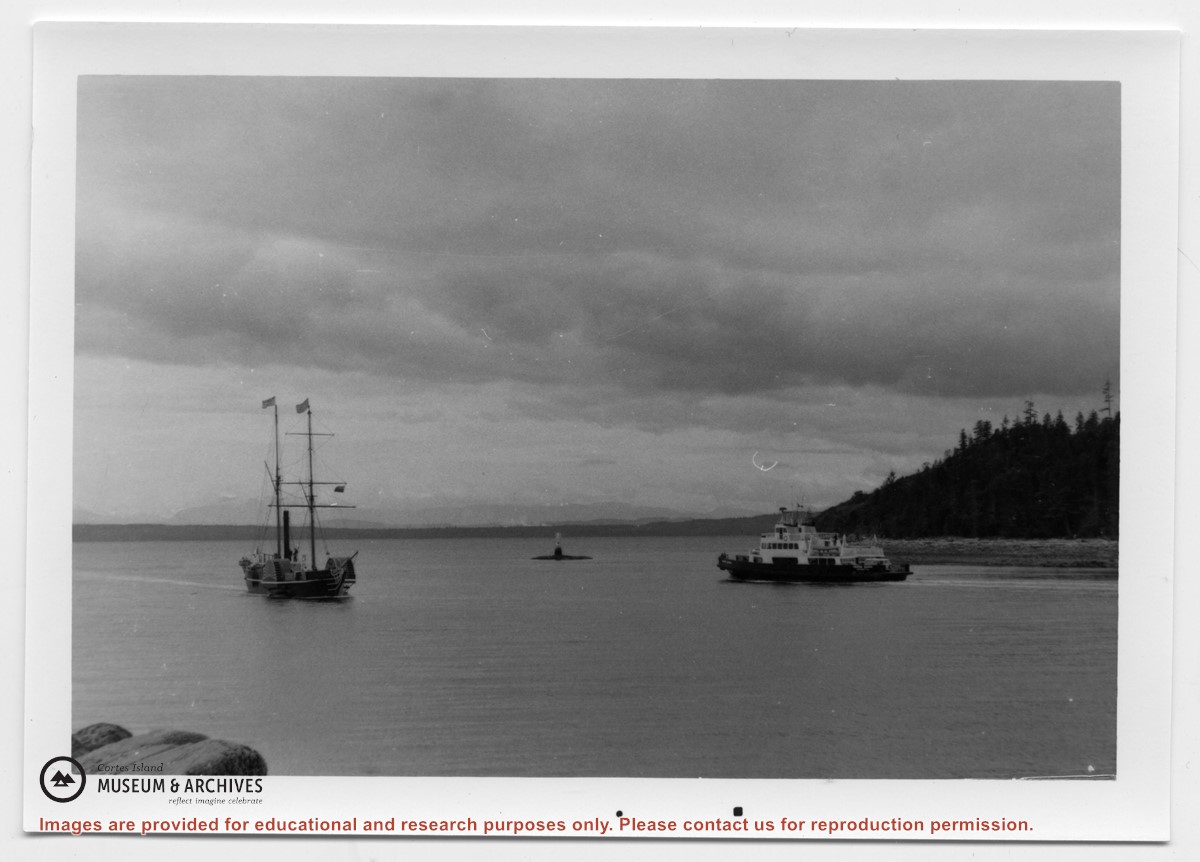
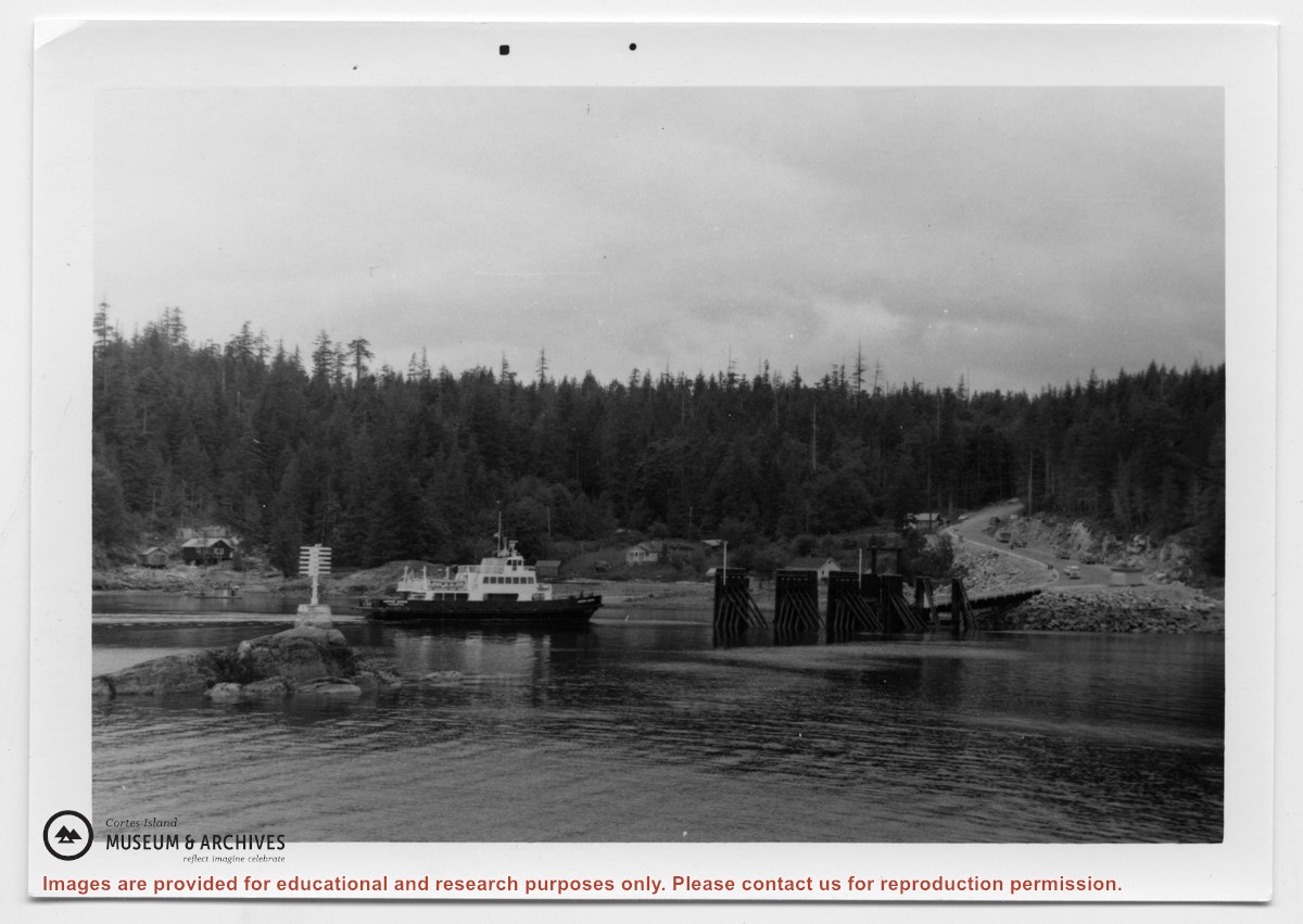
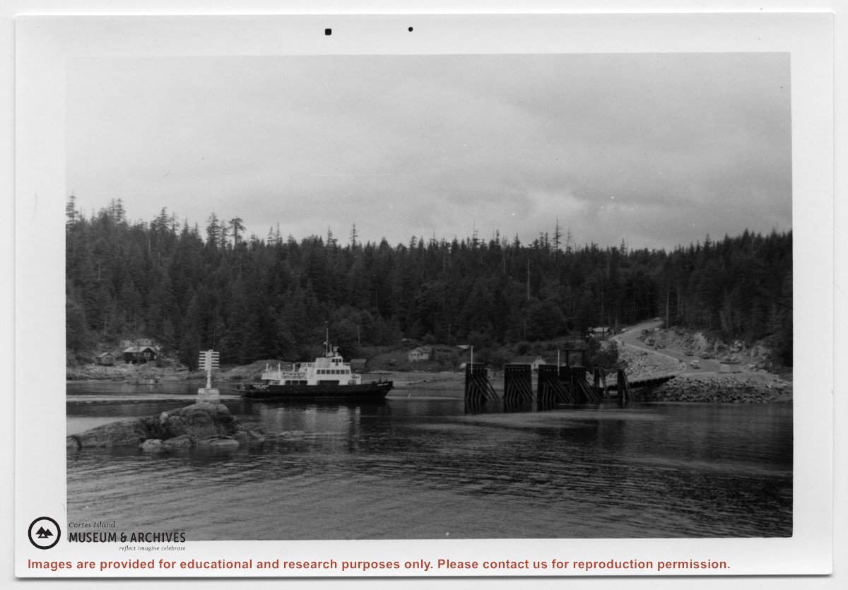
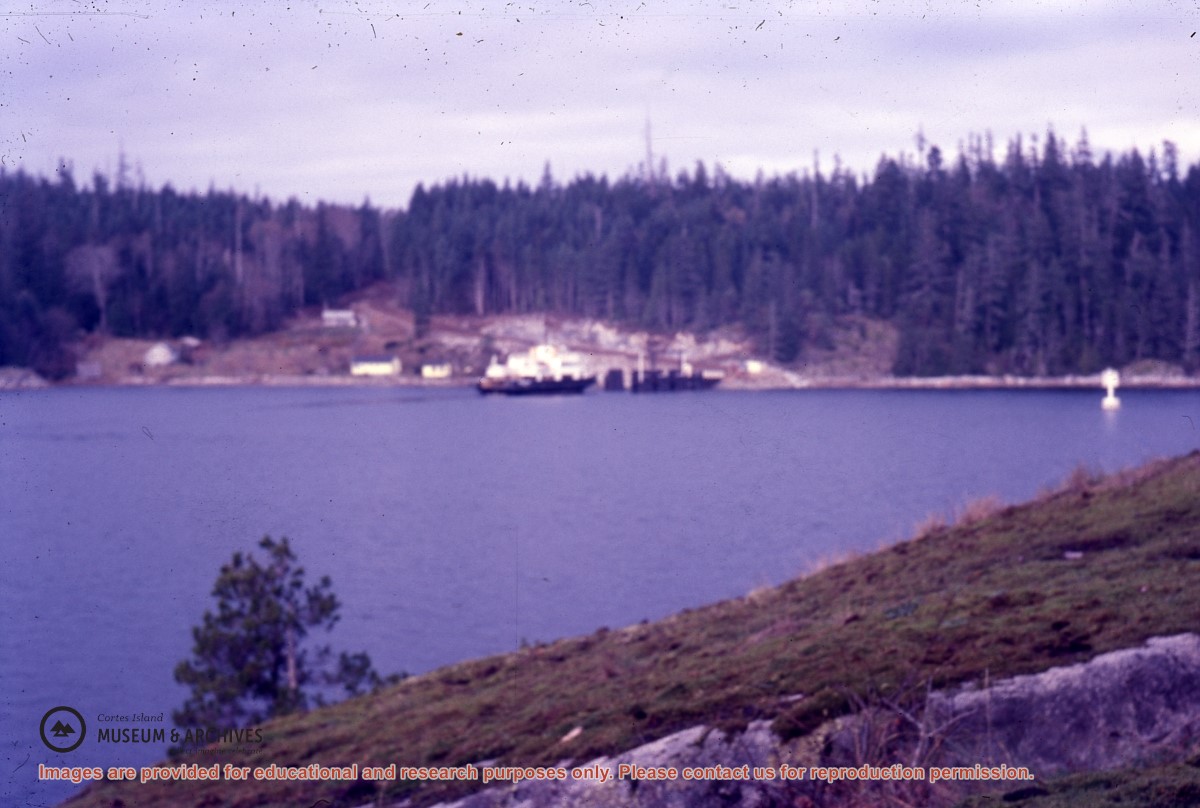
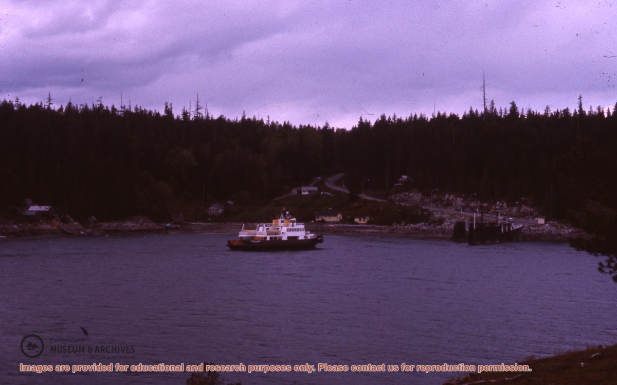
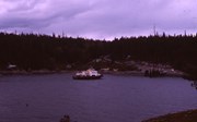
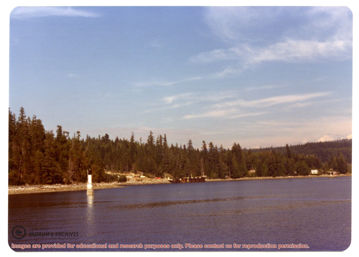
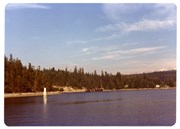
Photograph of Whaletown Bay taken from the water, showing the navigation marker at the entrance, and the houses to the left of the future site of the ferry landing.
Photograph of Whaletown Bay taken from the water, showing the navigation marker at the entrance, and the houses to the left of the future site of the ferry landing.