Series contains information on historic Crown Grants and subsequent title changes compiled by Doreen Thompson during her research for the CIMAS Windows on Whaletown exhibit in 1999. The area covered includes the northern part of Cortes Island, from just south of Gorge Harbour. Material includes maps, photocopies of original Crown Grants and other title documents, lists of subdivisions, and notes on changes of title.
Records were organized by Section or Plan number in large envelopes with a cover map and notes about the properties researched on the envelope back. They trace the ownership of parcels of land from the first grant or purchase from the Crown to 1999. Original order has been maintained.
Series consists of materials related to community planning and land use on Cortes Island, including materials relating to the formation and duties of the Regional District of Comox-Strathcona (RDCS) and the Cortes Island APC, proposals related to Cortes Island becoming part of the Islands Trust, RDCS planning study of Cortes Island, the Cortes Island land use questionnaire and final report, reports of CIRA planning committees, Cortes Island Community Plan drafts and draft revision, Cortes Island Official Settlement Plan and by-law, Subdivision Control by-law and Subdivision policy, zoning by-laws, drafts and amendments, proposed Siting by-law, and proposed application of the building code on Cortes Island.
Series consists of materials related to community planning and land use on Cortes Island, including materials relating to the formation and duties of the Regional District of Comox-Strathcona (RDCS) and the Cortes Island APC, proposals related to Cortes Island becoming part of the Islands Trust, RDCS planning study of Cortes Island, the Cortes Island land use questionnaire and final report, reports of CIRA planning committees, Cortes Island Community Plan drafts and draft revision, Cortes Island Official Settlement Plan and by-law, Subdivision Control by-law and Subdivision policy, zoning by-laws, drafts and amendments, proposed Siting by-law, and proposed application of the building code on Cortes Island.
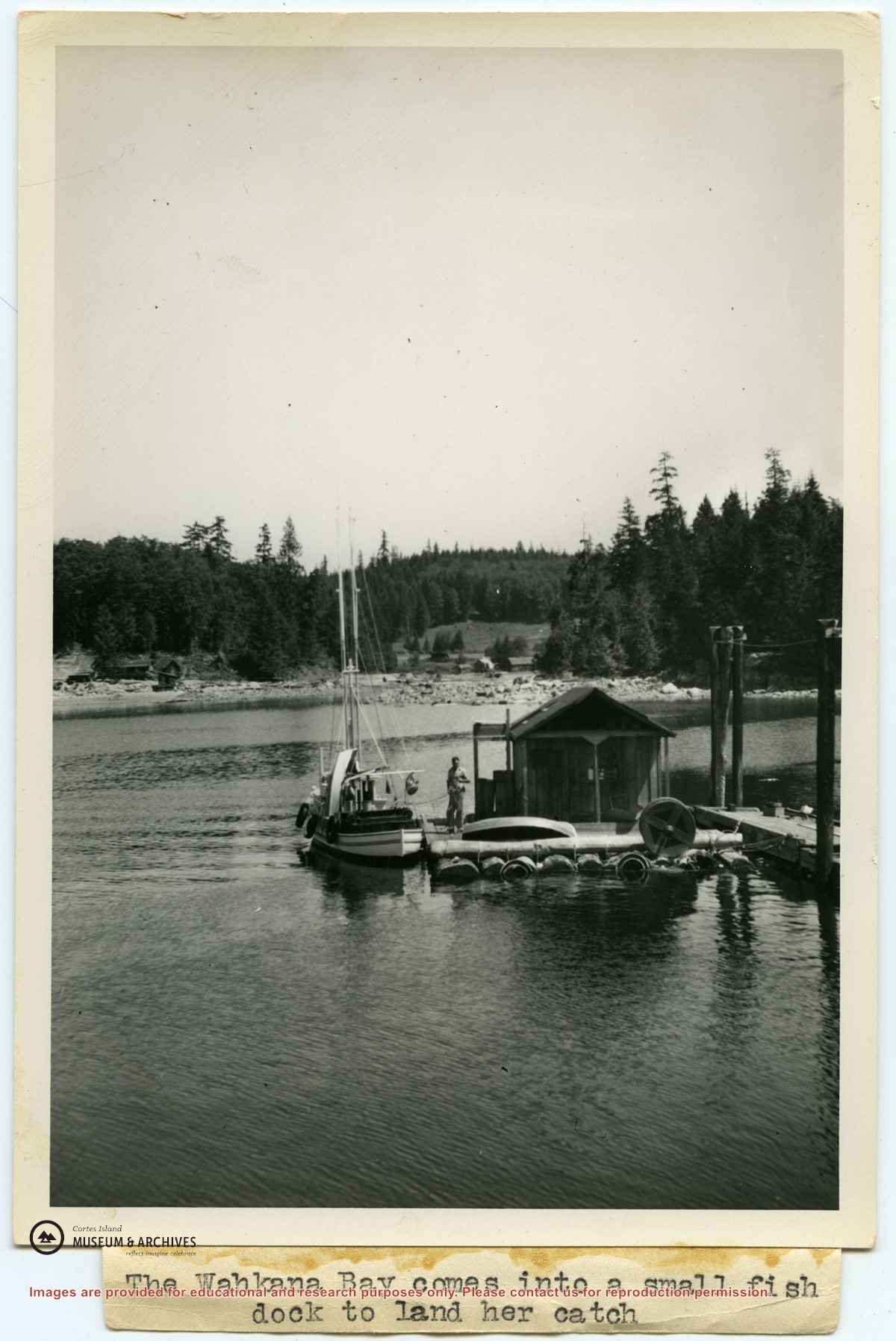
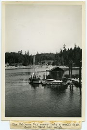
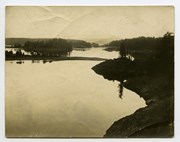
Photograph of Ken Slater's boat "Wahkana Bay" beside the fish scow at the end of the Whaletown dock. The buildings on the opposite side of Whaletown Bay may be seen in the background.
Photograph of Ken Slater's boat "Wahkana Bay" beside the fish scow at the end of the Whaletown dock. The buildings on the opposite side of Whaletown Bay may be seen in the background.
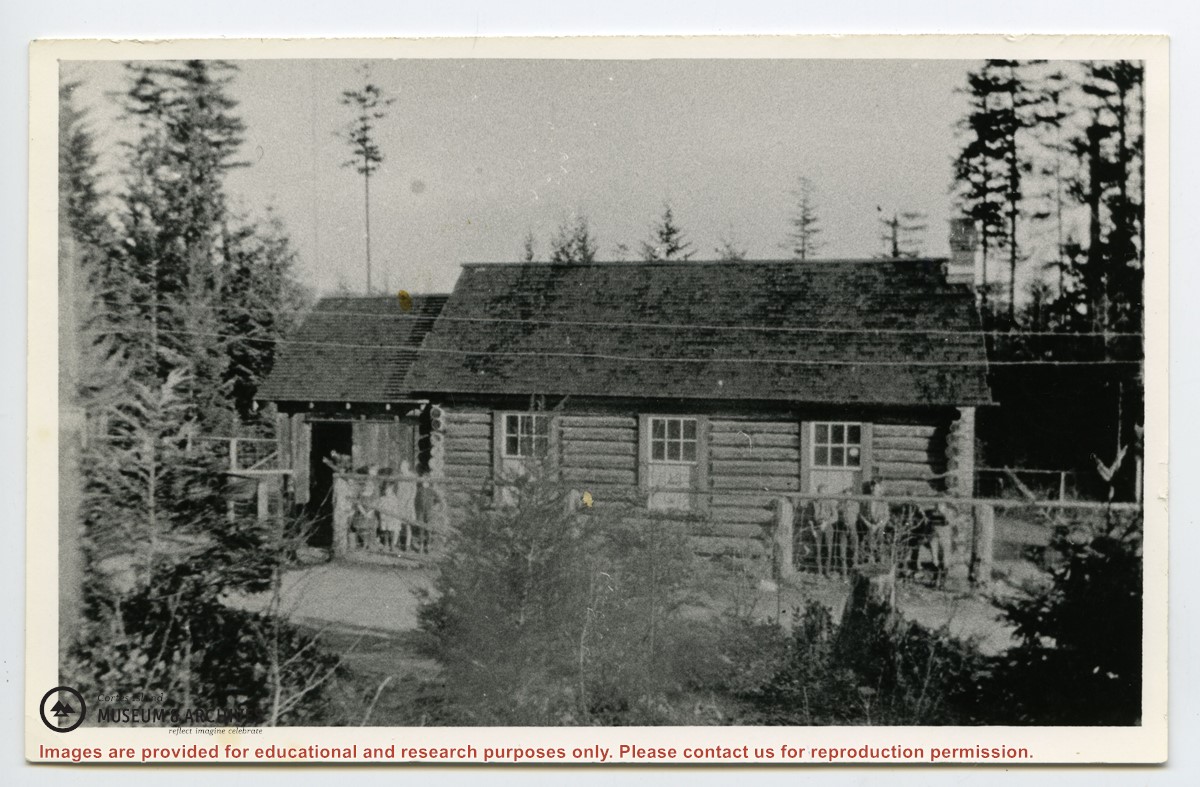
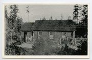
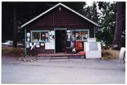
The Manson's Landing store in Mansons Landing Provincial Park. This photograph was taken a few months before the building was moved to Beasley Rd. to become the Cortes Island Museum.
The Manson's Landing store in Mansons Landing Provincial Park. This photograph was taken a few months before the building was moved to Beasley Rd. to become the Cortes Island Museum.
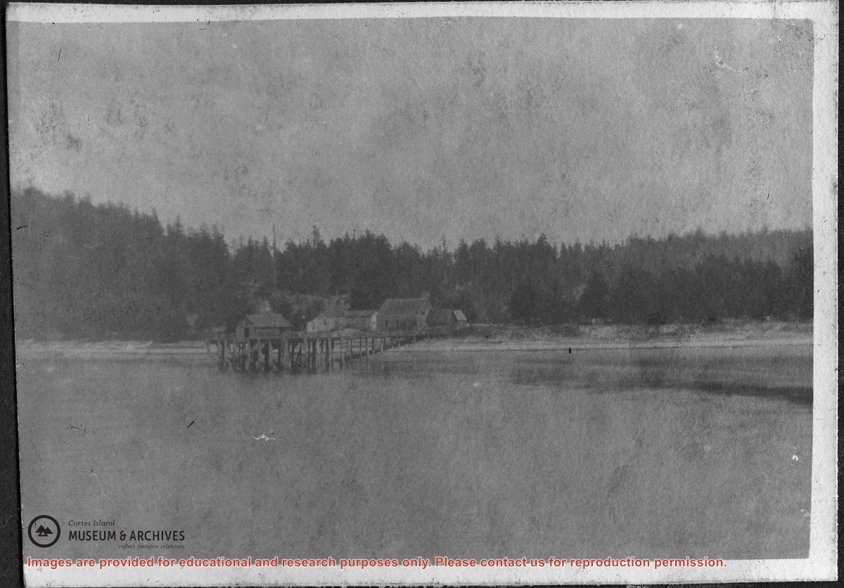
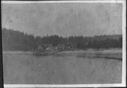
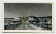
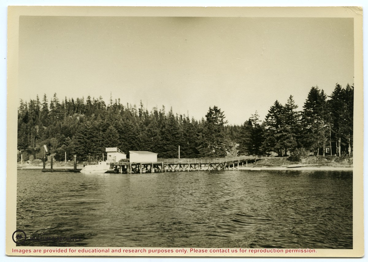
Photograph of the Manson's Landing wharf, taken from the water at high tide. It includes the oil and wharf sheds on the dock, an unknown scow boat with cabin at the float and the store ashore. Note: telephone poles from the original phone line across the mouth of the lagoon; higher banks along the shoreline.
Photograph of the Manson's Landing wharf, taken from the water at high tide. It includes the oil and wharf sheds on the dock, an unknown scow boat with cabin at the float and the store ashore. Note: telephone poles from the original phone line across the mouth of the lagoon; higher banks along the shoreline.
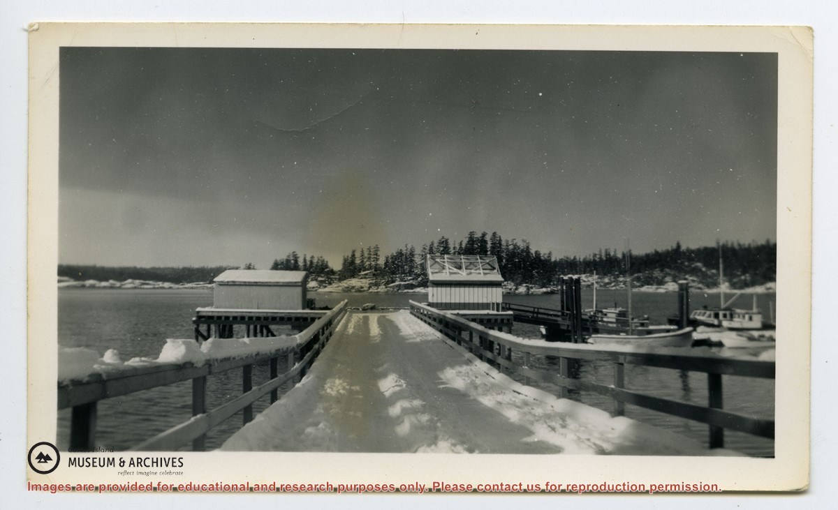
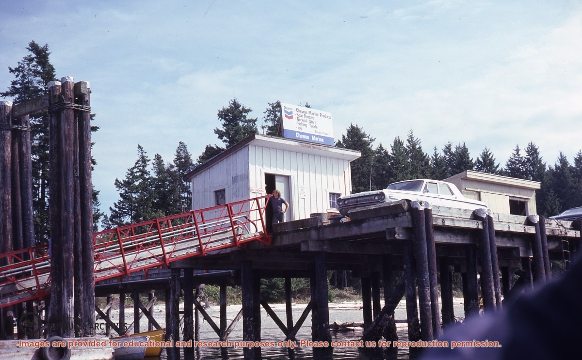
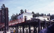
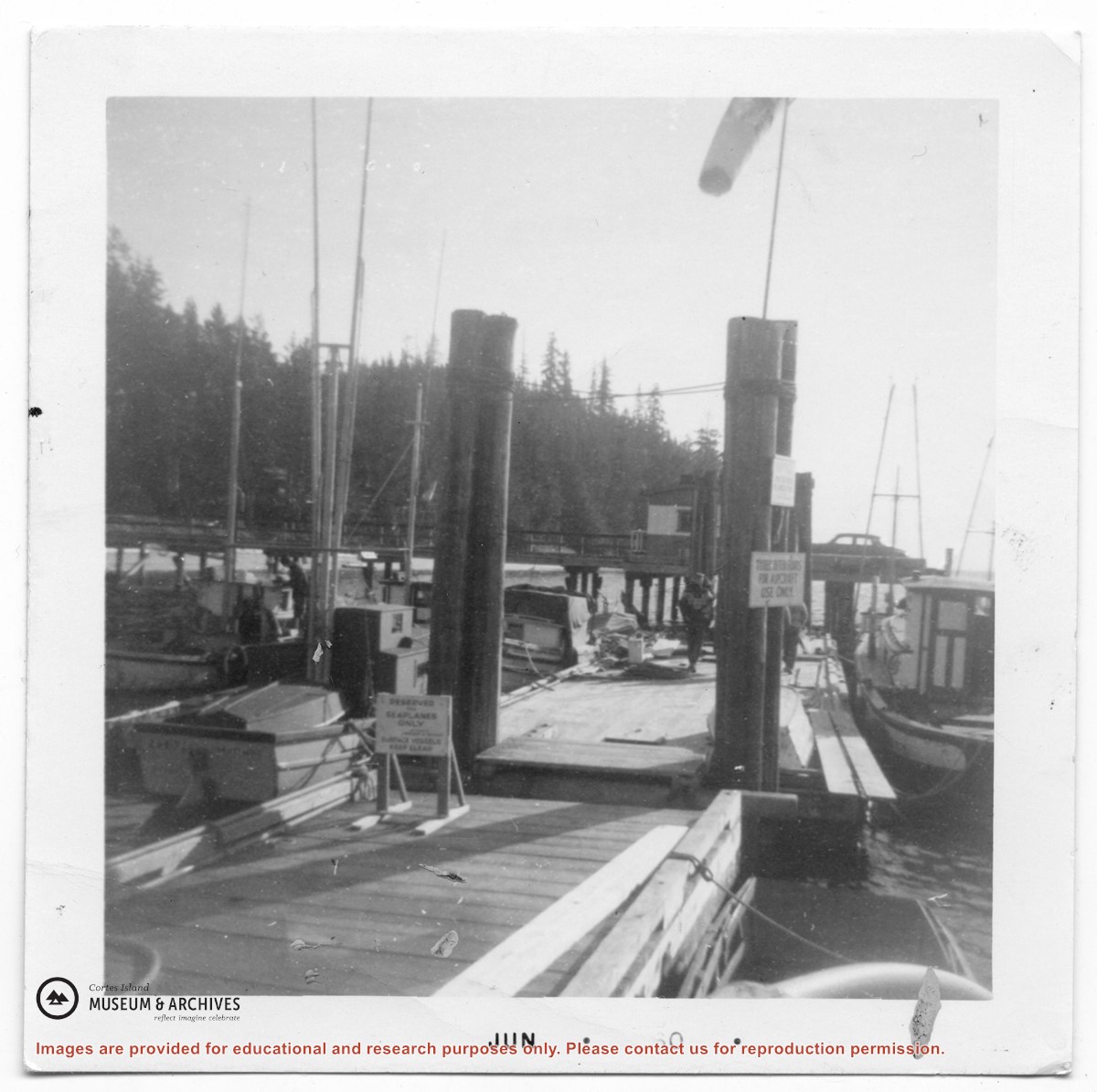
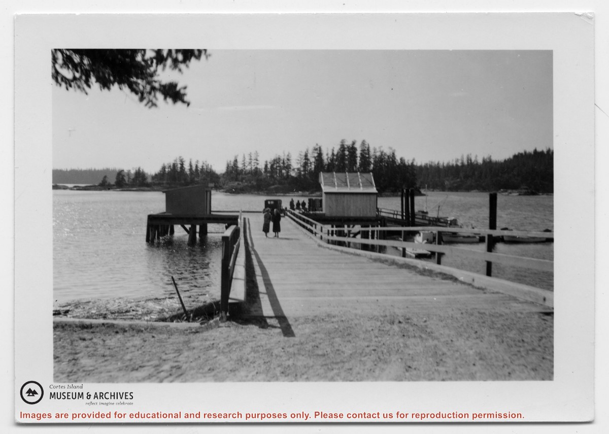
Photograph of Manson's Landing wharf, with Cat and Kitten Islands in the bacckground. Their are two sheds at the end of the dock above the ramp, and an old car is parked beside them. (date?)
Photograph of Manson's Landing wharf, with Cat and Kitten Islands in the bacckground. Their are two sheds at the end of the dock above the ramp, and an old car is parked beside them. (date?)