File contains a key map which was pasted on the front of the envelope indicating the areas researched for Files 12-16; notes on the titles; photocopies of Crown Grants and subsequent title information for:
BC Buildings Corp: 1982, Crown Grant for Block A of SW 1/4 of Sec. 25 (Highways Maintenance Yard)
District Lot 871 (40 acres between Carrington and Coulter Bays): to James Frederick McManus, 1919
To Ernest Henry Vaughn: 1922, Crown Grant for NE 1/4 and NW 1/4 of NE 1/4 of Sec. 24; SE 1/4 of SW 1/4 and SW 1/4 of SE 1/4 of Sec 31
Herbert Proctor: 1928 for fractional SW 1/4 of Sec. 41, bordering Tork Reserve; 159 acres for $159.00 (orig. Crown Grant to Herbert Proctor in 1922)
To William Cowan: 1937, E 1/2 of SE 1/4 of Sec. 26, 89 acres
(Files 12 through 16 are from the same envelope.)
File contains photocopies of original Crown Grants, subsequent title changes and maps for:
To Joseph Gregson: 1926, Crown Grant for fractional W 1/2 of Lot 899 and Lot 901 (between Coulter and Carrington Bays), with a water easement for Wailes
To John Nugent McIllree: 1957, Crown Grant of mineral rights to lots at Coulter Bay surveyed as the "Arrow" and "Bullseye" mineral claims
To Hilda Peterson: 1919, Crown Grant for Lot 878, Carrington Bay, 55 acres
(Files 12 through 16 are from the same envelope.)
File contains a page of notes, and photocopies of a tax sale notice (1938) and list of properties forfeited for non-payment of taxes, Crown Grants and other title information for the following:
William Walter James: 1926, Crown Grant for NW 1/4 of Sec. 38; 156 acres for $1.00; forfeited to Crown in 1939
Tom Albinson: 1919, Crown Grant for Lot 867; forfeited in 1927
Sadie McMurray: 1917, NE 1/4 of Sec. 39; 160 acres for $160
Peter Police: 1925, fractional NW 1/4 of Sec. 39; 103 acres for $1.00
(Files 12 through 16 are from the same envelope.)
File contains information for the following properties:
E. H. Vaughn: 1893, Crown Grant for fractional N 1/2 of Sec. 22; 90 acres for $90.00.
James P. Allen: 1913, Crown Grant for NW 34 acres of Sec. 23; $170.00
Bernard Robinson Allen: 1919, Crown Grant for SW 1/4 of Sec. 23, 159 acres
Charles Allen: 1912, Crown Grant for SW 1/4 of Sec. 33; 160 acres for $160.00
Harold Marshall Wood: Crown Grant for E 1/2 of NE 1/4 of Sec. 46 (east of Carrington Bay); 81 acres for $1.00.
File contains the following maps, stored in the Map Cabinet:
Subdivision Plan of parcel C & E, NW 1/4 of Sec. 21, 1976
Subdivision of the fractional NE 1/4 of Sec 21, 1966; with names of property owners penciled in
Subdivision Plan of Parcel C and part of Parcel E of fractional NE 1/4 of Sec. 21, 1975
Subdivision Plan of fractional NE 1/4 of Sec. 21 and W 1/2 of SW 1/4 of Sec. 34
(Files 17 through 19 are from the same envelope.)
File contains minutes, agendas and other material relating to meetings of the Klahoose Table, attended by members of CILAC, Klahoose First Nations and government negotiators. It includes material relating to a proposed park at Carrington Bay.
File contains minutes, agendas and other material relating to meetings of the Klahoose Table, attended by members of CILAC, Klahoose First Nations and government negotiators. It includes material relating to a proposed park at Carrington Bay.
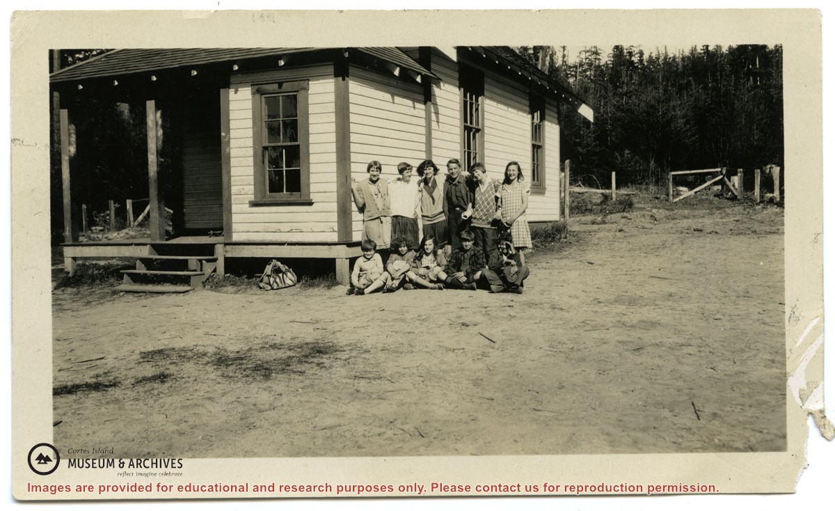
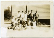
Photographs depict the pupils at the second Whaletown school standing beside the school. The photograph was taken by Evelyn Dow, who taught there from February 1928 to June 1929. This school was built in 1918 near the corner of Coulter Bay Road and Carrington Bay Road, and was used (with improvements) until 1950. The front, side and surroundings of the school are clearly shown.
Front row third from left is Marion Borden; Vernon Borden next to her fourth from left.
Top row, far right: Lorna Borden
(IDs by Terrill Marlow, Marion’s daughter, and Rob Borden, Vernon’s son).
Photographs are from an album created by Evelyn Dow and were donated to CIMAS by her niece, Sharon Thomas.
Scope and Content
Photographs depict the pupils at the second Whaletown school standing beside the school. The photograph was taken by Evelyn Dow, who taught there from February 1928 to June 1929. This school was built in 1918 near the corner of Coulter Bay Road and Carrington Bay Road, and was used (with improvements) until 1950. The front, side and surroundings of the school are clearly shown.
Front row third from left is Marion Borden; Vernon Borden next to her fourth from left.
Top row, far right: Lorna Borden
(IDs by Terrill Marlow, Marion’s daughter, and Rob Borden, Vernon’s son).
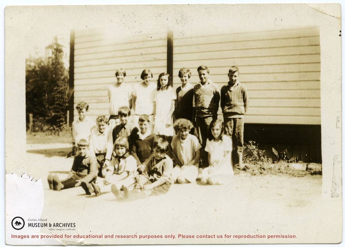
Photograph depicts the pupils at the second Whaletown school beside the corner of the school. The photograph was taken by Evelyn Dow, who taught there from February 1928 to June 1929. This school was built in 1918 near the corner of Coulter Bay Road and Carrington Bay Road, and was used (with improvements) until 1950.
Top Row: third from left, Lorna Borden; second from right, Doris Houghton-Brown
Middle row: second from left, Ken Houghton-Brown, third from left, Vernon Borden; far right, Marion Borden
Front row: far right, Claude Borden
(IDs by Terrill Marlow, Marion’s daughter, Rob Borden, Vernon’s son, and Joan Bevington, Ken Houghton-Brown's daughter).
Photograph is from an album created by Evelyn Dow and was donated to CIMAS by her niece, Sharon Thomas.
Scope and Content
Photograph depicts the pupils at the second Whaletown school beside the corner of the school. The photograph was taken by Evelyn Dow, who taught there from February 1928 to June 1929. This school was built in 1918 near the corner of Coulter Bay Road and Carrington Bay Road, and was used (with improvements) until 1950.
Top Row: third from left, Lorna Borden; second from right, Doris Houghton-Brown
Middle row: second from left, Ken Houghton-Brown, third from left, Vernon Borden; far right, Marion Borden
Front row: far right, Claude Borden
(IDs by Terrill Marlow, Marion’s daughter, Rob Borden, Vernon’s son, and Joan Bevington, Ken Houghton-Brown's daughter).
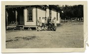
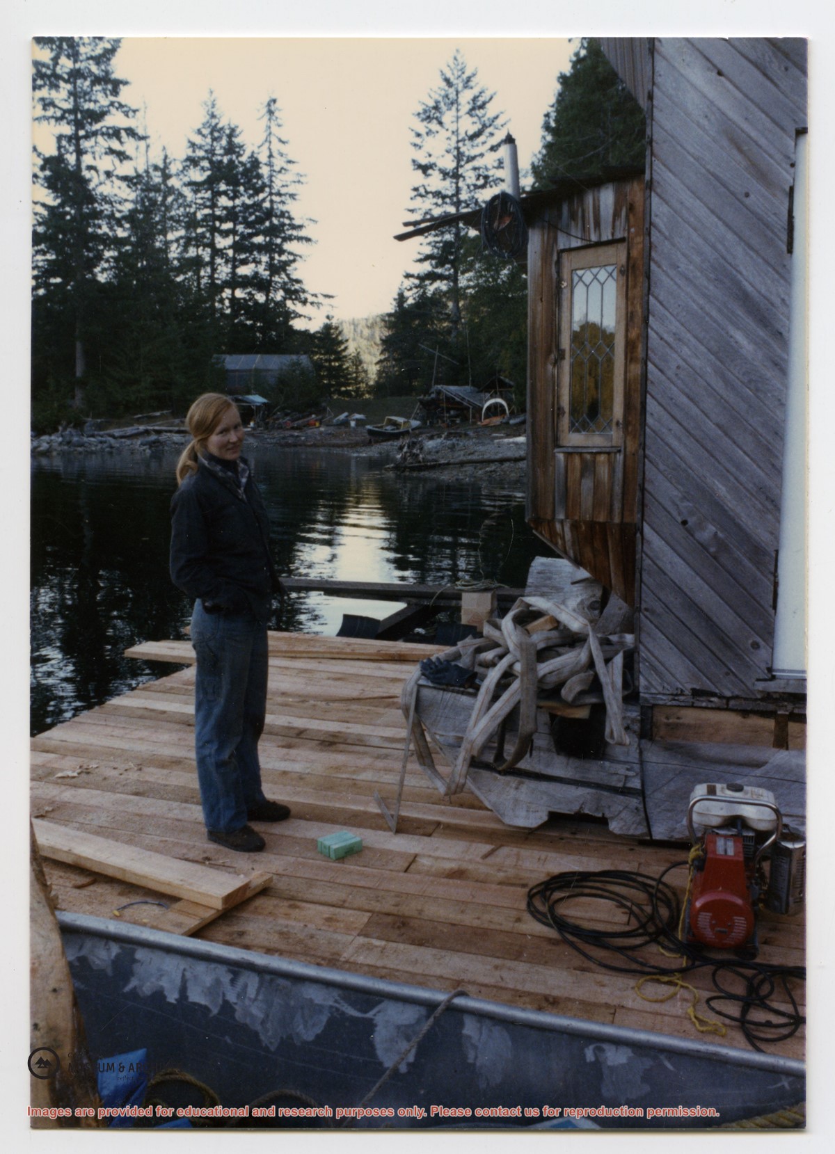
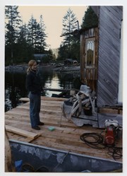
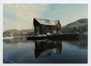
This floathouse was built at John and Anna Gregg's property in Manson's Landing, moved to Carrington Bay beside the entrance to Carrington Lagoon (ca. 1978), and then towed into Gorge Harbour by Bob Thompson with the "Sutil Chief" in 1985.
Transferred from Information Files August 20, 2020
Scope and Content
This floathouse was built at John and Anna Gregg's property in Manson's Landing, moved to Carrington Bay beside the entrance to Carrington Lagoon (ca. 1978), and then towed into Gorge Harbour by Bob Thompson with the "Sutil Chief" in 1985.
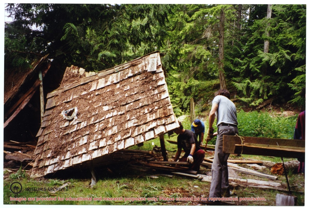
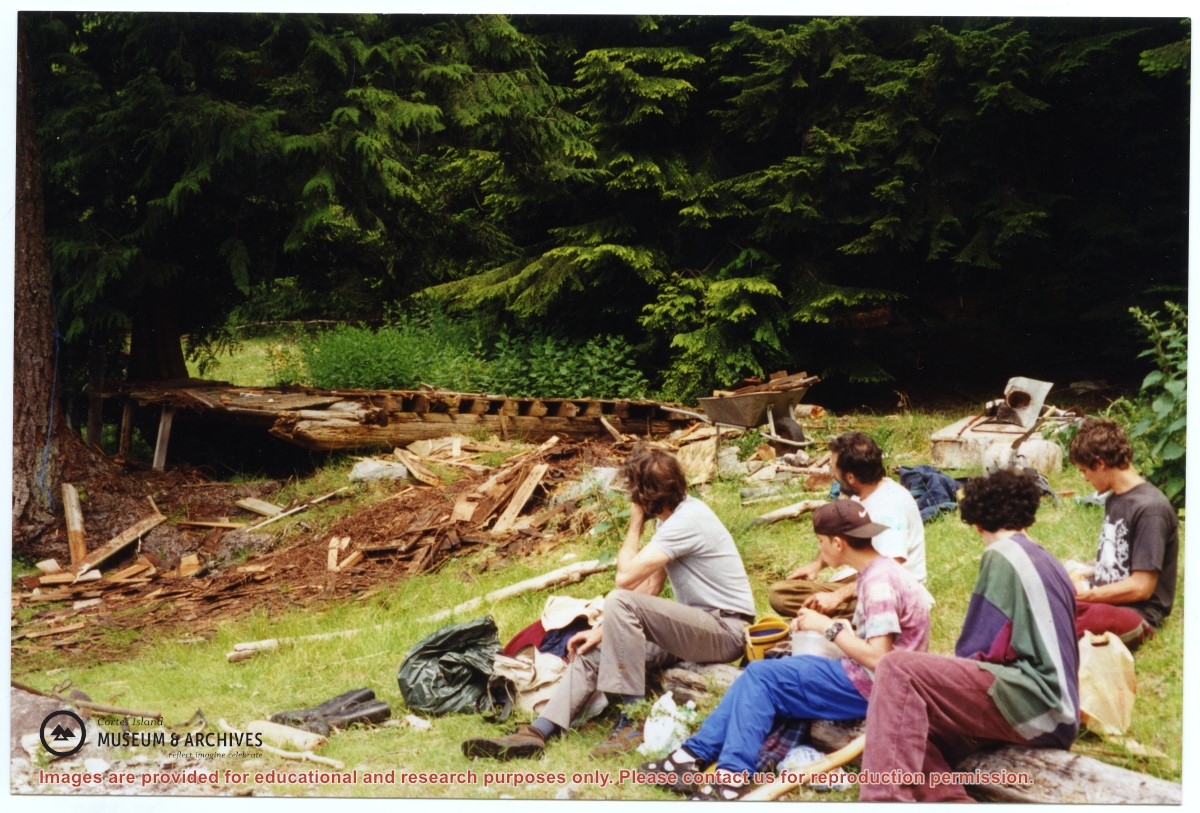
One of a series of photographs of volunteers removing the remains of shacks at Carrington Bay when Carrington Bay Marine Park was established.
L to R: Cedar DeTrey, Mike ?, John Shook
One of a series of photographs of volunteers removing the remains of shacks at Carrington Bay when Carrington Bay Marine Park was established.
L to R: Cedar DeTrey, Mike ?, John Shook
One of a series of photographs of volunteers removing the remains of shacks at Carrington Bay when Carrington Bay Marine Park was established.
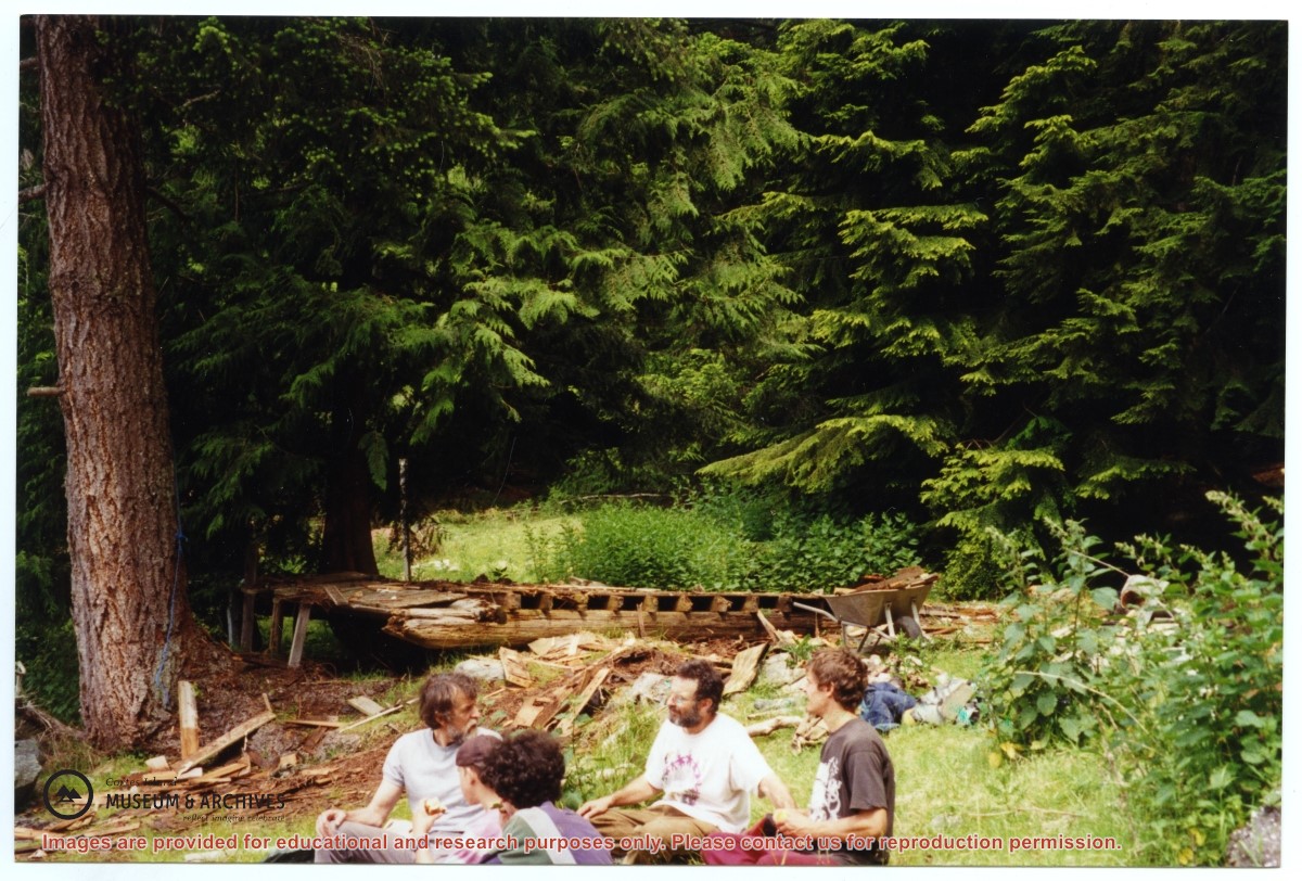
L to R: John Shook, Justin Stirn, Pierre DeTrey, Kiyoshi Kosky, Cedar DeTrey.
One of a series of photographs of volunteers removing the remains of shacks at Carrington Bay when Carrington Bay Marine Park was established.
L to R: John Shook, Justin Stirn, Pierre DeTrey, Kiyoshi Kosky, Cedar DeTrey.
One of a series of photographs of volunteers removing the remains of shacks at Carrington Bay when Carrington Bay Marine Park was established.
L to R: Kiyoshi Kosky, Pierre DeTrey, Cedar DeTrey
One of a series of photographs of volunteers removing the remains of shacks at Carrington Bay when Carrington Bay Marine Park was established.
L to R: Kiyoshi Kosky, Pierre DeTrey, Cedar DeTrey
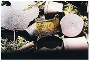
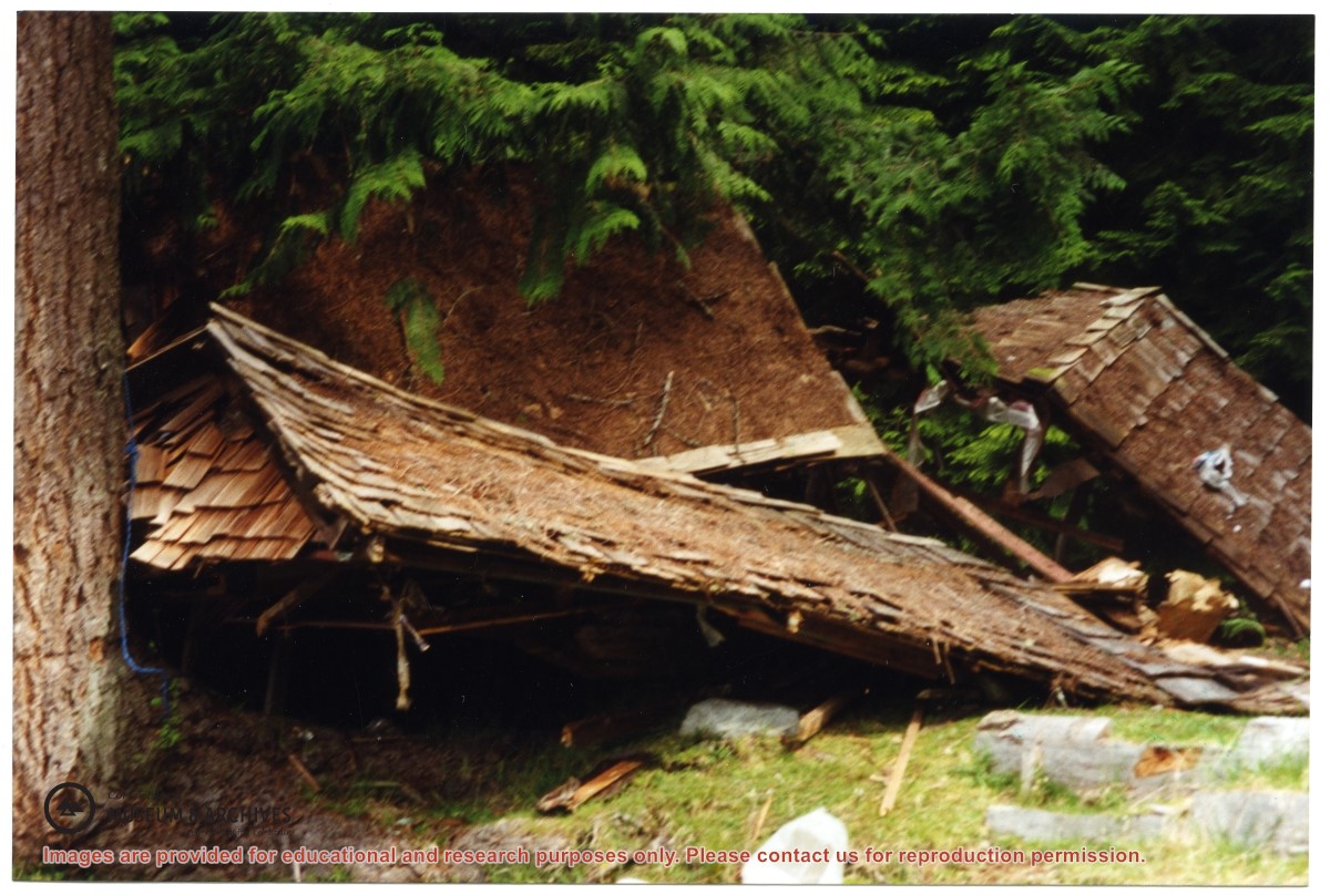
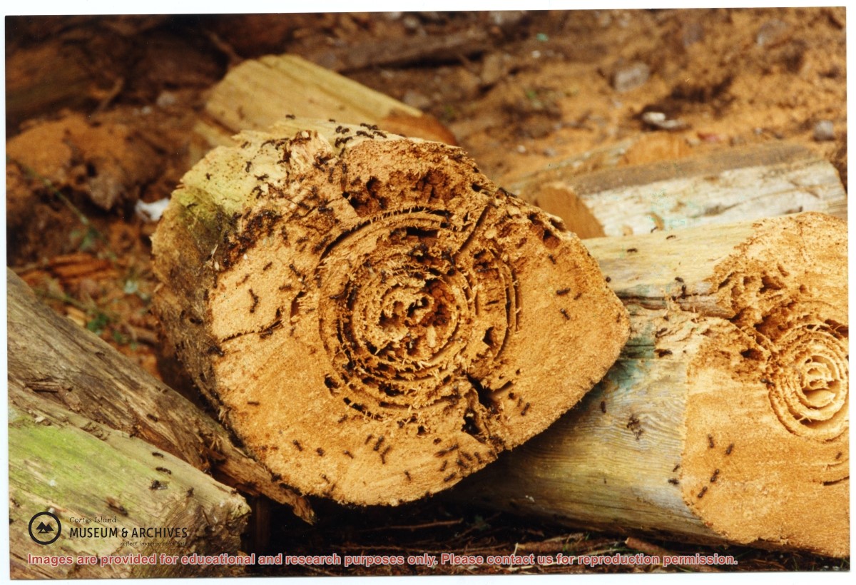
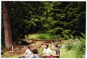
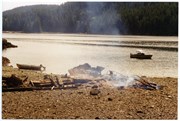
Part of a series of 8 photographs which document a clean-up at the proposed Carrington Bay Park site. The squatters' cabin was built in the 1970s, on the east side of Carrington Bay.
Part of a series of 8 photographs which document a clean-up at the proposed Carrington Bay Park site. The squatters' cabin was built in the 1970s, on the east side of Carrington Bay.
Part of a series of 8 photographs which document a clean-up at the proposed Carrington Bay Park site. The squatters' cabin was built in the 1970s, on the east side of Carrington Bay.
Part of a series of 8 photographs which document a clean-up at the proposed Carrington Bay Park site. The squatters' cabin was built in the 1970s, on the east side of Carrington Bay.
Part of a series of 8 photographs which document a clean-up at the proposed Carrington Bay Park site. The squatters' cabin was built in the 1970s, on the east side of Carrington Bay.
Part of a series of 8 photographs which document a clean-up at the proposed Carrington Bay Park site. The squatters' cabin was built in the 1970s, on the east side of Carrington Bay.